A hiking adventure: Engabreen, Svartisen in Meløy
 Trym Kristiansen
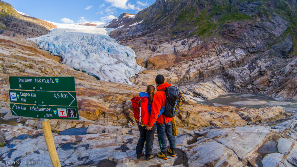
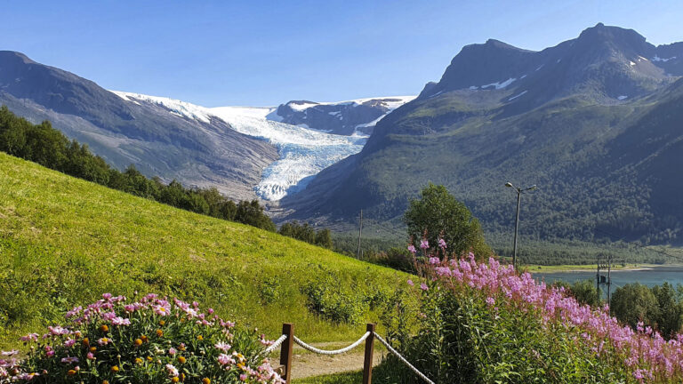
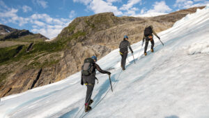
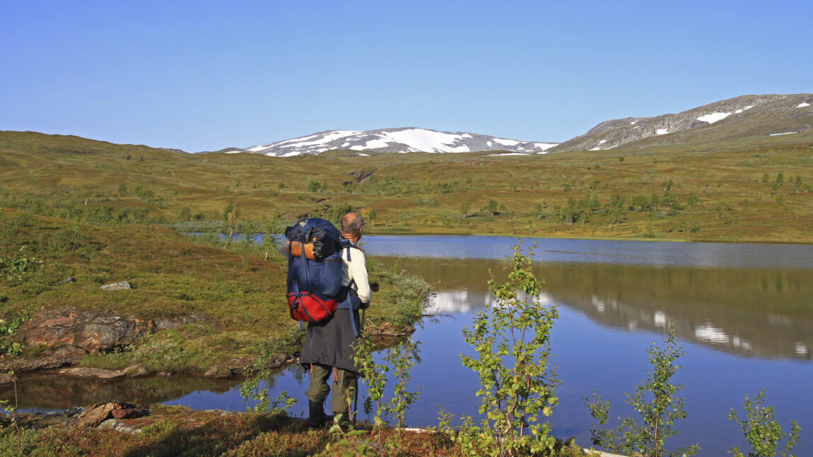
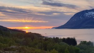
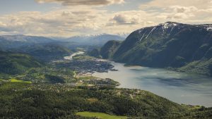
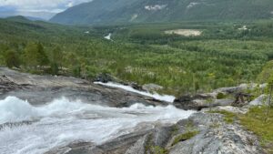
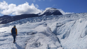
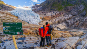
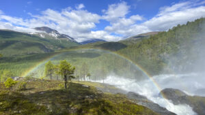
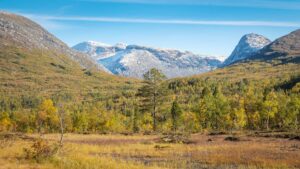
Engabreen (also known as Engenbreen) is a glacier arm of the Svartisen glacier in Meløy. The hike from the fjord up to the glacier front is beautiful, following the blue-green Engabrevatnet and climbing over the smooth rock that’s been polished by the ice over thousands of years.
Key info
Difficulty: Easy to moderately demanding. The first 3 km are on a gravel road. The terrain is mostly flat, but gets steeper toward the end.
Distance one way: Approx. 4.3 km
Elevation gain one way: Around 190 metres
Time one way: 1.5 – 2 hours
Season: June to August
Starting point: Boat across Holandsfjorden, then begin from the dock at Engen
View the parking in Holandsfjorden on Google Maps
View starting point in Engen on Google Maps
Important: The glacier is unstable and constantly moving. Large ice blocks can fall without warning. Always follow marked trails and stay at least 100 metres away from the glacier edge.
Be sure to check the boat schedule across Holandsfjorden and plan your trip accordingly.
 UT.no / Norgeskart
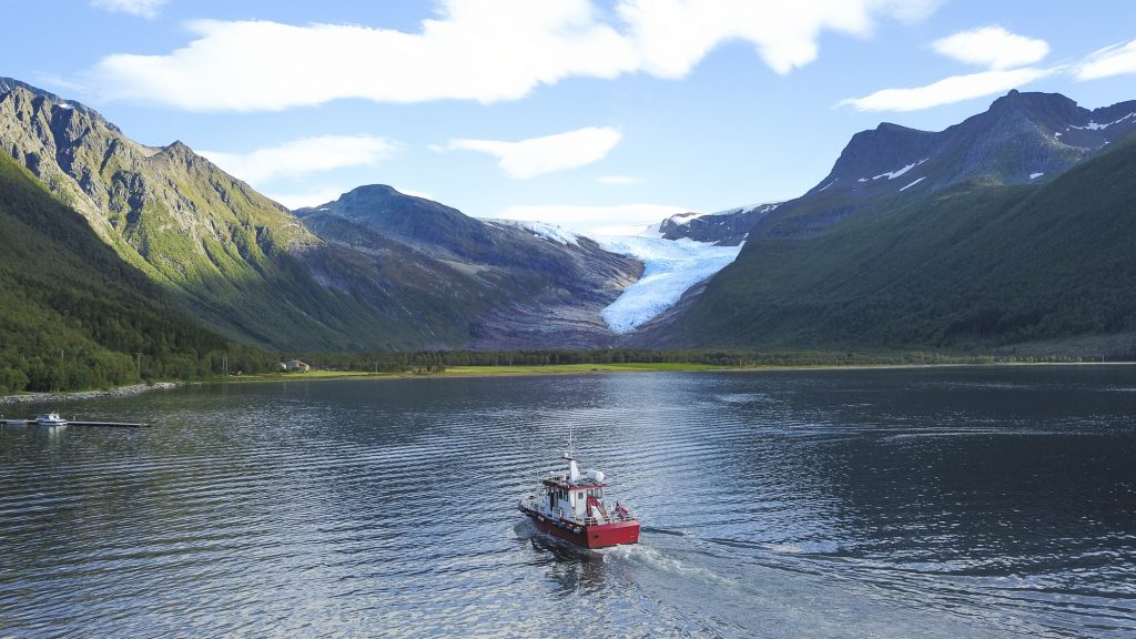
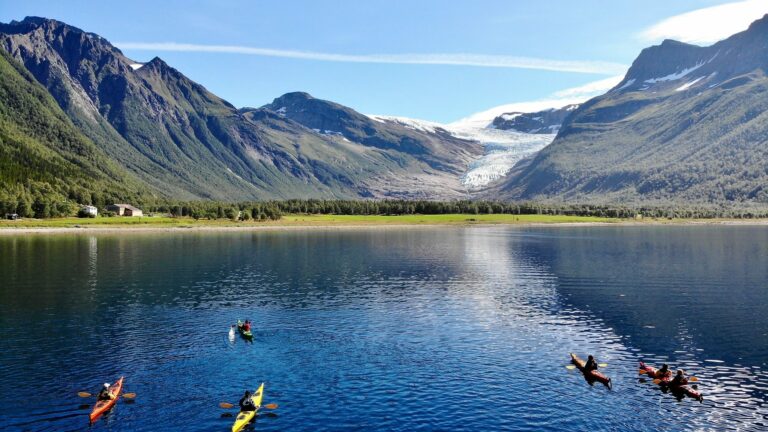
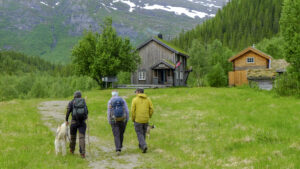
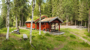
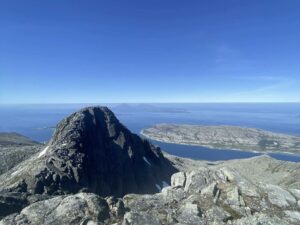
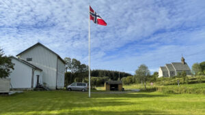
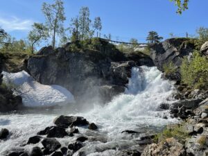
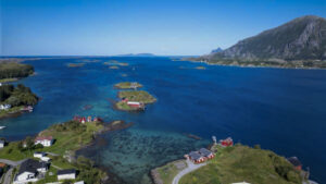
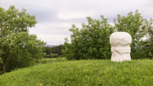
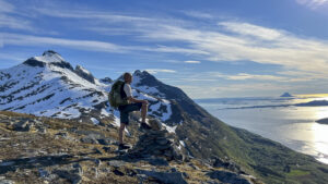
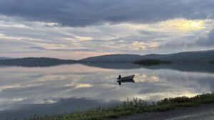
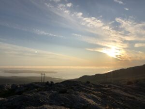
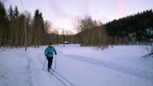
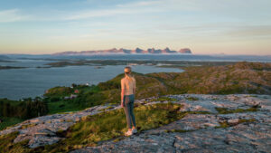
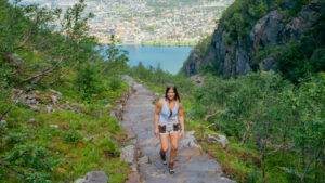
In addition to being Norway’s second-largest glacier, Svartisen is also the lowest-lying glacier in the country. In Meløy, the Engabreen glacier arm extends down to about 200 metres above sea level. This hike takes you from the dock, past Brestua café, along Engabrevatnet, and up to the cairn near the glacier front.
The hike begins at the dock in Engen. To get there, you need a private boat or to take the shuttle boat across Holandsfjorden, which operates several times daily during summer. Most of the hike follows a well-maintained gravel road alongside Engabrevatnet.
 Simon Fossheim / Visit Helgeland
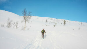
The gravel road ends at the far end of the lake. From there, continue about 1.5 km on trail and rock. Good hiking shoes are strongly recommended, especially in wet weather, as the rocks can be slippery. After a short while, the trail splits — stay to the right. The left-hand trail leads to the much longer and more demanding hike to the DNT cabin Tåkeheimen.
The final 500 metres are steeper than the rest of the hike. At the cairn, you’ll get a close look at the glacier’s size and enjoy great views down to Engabrevatnet. Remember to stay well back from the glacier edge, as large blocks of ice can fall suddenly. The minimum safe distance is 100 metres, and we recommend everyone stay on the marked trail.
From the cairn, you can return the same way or continue about 600 metres further to Svartisgryta, a giant pothole carved out by ice and water over thousands of years. It’s a great place for a refreshing dip on a warm summer day — for the adventurous!
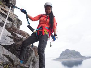
Glacier tours
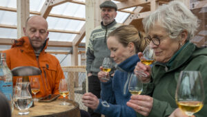
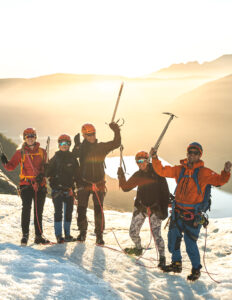
A guided hike on the glacier is an incredible experience. With a professional guide, you’ll explore the ice safely while learning about the glacier’s formation and history.

1. Follow the Norwegian Mountain Code and plan according to your ability and equipment
Short hikes on easy terrain don’t require much. If you’re heading out for an hour or two in the lowlands and not gaining much elevation, you won’t need a lot of gear or be in top shape. If it gets cold or you get tired, you’re usually not far from your car.
But if you’re heading into more challenging terrain—steeper, rougher, and above the treeline where the weather is more unpredictable—you’ll need to be better prepared. You should plan the trip based on weather and conditions, be fit enough to complete it, and be ready for uneven ground, boulder fields, slippery roots, and stream crossings. That means carrying a heavier pack with extra clothes and gear, and wearing sturdy hiking boots that support your ankles.
If you’re unsure about taking on a demanding mountain hike, start with an easy or moderate one and see how it feels.
Learn more about the Norwegian Mountain Code at rodekors.no
See what you should bring on your hike on VisitNorway.com
2. Stick to marked trails
A shortcut through unfamiliar terrain can easily turn into a long and difficult detour. What looks like a trail might just be a sheep path that leads you somewhere completely unexpected. If you want the hike to be as easy or challenging—and as long or short—as planned, it’s best to follow marked trails.
If you’re heading off-trail, it’s smart to follow a GPS track. You can download a GPX file from a hike description and use it on a GPS device, a smartphone app, or a GPS watch.
UT.no and the UT app offer hike descriptions with GPS tracks. If your hike doesn’t have one, you can upload a track to ut.no/mine-turer and access it in the app. It’s free, but you’ll need to create an account.
Always carry a map and compass as backup.
UT app for Android / UT app for iPhone
3. Talk to locals or join a guided hike
Locals often have useful tips about your planned hike. They can tell you where to park, whether there’s phone coverage, if the trail is wet, if rivers are high, or suggest a better alternative. Talk to the people where you’re staying, at the local tourist office, or other hikers on the trail—you might get some truly valuable advice.
The best option is to hike with a guide. You can join a group tour or book a private guide. These are experienced locals who know the area well. They’ll help tailor the hike to your needs and share insights that add to the experience.
4. Look out for cultural landmarks
Even high up in the mountains, you’ll find traces of past human activity—some hundreds or even thousands of years old. These can include ancient trail markers, signal cairns, hunting fences, huts, and shepherd shelters. If you spot something interesting, check the KulturPunkt app to see what it is—or use the app to find a cultural site as your hiking goal.
KulturPunkt app for Android / KulturPunkt app for iPhone
KulturPunkt.org
5. Remember your responsibilities under the Right to Roam
Norway’s Right to Roam means you can hike, bike, pick berries, camp, fish, and ski almost anywhere in nature. But it also comes with responsibilities—what we call the “duties of the Right to Roam.” Leave no trace, respect wildlife, and know the rules for hunting, fishing, cycling, and access in protected areas like national parks and nature reserves.
Read more about the Right to Roam and your responsibilities at VisitNorway.com
Thank you for respecting the local communities, and for helping us preserve the natural beauty of Helgeland!
Please:
- Strive to leave no trace of your visit. Bring back all your rubbish, including used toilet paper, and discard it in the nearest rubbish bin.
- Plan your toilet visits and use the opportunity when you pass a toilet. In the wilderness, make sure you are not a nuisance to others.
- Respect the local wildlife. Keep a good distance from wildlife, livestock and birds. Keep your dog leashed.
- Respect private property. Keep a respectful distance from houses and cabins.
- Show good boating sense. Keep a good distance from shore and drive at a low speed, especially when you are close to anyone or anything on the water, including birds or animals. Avoid loud and disturbing engine noise. Be aware that some islands and nature reserves are important nesting sites, and that going ashore is prohibited during the nesting season.
- Follow the Norwegian Mountain Code (Fjellvettreglene). Plan your excursion according to the weather forecast, your skills and experience.
- Join a guided excursion or consider hiring an experienced guide, especially when you don’t have sufficient experience or knowledge to guarantee a safe trip.

TP Bowling Center
Right in the centre of Mo i Rana, you’ll find TP Bowling Centre – a popular spot for both locals and visitors looking for a social and active break from everyday life or their holiday routine.
Sæterstad Gård
Are you looking for a unique experience? An experience where nature and culture meet and leaves an impression in all your senses? Then you should take a trip to Sæterstad Gård, beautifully situated 400 meters above sea level at the foot of Krutfjellet in Hattfjelldal, an area that has been populated by Sami, Swedes and Norwegians for many centuries.
Tømmerstua – A year-round log house at Strandli Farm
Stay in an authentic log house at the foot of Børgefjell national park, overlooking the national park and the mountain landscape of Fiplingdalen.
Dønnes Gård – Accommodation in historical surroundings
Dønnes Gård on the island of Dønna, offers a holiday stay in a former vicarage. The historical surroundings actually date back to the 13th century. Guests here can dine on traditional dishes made from locally-sourced ingredients. To hear the colourful history, take a guided tour of the vicarage and the neighbouring medieval church.
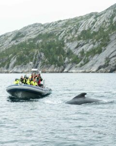
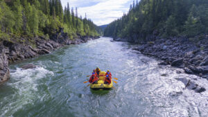
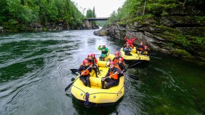
RIB sea rafting trips with Meløy Adventure
You are invited to join Meløy Adventure on a RIB sea-rafting adventure to the island of Rødøya and Rødøyløva (443 m). Other great options include a sea-rafting safari to explore the scenic Nordfjord, the spectacular island of Træna, or a visit to the remote island of Myken with a tour of its whisky distillery. These excursions start from Ørnes in Meløy municipality – but for your convenience you can request to be picked up elsewhere en route.
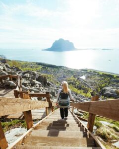
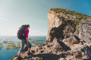
A hiking adventure: The Vega Stairs
The Sherpa-built Vega Stairs take you from the shore to the top of Ravnfloget, and the view becomes more impressive with every stone step you climb. While the stairs make it easy to climb the mountainside, your thigh and calf muscles will still get a serious workout. Be sure to save some energy for your descent!
A hiking adventure: Reinesaksla 308 masl
The summit of Reinesaksla in Leirfjord offers a stunning view of the Seven Sisters, Dønnamannen, Lovund, and the Helgeland Bridge.
A hiking adventure: Torghatten
Torghatten is one of Helgeland’s most iconic mountains, with its striking hole right through the rock. The trail through the hole is a designated National Scenic Hike, carefully prepared with a Sherpa-built stone staircase and benches for a well-earned rest along the way.
Bergh-brygga and Gammelskolen in Leirfjord
Leirfjord Museum is located in the old Bergh-brygga at Leland. Also, make sure to visit the beautiful Gammelskolen, which was in operation until the mid-1950s. Welcome to a journey through time!
Kvitneset Camping – Rorbu cabins and boat rentals in scenic surroundings
Kvitneset Camping in Leirfjord municipality offers accommodation in scenic surroundings by a secluded fjord. Guests enjoy a beautiful view of the fjord and the Seven Sisters mountains.
Oscarbrygga – Accommodation and dining
OscarBrygga at Tonnes offers accommodation in rorbu cabins or wharf rooms, right on the shore. From your balcony, you can enjoy the sunset or the glow of the midnight sun, to the soothing sound of the surf. Dining is offered in a refurbished old wharf building rich in ambience.
Træna Arctic Fishing
Selvær, the second-biggest island of the Træna archipelago, is a quiet and cosy fishing community. Like the rest of Træna, it faces the open sea and lies far from the mainland. Here, you can stay in a modern quayside holiday apartment, and experience scenic Helgeland at its best. You will find excellent fishing, literally thousands of islets and skerries, amazing birdlife, and skies that glow late into the summer nights.
A hiking adventure: Two mountain farms – Bredek and Granneset
Bredek and Granneset are two mountain farms that date back to the 19th century. Both are situated in beautiful surroundings within the Saltfjellet-Svartisen National Park. This is a wonderful excursion for the whole family.
Lyngvågen Café on Gjerdøya in Rødøy
At Lyngvågen Café on the beautiful Gjerdøya in Rødøy, you can enjoy homemade seafood and opt for an overnight stay. Lyngvågen is an excellent base for exploring Gjerdøya and the other islands in Rødøy.
Hiking description: The hill leading to the cairn in Sandnessjøen
Hike close to the city center with views of mountains and coast.
Dønnesfjellstua – Dining on a mountain top overlooking the Helgeland coast!
You are invited to enjoy an incredible 360-degree panorama, while dining on dishes made with locally-produced ingredients. Dønnesfjellet is only 128 metres high, but the view is magnificent.
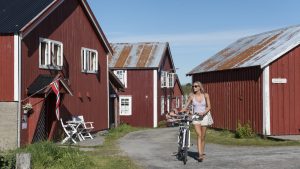
Kayak and bike rental in Herøy and Sandnessjøen
Herøy is an ideal destination for kayaking enthusiasts. Its stunning islands, skerries, and scenic shorelines provide an excellent opportunity to experience nature at its best. Herøy Kajakk & Sykkel offers a wide range of options for both land and water explorers. You can rent kayaks, e-bikes, and SUP boards to embark on your own adventure, or join a guided paddling tour led by experienced kayakers to explore the island.
Plahtes Eiendommer – Fishing, hunting and wilderness adventures
Welcome to fishing, hunting and wilderness adventures on one of the largest private estates in Norway. Plahtes Eiendommer covers 650 km2 of magnificent wilderness in southern Helgeland. Plahtes takes great pride in its environmentally conscious management of its wilderness, as well as the cabins, boats and other facilities that ensure our guests a truly memorable wilderness adventure.
A hiking adventure: Summit hike to Hatten (the hat)
Even from a distance, Hatten (1128) is a sight to behold. The Sámi people call this solitary mountain Aarpije, “the one who stands alone”. It is situated east of the village of Hattfjelldal.
Torgarhaugen Gjestegård (Guesthouse)
Torgarhaugen Gjestegård is beautifully situated at the foot of Torghatten, the legendary mountain with a hole through it. It offers rooms that are comfortable, bright and cheerful, letting in sunlight from every directions. Here you can relax and just enjoy, taking time to enjoy the tranquillity, the sight and sounds of your natural surrounding, a good cup of coffee and home-baked cake.
Kulturbadet in Sandnessjøen
With a swimming pool, cinema, library, and theater all under one roof, Kulturbadet in Sandnessjøen offers activities for the whole family and then some!
Glacier hike on Svartisen with Explore Svartisen
Join an adventurous glacier hike on the Engabreen glacier tongue in Svartisen, Meløy.
Events in Mosjøen
In the event calendar at iMosjøen.no, you’ll find a complete overview of everything happening in the city – from sports events and markets to concerts and festivals.
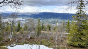
Ski touring: Steinlikammen 617 m
A popular ski tour with good routes for both beginners and experienced skiers, just a short half-hour drive from Mosjøen.
Light Backpack Hike from Børgefjell to Okstindan
This is one of the most stunning and thrilling hikes Northern Norway has to offer, passing through border mountains and national parks, reindeer grazing areas, open plateaus, wild valleys, and massive mountain ranges. And now, you can hike it with luggage transport from cabin to cabin.
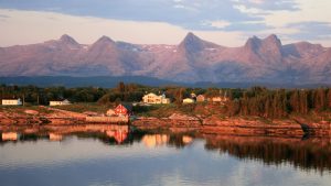
Støtt in Meløy – Top of Helgeland
The picturesque old trading post of Støtt offers some of Helgeland’s most beautiful and unique holiday experiences. Many adventures await you here, and you can enjoy charming quarters and great dining in historic buildings steeped in the island’s ancient coastal heritage.
Bitteliten Gård – A peaceful island farm experience
Slow down and find peace among the friendly animals at Bitteliten Farm, located on Handnesøya just off Nesna.

Havkanten Guesthouse – Restaurant & Accommodation
At Havkanten Restaurant, you can combine a delicious dinner with a spa and sauna on the pier, a sunset RIB adventure, or a wine tasting featuring local flavours.
Grønligrotta Cave near Mo i Rana
Grønligrotta, with its network of passages and beautiful limestone formations, has long been one of the most visited caves in Scandinavia. Electric lighting allows you to more fully appreciate it this natural wonder, which ice and water took 700,000 years to sculpt.
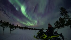
Guided Snowmobile Safari and Northern Lights Hunt
Hi North takes you into the wilderness just outside Mosjøen to the snowmobile trails and excellent lighting conditions. Skilled guides will train you and take you on a fun and thrilling snowmobile safari in spectacular surroundings.
Gildevangen Konditori – Lunch, coffee, and cakes
At Gildevangen Konditori in Olderskog, Mosjøen, you can enjoy a tasty lunch, relax with a coffee or iced tea, and perhaps indulge in a slice of cake—or even three.
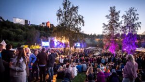
Verket
Music festival in Mo i Rana
August 28th and 29th 2026
The Verket music festival is an annual end-of-summer event in Mo i Rana. The festival is held at Revelen, within walking distance of Mo’s town center and just a few hundred meters from Mo Industrial Park, formerly AS Norsk Jernverk—the inspiration for the festival’s name.
Hattfjelldal Hotell – GoExtreme
This hotel, located just outside the village centre, enjoys a fantastic view of Hattfjelldal, a picturesque community in the mountains of Helgeland.
Røssvoll Camping
Røssvoll Camping offers peaceful surroundings by the Ranelva river, about 13 km north of the town of Mo i Rana. The campsite is a short distance away from attractions such as the Svartisen glacier, Grønligrotta cave, and Setergrotta cave. If you head into town, the entire family can enjoy a visit to Vitensenter Nordland, a science museum that explores nature, technology, and mathematics.
Gateway to Northern Norway – souvenir shop & fast food
Begin your journey through Helgeland with a good meal and a visit to the shop that has everything you need for the adventures awaiting you in Northern Norway.
The Havna festival
Music festival in Sandnessjøen
August 8th and 9th 2025
Locally known simply as “Havna” (the Harbour), this festival takes place in Sandnessjøen during the second weekend of August each year.
Idyllic farm retreat on Dønna
3 Kalver is located on the scenic island of Dønna along the Helgeland coast, making it an ideal spot for those seeking a peaceful place to stay and dine surrounded by idyllic, quiet farm life, with Dønna’s stunning coastal nature right at your doorstep.
Lovund Hotel
Lovund Hotel is the perfect base for exploring the enchanting island of Lovund. With comfortable accommodation, delicious cuisine, and stunning views of the sea and mountains, you can relax and unwind after a day of hiking or bird-watching. Enjoy the urban island life and breathtaking views from the comfort of your room or the hotel’s terrace.
Base Camp Vega – kayaking, climbing and accommodation
At Base Camp Vega you can stay in mini-cabins whose unique design is inspired by the little huts the islanders build for the thousands of eider ducks that nest in the Vega archipelago every year. We also offer good spots where you can pitch your tent. Base Camp Vega is situated right by the Vega Stairs and the Ravnfloget Via Ferrata, and the sheltered waters nearby are perfect for kayaking.
Torghatten Camping – Fishing, dining and much more
Torghatten Camping is idyllically situated at the foot of the legendary mountain Torghatten. Accommodation offered here includes high-standard cabins and apartments. There are spots to pitch your tent and electrical hook-ups for your caravan or camper. The restaurant here is known for excellent dining.
Hansinestua and Hagland – accommodation in historic houses on Gjerøy
In the beautiful island kingdom of Rødøy municipality lies Gjerøy – a vibrant island with around 50 year-round residents, surrounded by the open sea and sheltered coves. Here, you can unwind, explore the coastal landscape, and stay in authentic, historic houses – each with its own character and view.
Myken Apartments
At Myken Apartments, you have several accommodation choices on this quaint island far out on the Helgeland Coast. In the apartments at Myken Brygge, you’ll stay right by the express boat quay, enjoying a splendid view of the strait and Myken’s entryway. Alternatively, you can choose one of the houses located a bit more secluded, further inland on the island.
Experience all of Helgeland with Helgeland Travel Service
Helgeland Travel Service (HTS) will gladly take you on a tour to Helgeland’s many attractions. Whether we explore the coast or inland tracts, on a clear summer day or a day with mist and rain, all of our excursions will show you the magnificent landscape of Helgeland.
The Mosjøen Christmas village
Sjøgata is beautifully decorated for the holidays, and the christmas town Mosjøen welcomes you to enjoy the festive season throughout December with Christmas workshops, concerts, performances, and—most notably—the world’s longest Christmas porridge table, spreading holiday cheer for all ages.
A hiking adventure: Mosåsen hiking area
Mosåsen is one of the most popular hiking areas in Mosjøen, offering well-maintained trails, pathways, and beautiful outdoor spaces with picnic tables and benches.
Cross-country skiing trail: Sjåmoen
Just 15 minutes from Mosjøen, the 5 km Sjåmoen illuminated ski trail offers beautiful mountain views and preperad tracks suitable for all skill levels. There’s also a longer 16 km trail, without lights, for those who would like to venture further into the mountain.
A hiking adventure: Lurøyfjellet 689 masl.
Lurøyfjellet offers one of the most beautiful scenic hikes on the Helgeland Coast, with views of nearly all the iconic fairytale mountains and the amazing islands in Lurøy.
Aspnes Camping
Welcome to Helgeland and Aspnes Camping, beautifully situated by Fustvatnet lake, approximately 13 km north of Mosjøen.
Hiking Description: Høyholmstindan in Vevelstad
From the top of Høyholmstindan, 1015 meters above sea level, you will experience a breathtaking view of Vevelstad and the Helgeland coast to the west, Vistenfjorden to the north, and Lomsdal-Visten to the east.
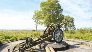
A hiking adventure: Skarsåsen Fortress in Brønnøy
Skarsåsen Fortress with lean-to-shelter and fire pit
Nature experiences and accomodation in the beautiful Solvær archipelago
At Solværøyan Birds and Beds, you’ll find unique accommodations and rare nature experiences in one of the Helgeland coast’s finest birdwatching paradises. Sleneset is part of the Solvær archipelago.
A hiking adventure: The Lapplia Homestead
The hike to the old homestead of Lapplia, takes you up a steep but nice and well-adapted path, through a forest and up the valley side, close to the E6, a short drive north of Mo i Rana.
Adolfstua on Myken – A Nordland House with Character
Welcome to a stay in your own cozy holiday home, at the outer edge of the Helgeland coast, and experience life in one of our smallest island communities.
Hike description: Appelsinhaugen and Grotneshytta on Mofjellet
Take a breath in nature and enjoy the view over Mo i Rana and the surrounding mountains on this easily accessible mountain hike just outside the city.
Holm cultural heritage trail – Audioguide
Holm cultural heritage trail is a 3-kilometer circular route in outer Bindal, where you can experience traces of people who lived here more than 1,500 years ago. The trail starts at the community hall Solvang, goes down to the old cemetery at Solstad, continues to the shoreline and through an area with Iron Age burial mounds—before returning to Holm Camping.
Join a journey through time and discover the traces left by those who lived here during the Iron Age.
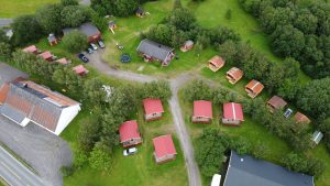
Skogmo Family Camping
Skogmo Family Camping is idyllic situated in tranquil surroundings 12 km south of Brønnøysund. It offers a relaxed family-friendly atmosphere well away from the city, where children can play freely and safely.
Audio guide Brønnøysund – a walk through 10,000 years of history
Brønnøysund is more than a beautiful coastal town – it’s a living map of history, with traces of people, trade, and life along the coast over 10,000 years. This audio guide lets you explore the town’s rich past and present at your own pace, right in the heart of a landscape scattered with thousands of islands, islets, and skerries.
Hotel Scandic Seven Sisters – Accomodation Sandnessjøen
As a guest, you will immediately realize why the Hotel Scandic Syv Søstre bears the name of the Seven Sisters mountains. The hotel enjoys a great view of these renowned mountains. A holiday base here is perfect for exploring the many island treasures of the Helgeland coast, including Dønna and its colourful history, the idyllic island of Herøy, and the Vega archipelago, which is a UNESCO World Heritage Site.
Mosjøen Via Ferrata
At the heart of Nordland County, in the geographic middle of Norway, is the friendly town of Mosjøen. Here you can join Hi North on an exhilarating mountain adventure on the world’s northernmost via ferrata. Take the challenge and feel the satisfaction as you reach the summit!
Selsøyvik Trading Post in Rødøy
Selsøyvik Trading Post is one of Helgeland’s oldest and most esteemed accommodation options. The island of Selsøyvik is beautifully situated along the shipping lane, surrounded by Rødøyløva, Hestmannen, and Svartisen. Here you will find accommodation, a large and beautiful guest harbor, a general store, and a café.
Augustbryggo – Restaurant with Local Food on Seløy
Experience the intimate waterfront restaurant with spectacular views and local ingredients.
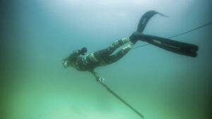
Freediving and kayaking in Træna – explore the underwater world
Dive below the surface and discover Træna’s beautiful underwater landscapes. In crystal-clear waters, among forests of kelp and sandy seabeds, you’ll encounter vibrant marine life — schools of fish weaving through the kelp, scallops and flatfish resting on the sand, and much more. Whether you want to freedive, snorkel, or paddle between the islands, you’ll find both equipment and experiences available at Kranberget on Husøy.
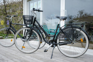
Rent a bike at Træna
At the Træna Tourist Office on Husøya, you can rent bicycles to explore the beautiful island.

Restaurant Sjyen
With delicious food, fine wine, beautiful views, and a casually elegant atmosphere, Sjyen is a great choice for a memorable meal, perfect for any day or a special celebration. Here, you’ll find fresh, modern dishes that showcase the best of the sea – or “sjyen,” as the locals say.
Hildurs Urterarium – Culinary adventures
Hildurs Urterarium is far more than a restaurant. It is a lush oasis imbued with life and personality, offering guests a respite from their busy lives and a unique dining experience shared with friends or family. Restaurant Sagastuen and the old parlour have an ambience that gives visitors a taste of bygone times.
Hildurs Urterarium – Accommodation
Stay in newly renovated and cozy rooms at Hildurs Urterarium outside Brønnøysund. Here you are met by pleasant hosts in homely and good surroundings.
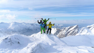
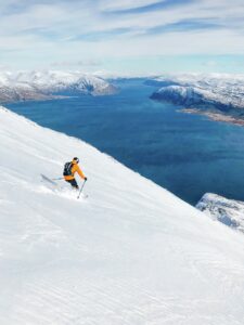
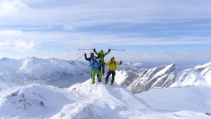
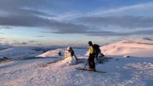
A weekend of high adventure on the lofty peaks!
The picturesque Meløy Alps offers some of the wildest off-piste skiing in Northern Norway!
Kvarøy Sjøhus – A holiday stay in rorbu cabin
When you choose a holiday stay in a modern rorbu cabin at Kvarøy Sjøhus, you have the most beautiful destination on the Helgeland coast within easy reach. A boat or kayak opens up wonderful opportunities for adventure.

Guided kayak tour in Herøy
Join us for a guided tour of some of the finest kayaking areas in all of Helgeland.
Korgfjellet Fjellstue Lodge
At the top of Korgfjellet pass, midway between the towns of Mo i Rana and Mosjøen, is Korgfjellet Fjellstue, a lodge that offers hearty meals. Tired travellers will be pleased to find good options for an overnight stay.
Svang Restaurant & Wine Bar – In the heart of Brønnøysund
A cozy place with a focus on local food, suitable for both big and small occasions. At Svang, the hosts warmly welcome you to stop by for a delicious meal, some snacks, or something delightful to drink
Alo restaurant
Welcome to an authentic taste of Helgeland, served in a warm and relaxed setting.
Norwegian Aquaculture Centre – Rorbu cabins by the sea
If you’re heading to the beautiful Helgeland coast, you’ll find yourself in the heart of one of Norway’s most important industries. Along the shoreline of Toftsundet, you’ll find the Norwegian Aquaculture Centre — right in the middle of salmon country. Here, you can experience the life of the salmon up close. The demonstration facility is easily accessible from land, located right next to the seaside cabins, an indoor historical exhibition, and the on-site restaurant. It’s a great place to stay by the sea, create lasting holiday memories, and enjoy the fresh sea air.
Velfjord Panorama Caravan Camp
Consider a stay at Velfjord Panorama Caravan Camp, situated right on the sea in beautiful surroundings!Here you can really feel the energy of the natural elements, and enjoy the summer sun all evening. You can go fishing, take a boat trip, hike the mountains, go bicycling or kayaking, and relax with sweet dreams in your cosy rooms.
Dønnes Skolestua – Accommodation and RV parking
In 1922, the old schoolhouse was built to provide a safe and warm shelter for children who had a long way home. Now, a hundred years later, it welcomes those who wish to experience the tranquility and beautiful nature in the northern part of Dønna, right on the Helgeland coast.
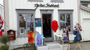
Galleri Stokland in Mosjøen
In a charming wooden house from 1852, on Sjøgata street in the historic heart of Mosjøen, you will find Galleri Stokland. On display are colourful artworks, knitwear, glass and ceramics by creative local craftsmen and artists.
Bimbo Veikro – Food and accommodation
Bimbo Veikro offers hearty homemade fare and reasonable accommodation near the town of Mo i Rana.
Paddling route: Round Trip around Støtt
Støtt consists of a fantastic archipelago that is perfectly suited for paddling. The area lies in sheltered waters, where it often remains calm even when many other places experience winds from southeast.

A hiking adventure: Kjølen and Hammarøyfjellet
From Kjølen in Nesna, you can enjoy the midnight sun or a beautiful sunset. You can also extend the hike to the summit of Hammarøyfjellet.
A hiking adventure: Tortenkøta
The hike to Tortenkøta is an easy and family-friendly walk along the Coastal Route (Kystriksveien) near Flostrand. By the shelter, you’ll find small pools and natural rock slides — a great place for the family to swim and relax.
Toranes Overnatting
At Toranes Overnatting, you stay just outside Mo i Rana city center, with easy access to the city’s restaurants and cafés, parks and shops, science center, water park, cinema, and more.
Tjøtta Gjestegaard – Accommodation and café in historical surroundings
Stay close to nature experiences in historic surroundings at Tjøtta Guesthouse, conveniently located near the Seven Sisters mountain range, cultural trails, and historical sites, with excellent ferry connections for day trips to the islands along the Helgeland coast.

Ytri Island Retreat – more than just a hotel
Ytri Island Retreat in Træna is an exclusive coastal resort offering 38 rooms and suites, a bar, seafood restaurant, meeting rooms, saunas, an outdoor wellness area, boathouse, guest harbor, and a sandy beach.

Restaurant Gammelbutikken – authentic local seafood
Restaurant Gammelbutikken is Støtt’s grand locale and exudes authentic coastal culture. Here, you can taste the best that the island and the sea have to offer in terms of local culinary treasures. They follow the entire value chain, from harvesting ingredients in the island’s natural surroundings and catching fish in the Vestfjorden, to serving it in the restaurant.
Hotel Svartisen – Apartment hotel in the middle of Mo I Rana
At Hotell Svartisen, you can stay close to everything Mo i Rana has to offer, within walking distance of parks and shopping centers, restaurants and cafés, a science center, and a museum
Whisky Carthedral at Myken
Join a Whisky Tasting with Storytelling on a Guided Tour through Myken’s Own Whisky Cathedral

Terråk Guesthouse
At Terråk Gjestegård, you can stay in comfortable rooms and enjoy dinner at the in-house restaurant, Færingen Spiseri—all just a short distance from everything Terråk and Bindal have to offer, from fjord adventures to mountain hikes.
Topcamp Havblikk – Good food and lodging at Nesna
When you stay at Topcamp Havblikk at Nesna, you have access to varied activities that you can enjoy with family or friends. This campsite is well-suited to people travelling with caravans, campers or tents. If you prefer, you can choose a cabin or room.
Yttervik
Yttervik, situated in idyllic surroundings by the Ranfjord, offers accommodation a short distance from Mo i Rana’s town centre. The cabins and campsite and the surrounding area is well suited for varied activities for the whole family.
Inderdalen Gård – Charming farm stay with rich history
Nestled at the foot of Okstindan in Hemnes Municipality lies a treasure trove of a mountain farm dating back to the 1600s. At Inderdalen Gård, you can spend the night in Kjellerhuset and immerse yourself in the rich cultural history of the farm while enjoying the hospitality of its fantastic hosts in scenic surroundings.
Forvik Old Trading Post
The old trading post at Forvik in Vevelstad, which dates back to 1792, is beautifully situated on the sea along route Fv17. Accommodation in charming surroundings is offered in the oldest building, Grålåna. There is a restaurant in Naustloftet, and a coffee roastery in the old general store. People often gather in Brygga, the wharf building, to enjoy the long bright summer evenings.
Ski touring: Tomskjevelen, 922 m
Tomskjevelen is a 922-meter peak located on the island of Tomma in Nesna, in the middle of the stunning Helgeland coast. The pointed peak rises steeply from the sea, presenting a challenging and rewarding experience for experienced and skilled skiers.
The Romantic House on Herøy
Det Romantiske Huset (“the Romantic House”) offers charming accommodation in tranquil surroundings by the sea, on Herøy on the Helgeland coast. The panorama is magnificent, spanning from the Seven Sisters mountains in the south to the peak called Dønnamannen in the north. Holiday adventures available here include kayaking, RIB sea rafting excursions, fishing, hiking, cycling and island hopping.
Løkta Museum
Be sure to visit Løkta Museum, beautifully located on the west side of the island. Here, you can experience what life was like on a small farm in the old days. The area is open to all and features a picnic area, a fire pit, and a small outhouse.
Arctic Circle Center- Souvenir shop and bistro by the Arctic Circle
With food service and a large souvenir shop, the Arctic Circle Center is a natural stopping point on your journey across Saltfjellet and the Arctic Circle.
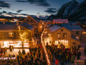
Christmas weekend in Mosjøen
In the first weekend of December, the town of Mosjøen invites you to a warm‑hearted Christmas experience! The friendly town decorates the charming wooden houses of its historic centre with lights, and fills its streets with music and elves. Explore booths where craftsmen and merchants offer their wares, warm yourself by the fire in a lavvo, and dine on traditional Norwegian Christmas fare.
A hiking adventure: Silforsen og Breidal mountain farm
Embark on a delightful family-friendly excursion to discover picturesque bathing spots and the enchanting abandoned mountain farm of Breidal. Starting from Krokstrand Fjellpark, this adventure takes place in the scenic surroundings on the border of Saltfjellet-Svartisen National Park.

Onkel Oskar – Pub, Food, and Beer Tasting
Step inside Onkel Oskar, where new faces are met with the same warm hospitality as the regulars. Here you can enjoy hot meals and cold drinks, live sports on the big screen, and a relaxed, friendly vibe. Or join in on the monthly beer tasting, where you can explore new flavours from a well-stocked and varied selection.
Doktorgården on Lurøya
A historic and charming place to stay in the heart of the Helgeland archipelago, with views of mountains, sea, and a vibrant island community. Doktorgården on Lurøya is a welcoming choice for anyone wanting to experience the Helgeland coast up close — whether travelling solo, as a couple, with family, or with friends.

Storli Camping and Aernie – Accommodation and a sámi experience
At Aernie, you can indulge in culinary and cultural experiences based on the history and traditions of the Southern Sami people. You can stay overnight in a luxury Sami hut or in a cabin, motorhome, caravan, or tent. Storli Camping and Aernie are located along the E6, a 20-minute drive north of Mo i Rana.
Vitensenter Nordland – A science center for the whole family
At Mo i Rana’s science centre, Vitensenter Nordland, you can experiment, explore, and learn about the natural world, technology and mathematics. The interactive exhibition encourages you to touch and be active, not just to see. And the centre offers activities for the whole family.

Winter dream at Støtt
Do you dream of going from the hustle of the big city to “winter world” where the polar lights and the northern lights create magic? Visit the island Støtt and be close to nature, culture and history.
Myken bed and soup
Myken is a small fishing community far from the mainland. The islands of this archipelago have no car traffic – in fact the main island has less than one kilometre of road. Myken invites you to experience its island scenery, the ever-changing sea, and the midnight sun.
A hiking adventure: Kvigtind – Børgefjell
Summit hike to Kvigtinden/Voenjelensnjurhtjie – Børgefjells highest peak
Fiskebruket Restaurant – A dining adventure at Myken
At the far edge of the ocean, on the island of Myken, you’ll find Fiskebruket — a restaurant where dinner is built around ingredients from the sea, local wildlife, and nearby farms. Chefs Stian Floer and Tuva Sætnøe are ready to serve you a memorable meal inspired by their surroundings.
Exhibition: The Life and Work of Ole Edvart Rølvaag
Ole Edvart Rølvaag emigrated from Dønna to the USA in the late 1800s. There, he wrote several novels about emigrating from Norway and being an immigrant in the USA during that time. At the Dønna exhibition, you can learn more about the author’s life and work and see the complete collection of Ole Edvart Rølvaag’s first editions.
A hiking adventure: The seven sisters – all seven peaks all at once
Taking on all seven peaks of the Seven Sisters in a single hike is one of the toughest and most demanding mountain adventures in Helgeland. It’s a hike that requires good preparation and fitness — and it promises a nature experience you won’t forget.

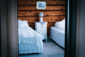
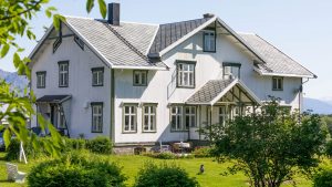
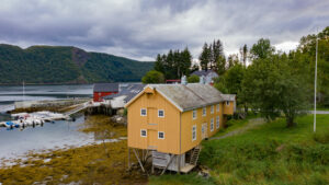
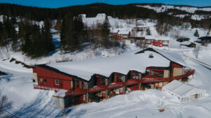
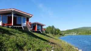
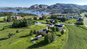
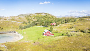
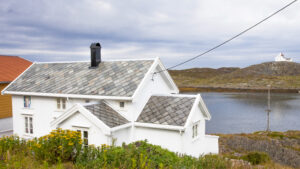
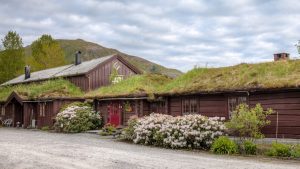
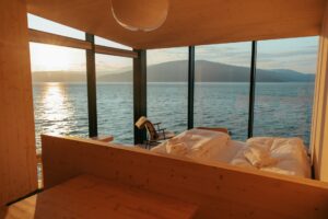
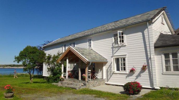
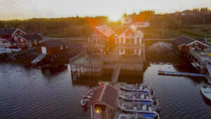
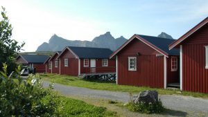
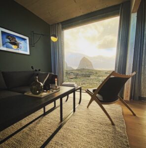
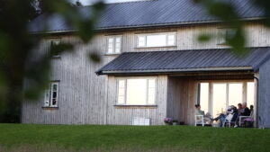
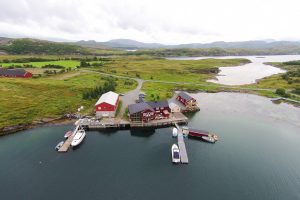
Stay with a view of the stunning Svartisen glacier
Enjoy a memorable holiday at Engen Gård, surrounded by beautiful scenery and overlooking the Engenbreen glacier in Meløy. This location is perfect for couples, families, or groups of friends looking to spend quality time together.
Aloha Cafe on Træna
Aloha Cafe, nestled in the heart of Høusøy in Træna, offers a delightful cafe experience with a touch of island charm. With it’s central location it’s just a short walk from the express boat and ferry terminals, the church, tourist information center, grocery store, Træna Accommodation, and House by the Sea.
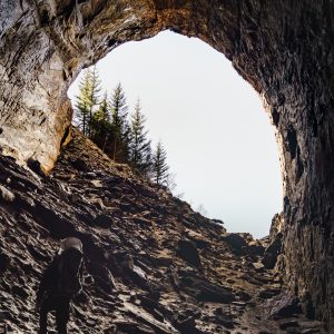
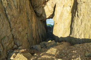
A hiking adventure: The Tonnes grotto
Please be aware: All travel at your own risk.
Tonnesgrotta is a cavernous gave situated a short but steep walk from Tonnes. The cave is almost 200 metres deep, but because of the large opening sunlight reaches all the way inside.
Jul på Berget
Christmas market in Hemnesberget
22.- 23. november 2025
In November, it’s once again time for cozy pre-Christmas magic at Jul på Berget. Here you can soak up the authentic local Christmas atmosphere through food, music, and togetherness – and maybe even take care of those last Christmas gifts while you’re at it!
Etcetera – botaniske utskeielser
Step into a botanical wonderland and a shopping experience of a lifetime, overflowing with flowers and décor, interior design, and creative art. And licorice, chocolate, ice cream, and coffee. This is a treat for all the senses, something you won’t soon forget and definitely won’t want to miss.
Vevelstad Gjestegård and Rorbuer
Vevelstad Gjestegård offers bed and breakfast accommodation in historic surroundings, located near the center of Vevelstad, a small municipality just north of Brønnøysund. The guesthouse serves homemade local traditional food and has a farm shop in the storehouse.
Seaside stays on Dønna
A spacious boathouse, a charming fisherman’s cabin, and a cosy cottage – all set in beautiful surroundings where the sea meets the hills in northern Dønna.
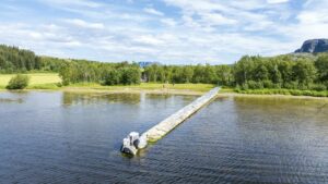
Scenic stop: Sundshopen rest area in Sømna
Sundshopen is part of Norway’s National Scenic Routes and is a beautifully designed rest area along the National Tourist Route Helgelandskysten, or the Coastal Route, passing through Sømna. Here, you’ll find benches, restrooms, and a long, gently sloping stone pier extending into the water.
HTS Mosjøen – charter tours throughout Nordland
HTS Mosjøen offers charter tours in comfortable buses with experienced drivers. With a base in the town of Mosjøen, HTS offers tailored scenic tours throughout Nordland County.
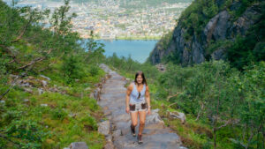
The Stair Way
Pack both your hiking and city shoes, and come along to the café city of Mosjøen. Here, you’ll experience the historic Sjøgata, the food and atmosphere at the venerable Fru Haugans Hotel, and the magnificent journey up the mountains stairs of Helgelandstrappa, the world’s longest mountain staircase and one of Helgeland’s most popular natural attractions.
The River Way
Join us on an exciting journey through raw nature, with speed and excitement, salmon fishing, and authentic traditional food on the menu. Great natural experiences meet compelling storytelling in this package tour from The Trail Way, where you’ll experience how the river and forest once served both as way of travel and way of life.

Hiking description: Vetfjellet
A nice and easy hike that takes you a bit higher up, rewarding your effort with views in several directions.
Træna Lodge – waterfront accommodation on the Helgeland coast
Stay close to the ocean and island life at Husøy in Træna. Træna Lodge is a modern wharf house with four bedrooms, a private floating dock, and easy access to fishing, culture, and everyday life in one of the most beautiful island landscapes in the world.
Guest Houses in the historic area in Mosjøen
Visitors are welcome to stay in one of the historic houses on Sjøgata street. The apartments offered are furnished in the old style but fully-equipped. Renting accommodation here will give you a good feel for a time that was less hurried – while enjoying all the comforts and amenities we have come to expect today.
Cross-country skiing trail: Kjærstad
Just ten minutes outside Mosjøen, you can enjoy cross-country skiing in beautiful terrain and lit ski tracks, and if you’re particularly lucky, you might even encounter alpacas wandering on the trail.
Historical walk through Myken
Hårek, who was born and raised on Myken, takes you on a walk around the small island. Here, you get a unique opportunity to look back at Myken’s history and learn about life in this small island community, far out at sea.
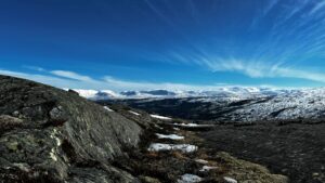
A hiking adventure: Kjemåforssen by Svartisen-Saltfjellet National Park
Round trip to Kjemåfossen, which winds down the steep slope from Kjemåvatnet on Saltfjellet.
The Mountain Way
Join us for a majestic journey to Rabothytta in the Okstindan mountain range, the roof of Northern Norway. You’ll be following in the footsteps of the mountaineers and pioneers who first explored and summited these peaks and pinnacles. With local food and pastries in your backpack, you’ll be guided on a journey through vast and wild nature, to the peace and quiet found deep within the mountain wilderness. Great natural experiences meet compelling storytelling in this package tour from The Trail Way.
A hiking adventure: Langvatnet
Family-friendly hike with a campfire site and a lean-to shelter.
Træna Rorbuferie
The Træna archipelago is surrounded by the open sea. Træna Rorbuferie is situated on Husøya, the most populated of these islands. Here, amidst magnificent scenic surroundings, you have a golden opportunity to experience the thriving coastal culture of a vibrant island community.
Brønnøysund Kajakk- courses and rental of kayaks, SUPs, and boats
Brønnøysund Kajakk has everything you need to explore the beautiful sea areas and islands around Brønnøysund, whether you want to do it with a kayak, SUP, or boat.
Halibudskole Vandve – A holiday home with boat rental and a nearby glasblowers workshop
Halibutskole Vandve offers a holiday stay where you’ll have some really great fishing opportunities. Guests who appreciate the arts and creative crafts will be pleased to know that a glassblower has a workshop nearby.
Stekvasselv Gård
Stay in the heart of the mountain wilderness with a variety of hiking opportunities, whether you want to walk on foot, climb high peaks, or go small game hunting. If you’re hiking along the Nordland Route, this is a good place to stay overnight.
Rana Museum, Stenneset open-air Museum and Bredek Mountain Farm
Rana municipality has a fascinating and varied history, which the exhibitions at MOment, the new museum in Mo i Rana’s town centre, reveals in the form of a multi-sensory experience.In addition, at Stenneset’s open-air museum, you can stroll amongst 20 historic buildings, while the mountain farm at Brenek is a popular hiking destination.
Offersøy Camping Helgeland – Camping, boat and bike rental
With Offersøy Camping as your holiday base, you can easily explore the islands of your choice along the Helgeland coast. You can island hop by kayak, or by bringing your bicycle on the express boat or ferry so you can explore various islands on two wheels. Either way, it’s a delightful way to immerse yourself in the region’s rich cultural heritage and feel close to the magnificent landscape and natural elements.
KRED Pub & Café in Brønnøysund
This is the most popular venue for local musicians as well as established artists. The pub has a big-city feel to it, and when you’re hungry, the chef offers tasty dishes. KRED is also popular as a stand-up stage, the place to watch the football game, and for its Quiz Evenings.
Hike description: Rødøyløva
Rødøyløva is one of Helgeland’s most popular and scenic hikes, as well as Northern Norway’s first National Tourist Trail. The mountain isn’t very high, and the hike isn’t long, but the view from the top is still stunning, stretching from the Lofoten Wall in the north to Vega in the south.
Lurøy Rorbuer
Enjoy long, bright summer days or a beautiful winter visit to Onøy and Lurøy. Experience island life, coastal culture, and scenic hiking areas. Go kayaking in the sheltered archipelago, visit neighbouring islands like Lovund, Træna, and Hestmannøy — and end the day with the evening sun by the pier or a quiet moment in the sauna.
Kulturminne
An easy and accessible walk suited for locals, history enthusiasts, and visitors who want to explore Nordland’s hidden treasures on foot.
Storsletta – Scenic accommodation along the Vefsna river in Grane
With the Vefsna River as its nearest neighbor, the enchanting house at Storsletta is nestled in a picturesque area.

Camping with cabins and motorhome pitches at Kjelleidet in Bindal
Along the Coastal Route in Bindal, Kjelleidet Camping offers cabins, motorhome pitches and tent areas with easy access and a close-to-nature setting. It’s a quiet and convenient stop for travellers.
Tailored boat trips with Sea Adventure Helgeland
How would you like a cruise along the Helgeland coast, designed to show you and your friends the very best the scenic region has to offer? Or how about a shuttle boat that quickly takes you where you want, exactly when you want? Sea Adventure Helgeland offers you boat trips tailored to your needs and wishes.
Korgfjellet Lodge
Come and stay right in the heart of a beautiful mountain area, in the heart of Helgeland. From Korgfjellet Lodge, you have a beautiful hiking area right outside your cabin door, both in summer and winter. Perfect for those who want to go hiking or skiing, fish in mountain lakes, hunt, or pick berries.

Hotel Sjyen – with fjord and mountain views
In the heart of the coastal village of Nesna, overlooking the fjord and the islands of Tomma, Hugla, and Handnesøya, you’ll find the newly opened Hotell Sjyen.

Pool and Cinema Weekend at Scandic Syv Søstre
Enjoy a relaxing weekend in Sandnessjøen with two nights at Scandic Syv Søstre. Take a refreshing swim in the modern pools at Kulturbadet, and round off the day with a cosy film at the cinema. The result is a comfortable mix of culture and coastal atmosphere.
Bindal Museum and the old croft at Vassås
Bindal Museum at Terråk documents local forestry, boatbuilding and other wood-working traditions. It contrasts past and present practices. The museum also includes Bindal Bygdetun, an open-air museum at an authentic old croft at Vassås, 2.5 km north of Terråk.
Your own island adventure at Myken Lighthouse
In 1918, a lighthouse was built on the fishing village of Myken, far out towards the open sea. It was guarded and cared for by a lighthouse keeper, his wife, their five children — and a cow. In 1975, the lighthouse was automated, and in 2018 it was beautifully renovated by Eventyrlig Oppussing (a Norwegian home renovation TV show). Today, you can stay here and experience the unique atmosphere of having your very own small island on the Helgeland coast.
The Petter Dass Museum
At Alstahaug you will find a museum and a church that highlight centuries of the cultural and architectural history of Northern Norway. Moreover, the area is rich in cultural monuments and is a popular hiking area for both locals and tourists. The Petter Dass Museum and Alstahaug were chosen as Nordland County’s venues to celebrate the dawning of a new millennium.
Scenic stop: The Marble Phallus on Dønna
The Marble Phallus at Glein on Dønna is the largest of its kind in Northern Europe, standing on the largest burial mound in Northern Norway. Located conveniently near the road, it’s an ideal destination for both cyclists and drivers.
Krambua Café in the coffee roastery at Forvik Old trading post
Nestled between the sea and history, along the Coastal Route in Vevelstad, you’ll find Forvik old trading post — a living tribute to Northern Norwegian coastal culture and one of Helgeland’s most charming roadside stops. Here, you can visit the cosy café, shop, and coffee roastery in the old general store, and enjoy a moment of rich aromas and flavours in a truly historic setting.

Lamesa – The taste of Asia in Helgeland
Lamesa Asian Fusion combines Asian dishes with Norwegian ingredients for a delightful culinary experience. The restaurant is located next to Kulturbadet and Scandic Syv Søstre in downtown Sandnessjøen, making it perfect for a night out with friends, a quiet evening with your partner, or a dinner with the whole family.
A hiking adventure: Klampen in Leirfjord
Klampen in Leirfjord is a wonderful hike for those wanting a mountain or summit hike that isn’t very steep but still offers amazing views.
Grane Museum
Laksforsen nature and cultural gallery tells the history of the Salmon River Vefsna, specifically its use and recreation close to one of Norway’s most fantastic waterfalls. You’ll find the gallery in the lower floor of Laksforsen café, approximately 30 km south of Mosjøen and approximately 8 km north of Trofors in Grane.
A hiking adventure: Klubben and Åstuva in Aldersundet
From Åstuva and Klubben you get panoramic views of the beautiful Aldersundet and the Helgeland Coast. There’s a reason it was one of the finalists for the title of Nordland’s best mountain hike in NRK’s summer contest.
A cycling adventure: Mosjøen – Hundåla – Sandnessjøen
1–2 Day Cycling Trip – the perfect way to experience the Inland and the Coast
Volunteer Tourism on Træna
Now you can become a volunteer tourist on Træna and receive free accommodation at House by the Sea in exchange for participating in volunteerism – contributing and becoming a part of the local community.
A hiking adventure: Skjæringen and Tvillingan in the Seven Sisters
It’s easy to see why the Seven Sisters (De syv søstre) is one of the favourite hiking destinations in Helgeland. These mountains are some of Norway’s most spectacular. While several of the summit hikes are very demanding, your whole family can enjoy the kinder mountain trails up to Skjæringen and Tvillingan.
Falch Old Trading Post, Rødøy
Falch Old Trading is beautifully situated on the Tjongsfjord, and it’s just a short detour from the Coastal Highway, Fv17. This trading post has provided many functions through the years: a fish plant, cod liver oil production, fishnet production, country store, doctor’s offices and pharmacy.
House by the Sea – A unique place to stay on the island of Træna
The House by the Sea is a unique experience, thanks to its scenic location, incredible view and innovative architecture. The three cabins are designed to make your scenic experience an integral part of your holiday accommodation.
Sijti Jarnge – Center for sami language and culture
Sijti Jarnge is a Sami language and cultural center located in Hattfjelldal, where you can experience and learn about Sami culture in Helgeland.
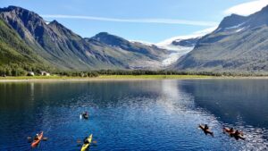
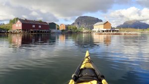
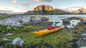
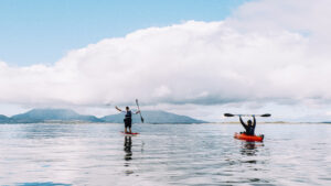
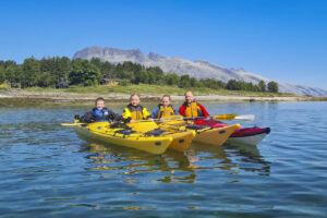
Kayaking trips in the Meløy and Rødøy area
Meløy Adventure offers guided kayaking trips on the Glomfjord, to the Svartisen glacier, and on the waters near Rødøyløva (443 m), as well as longer excursions around the island of Mesøy. The company also rents out kayaks, and its experienced instructors offer a variety of kayaking courses.
Kulturverkstedet Mosjøen – A cultural workshop
The cultural workshop in the old town, Sjøgata in Mosjøen, is a unique environment where past and present blend together.
Seil Norge – Sailing adventures on the Helgeland coast
SeilNorge is the country’s leading organizer of sailing tours, expeditions, and sailing courses. Join them for an active holiday week up and down along Norway’s most beautiful coastline; the Helgeland coast. Set against a backdrop of thousands of islands, islets, and skerries, you will learn the art of sailing, whether you are a beginner or experienced sailor.
Guided hikes and courses on Okstinbreen
Experience the beautiful Okstindbreen and Oksskolten with MAD Mountain Guides and join exciting glacier tours and courses in a magnificent glacier landscape. At 1,916 meters above sea level, Oksskolten is Northern Norway’s highest mountain and an impressive sight in a wild and beautiful mountain massif.
Velfjord Museum
The Brønnøy and Velfjord districts share an ancient history of fishing and farming, as well as a proud indigenous Sámi culture. You can gain many cultural insights by visiting the exhibitions in the old supermarket at Minnetun, as well as in the goahti (reconstructed turf hut) near here.
Kråkeslottet – Unique woollen design at Hemnesberget
The apparel store Kråkeslottet in Hemnesberget is an attraction in itself. They offer handmade woollen garments of their own design that are produced right in the store. This includes beautiful wool coats, dresses, lovely items for babies and toddlers, and clothes that will keep you warm on your hikes and outdoor adventures.
A hiking adventure: Heilhornet 1058 masl
Heilhornet towers 1,058 meters above sea level, dominating southern Helgeland’s and northern Trøndelag’s lower coastal landscapes. It’s a beautiful but challenging hike through steep and demanding terrain.
Blomsterbua Food & Wine in Mosjøen
On Sjøgata, the historic street in the heart of Mosjøen, you will find Blomsterbua Food & Wine. This cosy and beautifully decorated restaurant is suitable for every occasion.
A hiking adventure: Tårnet in Mosjøen (The Tower in Mosjøen)
Dolstadåsen in Mosjøen is a popular local hiking area, with The Tower as a great hiking destination offering views towards Vefsnfjorden.
Cycling tour: Cultural exploration on the island Dønna
This cultural tour takes you on a delightful journey across the island of Dønna, with enriching cultural and historical stops scattered like treasures along the way.
A hiking adventure: Hjartåsen in Mosjøen
Hjartåsen provides a fantastic view of Mosjøen and the Vefsnfjord, and is an easy hike that suits the entire family.
An idyllic Helgeland holiday on Rangsundøya
Just north of the Arctic Circle, in Rødøy municipality, lies Rangsundøya. At Helgelandsidyll on Rangsundøya, you stay in a glamping tent, apartment, or the “Eagle Dome.” Rent a boat, kayak, or SUP and spend your days on the water or in the mountains of the island, and relax in the evenings in the sauna. Here, you can find peace and quiet, away from the crowds.
Sailing adventures with Nordvær
Nordvær on Seløy can give you a diverse range of activities and experiences with their modern sailing catamaran as your base. You can choose between kayaking, freediving, hiking, skiing, and culinary experiences while enjoying the breathtaking views of the Norwegian landscape.
Rauvassgården mountain farm in scenic surroundings
The historic Rauvassgården is a gem in the mountains outside Mo i Rana, perfect for larger groups on a trip together, or smaller groups looking for ample space.
An exciting family rafting trip with RiverNorth
Join the fun activities, on the river and on shore, with RiverNorth at Trofors!

Scandic Meyergården Hotel – Dine and stay in Mo i Rana
Scandic Meyergården Hotel is situated in Mo i Rana’s town centre. Its restaurant features a menu based on locally sourced ingredients. Whether you are with your family, friends or colleagues, this hotel is an ideal place to stay. It’s close to premier hiking destinations such as Rabothytta cabin and Saltfjellet national park.
Topcamp Mosjøen
Located conveniently by the E6 at the entrance to Mosjøen, Topcamp Mosjøen is just steps away from some of the town’s most beautiful outdoor and activity areas. The campsite boasts a large playground, spaces tailored for motorhomes, caravans, and tents, and offers guests a choice of comfortable cabins and apartments.

Guided mountain tours on Dønna and the Seven Sisters
Join a guided mountain tour to three of the finest hiking destinations in Dønna and Sandnessjøen. Herøy Kayak & Bike can guide you on an easy hike to Åkvikfjellet or Markvollkulpen, or join us to the top of the spectacular mountain Dønnamannen.
Kayaking the waters around Ylvingen
Based on the island of Ylvingen, Himmelblå Brygge offers introductory and more advanced kayaking courses, kayak rentals, and guided kayaking trips on the nearby waters. Their beautiful island is situated just south of Vega.
Bike rental in Brønnøysund
Situated in the centre of Brønnøysund, the Tourist Information office offers bicycle rental, as well as all the equipment you need for short bike rides or long cycling adventures.
Træna Kaffekollektiv – Charming coffee bar in Træna
Træna Kaffekollektiv is a small and cozy coffee bar offering stunning views over Trænfjorden, serving the finest coffee in the archipelago.
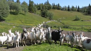
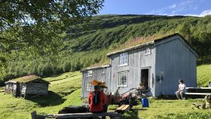
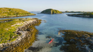
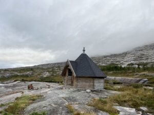
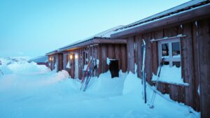
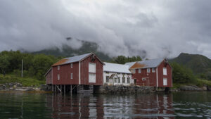
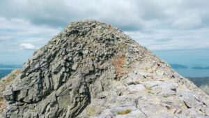
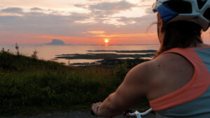
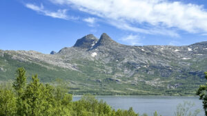
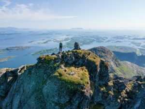
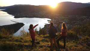
A hiking adventure: Engabreen, Svartisen in Meløy
Engabreen (also known as Engenbreen) is a glacier arm of the Svartisen glacier in Meløy. The hike from the fjord up to the glacier front is beautiful, following the blue-green Engabrevatnet and climbing over the smooth rock that’s been polished by the ice over thousands of years.
Kayaking Around Sandnessjøen and Herøy – Courses and Guided Tours
Explore stunning nature and vibrant coastal culture with Tømmervika Opplevelsessenter around Sandnessjøen, Tjøtta, and Offersøya. Join family-friendly day trips or exciting multi-day tours in Herøy and the Vega islands—and wrap it up with a fun game of football golf.
Mosjøen Hotell
Mosjøen Hotel is a cosy little hotel conveniently situated along highway E6, just 1.5 km from the Mosjøen town centre. Being within easy reach of many sights and attractions, it is an excellent base for day excursions along the coast and into the inland wilderness.
Helgeland Havhus – exclusive sea house
Many places can offer you seaside accommodation – Helgeland Havhus actually offers you a holiday home right on the sea! Treat yourself to a very special holiday, where the salty fragrance of the sea, and the sound of waves and seabirds are natural ingredients.
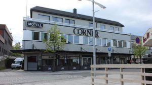
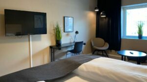
Corner Hotel
Corner Hotel – Hotel in the center of Brønnøysund, a coastal town in the middle of Norway! Corner Hotel offers affordable accommodation in close proximity to Norway’s perhaps most beautiful coastal stretch. Vega world herritage area is only a 25 minute boat ride away. The motel is perfect for those who want adventure and activity when visiting Helgeland.
Herøy Brygge – Accommodation in Herøy's island kingdom
At Herøy Brygge, you can stay in beautiful, newly renovated rooms by the sea, in your own boat at the guest dock, or stop by for a pleasant dinner by the pier. With good food, comfortable beds, and excellent hospitality, you’ll have a wonderful time in this beautiful archipelago.
Sjokoladebrygga on Dønna
Visit “the world’s smallest chocolate factory” by the sea on Dønna and experience how delicious chocolate can be when made with care and attention to exclusive, organic ingredients.
A hiking adventure: Storrunden by De Syv Søstre
If you’re looking for an easier hike in the Seven Sisters mountain range, the Storrunden loop on the southern side of Breitind (Stortind) is a great option. It offers varied terrain and stunning views — perfect for anyone wanting a scenic round trip.
A hiking adventure: Smaltiden
With Smaltind as your destination, you can enjoy a stunning view of the Helgeland coastline for almost the entire journey to the top!
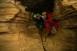
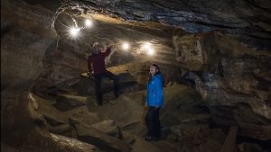
Setergrotta – An adventure inside the mountain!
In Setergrotta you can experience the mountain from the inside! A visit to this cave, situated near the town of Mo i Rana, is suitable for the entire family, and individuals as well as groups. Guided tours are given several times a day, every day throughout the summer.
Møteplass Børgefjell
Møteplass Børgefjell is beautifully situated in Susendalen, on the doorstep of Børgefjell National Park. This is a wild and beautiful natural area with nearly endless opportunities for active outdoor life, whether you want to fish or hunt, hike in the mountains, paddle a canoe, or go skiing and ski touring.
To Elise from Marius – From farm to table
In the village of Utskarpen, between Mo i Rana and Nesna, Elise and Marius established a culinary attraction that is drawing a steady stream of foodies. They offer a dining experience where every dish is made from ingredients fresh from the farm and pasture. They also offer accommodation – charming rooms in a countryside setting.
Hemnes open-air museum
Hemnes Bygdetun consists of a beautifully situated farm that can be just glimpsed from highway E6. The farm has a 500 year history, so its buildings and collections offer many insights into how our ancestors, both rich and poor, lived.
Lille Herstrand – Beachfront holiday home
Lille Herstrand is a modern holiday home just meters from the sea, located in Meløy at the northern end of the Helgeland Coast. Here, you can enjoy nature and the peaceful surroundings, perhaps from a kayak or boat?
Mosjøen city beach
Mosjøen city beach is a central swimming spot, not far from downtown Mosjøen, offering white sand, palm trees, and a playground for the little ones.
Vega World Heritage Center
The Vega World Heritage Centre, which is beautifully located at Gardsøy, documents the history and culture of the Vega islanders. Here you can gain fascinating insights into the lives of these fishermen-farmers, and about their centuries-old local tradition of protecting the eider ducks who come to nest here – a tradition that led to Vega being granted UNESCO’s World Heritage status.
Herøy Bygdesamling – A rural museum
This rural museum, situated on the beautiful island of Herøy in Helgeland, documents the local culture and history. The museum consists of a compete farmstead, altogether seven buildings dating from the period 1745–1890, all of which are protected or listed as worthy of preservation.

Local food in Sømna
The shop at Sømna Kro og Gjestegård is stocked with cheese and honey, liquorice and spices, ketchup, dressings, and much more from local food producers.
Dønna Rorbuer Bøteriet – A charming restaurant and accommodation
Dønna Rorbuer Bøteriet, situated on the quay in beautiful surroundings on the island of Dønna, offers good dining in charming surroundings, accommodation and guided boat trips.
Thon Hotel Brønnøysund
Thon Hotel Brønnøysund is situated in the heart of this coastal town in southern Helgeland. The hotel offers attractive new rooms, a restaurant with à la carte dining, and plenty of free parking for guests.
Sailing with the Nordland boat Faragut
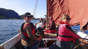
Join the sailing trip on the beautiful Nordland boat Faragut and experience Helgeland from the sea just as people here have done since the Viking Age. The Nordland boat is an open, low, and sturdy wooden boat that has its roots all the way back to the Viking ships, and it’s an experience to stand at the helm when the wind fills the sail.

Hiking description: Lomtjønna and Gråsteintinden
A family-friendly cultural trail to Lomtjønna, with the option to continue up to Gråsteintinden for a rewarding hike. Located in Utskarpen, about 40 kilometers west of Mo i Rana.
Explore Mo i Rana by Kayak – A Guided Tour
Enjoy a guided kayak tour with views of Moholmen’s historic wooden houses, Mjølanstranda beach, Mo i Rana’s industrial landmarks, and the Ranfjord.
Jacobsenbrygga and the folk museum in Mosjøen
The Vefsn Museum has numerous exhibitions at several locations in and around the town of Mosjøen. These focus on everything from rural life and urban history, to weapons smuggling and the work of the Norwegian resistance during Nazi Germany’s World War II occupation. You can also join a guided tour of the historical street Sjøgata, which is lined with 19th-century houses.
Activity vacation on Ylvingen
This is the four-day vacation you need, with accommodation, meals, and activities on the beautiful ‘Himmelblå Island’ Ylvingen.
Cross-country skiing trail: Klokkaråsen ski facility
Located just a short drive from Brønnøysund, Klokkaråsen offers a four-kilometer lit track, with groomed trails suitable for both classic and skating styles. The route winds through varied terrain with moderately steep slopes. You’ll also find a nice, family-friendly ski lift here, along with a cozy café run by the local sports club.
Rødøy Coastal Shop- café and 24-hour grocery store
The Rødøy Coastal Shop (Rødøy Kysthandel) you’ll find both a cozy café and a 24-hour, self-service grocery store, so you can get what you need whenever you need it.
Torghatten Strandrestaurant – A dining close to the ingredients
Torghatten Strandrestaurant is magnificently situated at the foot of the legendary mountain Torghatten, 15 km from the Brønnøysund town centre. Time and again travellers are delighted to discover this beautiful seaside restaurant and its terrific fjord view.
Nordvika Old Trading Post, on Dønna
The old trading post at Nordvika is one of the oldest and most intact in all of Nordland County. The museum is beautifully situated between towering mountains on the island of Dønna, just a ferry ride from its nearest town, Sandnessjøen.
Hattfjelldal Museum
In Hattfjelldal it is Fjellfolkets Hus (House of the mountain people) which is the museums home base. Here you’ll find great exhibitions and disseminations services about the place. In the house there is also a Tourist Information Office, a café, accommodation and place for meetings and events.
Toppen Panorama Mosjøen – in tranquil surroundings
Toppen Panorama, a hotel in Mosjøen that is open during the summer, offers a panoramic view of both this coastal town and the nearby fjord. Guests here enjoy tranquillity and scenic surroundings, and yet are only a few minutes’ drive away from the centre of Mosjøen
Bakarstuo – Year-round guesthouse by Trofors
Stay in an authentic log house from 1860 on the banks of the Vefsna River.
The Geopoetic Way
We call it “untouched nature.” But when you know what to look for, you’ll see that it’s full of stories and traces. Geological traces left by glaciers and ancient riverbeds. Archaeological traces and tracks from the people who came before us. On this tour from The Trail Way, you’ll learn more about these traces, how we discover them, and how we preserve them.
Cross-country skiing trail: Klokkerhagen
Klokkerhagen ski trail is just a stone’s throw away from the bustling center of Mo i Rana. The trail is well lit, and offers several kilometers of preppered tracks.
Ski touring: Kveldstuva 765 m
Just 30 minutes from Mosjøen, this popular summit tour caters to both beginners and experienced skiers. The ascent is relativly short, but the view is beautiful and the diverse terrain both above and belowe the tree line makes for excellent skiing back down again.
Fru Haugans Hotel in Mosjøen
The venerable Fru Haugans Hotel, part of the “Heimr Collection” chain, is located at the end of Sjøgata, the historic and preserved district in the center of Mosjøen.
Augustbryggo – Accommodation on Seløy in Herøy
Whether you arrive at Seløy on Herøy by paddle, bike, car, or sea, Augustbryggo welcomes you.
A hiking adventure: Summit hike to Dønnamannen
The view from the top of Dønnamannen (858 m), a mountain on the island of Dønna off the town of Sandnessjøen, is quite simply breathtaking. It’s a panorama that you can enjoy for many hours. However, the summit hike is very demanding, and is only recommended for experienced mountain hikers.
A hiking adventure: Panorama in Mosjøen
As the name suggests, Panorama is a vantage point and offers great views of the city.
A hiking adventure: Himmelbærsteinen
The hike to Himmelbærsteinen starts at the viewpoint on Kleivhalsen along the Coastal Route (Kystriksveien) in Lurøy. From the top, you’ll have a beautiful view of the islands along the Helgeland coast.
A glacier trek on Svartisen
Join us for an exotic adventure: a guided glacier trek on Engabreen. The experienced guides from Meløy Adventure will ensure that this is a safe and unforgettable adventure.
Events in Mo i Rana
In the event calendar at MoiRana.com, you’ll find a complete overview of all the city’s events – from sports competitions and markets to concerts and festivals.
Myken Handel – local shop and gathering spot
On the island of Myken, far out at sea, you’ll find a small shop with big importance. Myken Handel is more than a grocery store – it’s a natural meeting place for locals and visitors alike, located just a stone’s throw from the express boat dock.

A Weekend of Taste and Theatre: The Tale of Peer Gynt
Share an unforgettable weekend in Mo i Rana! Experience Peer Gynt with Kåre Conradi, taste the Helgeland coast’s finest ingredients, and enjoy comfortable accommodation by the Ranfjord—right in the middle of the festival atmosphere.
8770 Træna
If you visit Husøya, the main island in the Træna archipelago, consider staying at the cosy little hotel called 8770 Træna. Træna is a vibrant community, and here you will find good dining as well as strikingly beautiful scenery.
Hiking Description: Stortuva, 98 meters above sea level.
There are few other “mountains” in Helgeland that can boast about such a great panoramic view after just a 15-20 minute hike.
A hiking adventure: Bolgtinden 338 masl. and Bolgbørra
Just 338 metres above sea level, you’ll be rewarded with an incredible view of Bolga Island and the Meløy archipelago.
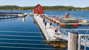
Norwegian Aquaculture Centre – A salmon success story
The Norwegian Aquaculture Centre is beautifully situated by Toftsundet. The actual fish farm is reached by a gangway from the shore. This is the place to learn more about the fascinating life cycle of salmon, and the pioneering work that made Norwegian aquaculture such an international success.

Holiday fun for the whole family in Mo i Rana
Treat the family to an active mini-holiday with a stay at Scandic Meyergården Hotel, entry to Vitensenter Nordland, and a full day of climbing and bouldering at Max Arena. Bowling, a water park, and great dining are all just a stone’s throw away – right in the heart of Mo i Rana. It’s the perfect way for both kids and parents to enjoy the festive season!
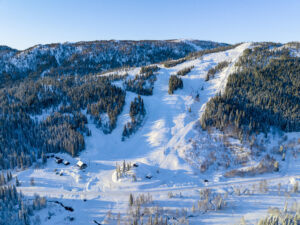
Kjemsåsen ski resort
With slopes catering to all levels, Kjemsåsen Alpine Center is the perfect destination for families looking for a fun and adventurous ski experience. Whether you’re a beginner, a seasoned skier, or a future alpinist, Kjemsåsen has something for everyone. Let the kids learn on the gentle children’s slope, while older beginners enjoy the rolling green run and the seasoned skiers test their skills on the challenging red and black run.
A hiking adventure: Kvasstind on The Seven Sisters
The hike up to the steepest peak in the Seven Sisters is perhaps the most demanding single hike in the entire mountain range. This is the hike in the Seven Sisters with the most elevation gain per kilometer!
Terråk Gjestegård – Comfortable Accommodation and Good Food in Bindal
At Terråk Gjestegård, guests can stay in comfortable rooms and enjoy dinner at the in-house restaurant Færingen Spiseri – all within easy reach of the many experiences Terråk and Bindal offer, from the fjords to the mountains.

Øyfjellgrotta – A cave adventure near Mosjøen
Øyfjellgrotta is a 500 meter long limestone cave in a mountain that towers over the scenic town of Mosjøen. The experienced guides of Hi North invite you to book an unforgettable tour of the cave.
A hiking adventure: Tjuvtrappa (The Thief Stairs)
“Tjuvtrappa” is one of Mo i Rana’s most popular urban hiking destinations. It’s a short hike on forest roads and trails, offering a splendid view of the city and the fjord.
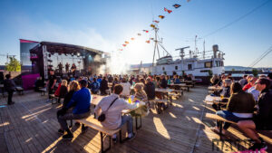
Festspillene Helgeland
Experience a week where culture and the North Norwegian summer meet through over a hundred events, thirty exhibitions, and a vibrant mix of music, art, conversations, and city life. Festspillene Helgeland is one of Northern Norway’s largest cultural festivals, attracting visitors from across the country to Mosjøen.

Gilles Cafe & Restaurant in Mosjøen
This cozy cultural café in Mosjøen is located at the “beginning” of Sjøgata and offers good food, coffee, and both small and large concerts throughout the year.
A hiking adventure: Simskardrunden in Børgefjell
Experience a taste of what Børgefjell has to offer with Simskardrunden, with a pitstop at the Simskards cabin to enjoy a cup of coffee along with your packed lunch.
Thon Partner Hotel Mo i Rana
At Thon Partner Hotel Mo i Rana, you stay comfortably by the fjord — right in the heart of Mo i Rana town centre.
The Sami Way
At the foot of the majestic Saltfjellet, by the banks of the Ranelva river, you’ll find Storli Farm and Aernie; “the hearth”. Here, you’ll get a taste of life among the mountains under the Arctic Circle, as it was and is in Sami and local culture. This package tour from The Trail Way combines authentic food traditions with vibrant cultural storytelling.

Øksningsøya – Cozy cabin getaway
Stay in peaceful surroundings in a private cabin on Øksningsøya, just a short boat ride from Terråk.
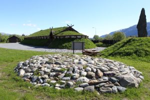
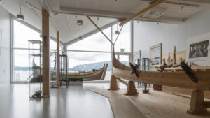
Visit the recreated Viking chiefdom seat in Sandnessjøen
You are invited to an authentic Viking experience! Bring your family or friends and see the clothes and customs, partake in activities, and enjoy a Viking banquet.
Sauna in Træna’s Old Boathouse
Get warm in the wood-fired sauna inside Træna’s oldest boathouse, then cool off with a refreshing dip in the crystal-clear sea just outside.
Velfjordferie – A holiday stay for guests who love fishing!
Velfjordferie is beautifully situated by the fjord, with great fishing spots and hiking trails nearby! The area lies just south of the Arctic Circle, which means you have daylight virtually round-the-clock, from mid-May to the end of July. Fishing is especially popular at “night”, when the wind dies down and the sea often is calm as a mirror.
Cross-country skiing: Skillevollen and Båsmofjellet
At Skillevollen, just outside the center of Mo i Rana, you’ll find a great ski arena that meets national standards. Train on the 5-kilometer illuminated trail, or take a longer trip on the total of 40 kilometers of groomed trails in the forest.
Accommodation and homemade food in Terråk
Terråk Gjestegård offers comfortable accommodation and homemade food in the heart of beautiful Bindal.
A hiking adventure: The Helgeland Stairs in Mosjøen
With 4 175 steps, Helgelandstrappa is the world’s longest stone staircase. It stretches from the Vefsna River just outside the center of Mosjøen, all the way up to the summit of Øyfjellet, towering 818 meters above the fjord and the city below.
Football Golf at Tømmervika Activity Centre
At Tømmervika Activity Centre, families and groups of friends can challenge each other to a round of football golf – a fun and social activity that blends the best of football and mini golf.
The Ravnfloget Vega Via Ferrata and the Vega Stairs
“Climbing Ravnfloget has been a dream for many people. This rugged mountain was once a lofty playground accessible only to sea eagles and ravens, hence the name.” Today, the Ravnfloget Via Ferrata, a spectacular climbing trail, will take you to the summit of Ravnfloget. The mountain is situated on the western side of the island of Vega.
Rana Climbing Center
Experience the challenges and excitement of the climbing wall at Rana Climbing Center. Whether you are a beginner who just wants to test something new, or an experienced climber on your way to new heights; here you will find routes that suit your level.
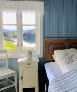
I Ro og Mak at Straumen Farm
Heartwarming stay and accommodation in the cozy Grandma’s Cabin. Find peace close to nature and the simple life in the countryside.
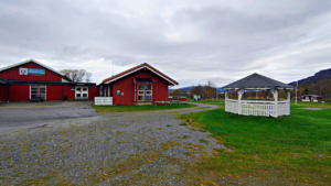

Guided island hopping by bike to Dønna and Herøy.
Take a guided bike ride from Sandnessjøen to the scenic islands of Dønna and Herøy, with stops at charming cafés and unique local shops along the way.
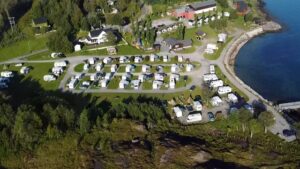
Furøy Camping by the Svartisen glacier
Furøy Camping is conveniently located near the coastal route «National Tourist Route Helgeland Coast», in the northern parts of the coast, with close proximity to the Svartisen glacier. The campsite offers cabins and spaces for motorhomes, caravans, and tents.
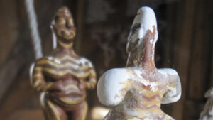
Fertility Exhibition at Fallosen on Dønna
At Glein on Dønna, you can see Northern Europe’s largest marble phallus and take a tour of the Fertility Exhibition, a collection of fertility symbols from around the world dating back 25,000 to 30,000 years.
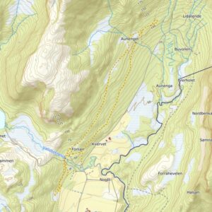
Bysprinten ski festival
Sports event in Mosjøen
April 24th to 26th
Bysprintent in Mosjøen is a festive ski race, where world-class athletes, local stars, and promising talents ski together through the center of Mosjøen. With a focus on skiing joy and good sportsmanship, accompanied by music, a great atmosphere, and packed venues, Bysprintent always provides an excellent reason to visit Mosjøen.
Skillevollen Sports Park
At Skillevollen Sports Park, there’s plenty to do for active individuals, whether you’re alone or with your family. Bring your cross-country skis, ice skates, or sled. There are also downhill slopes and a biathlon stadium.

Brasserie 8622
On September 7, 2023, Brasserie 8622 opened its doors in newly renovated premises in the center of Mo i Rana. The menu is inspired by French cuisine, made with top-quality local ingredients.
The Power Way
How do we utilize nature responsibly? How do we build a city? How do we harvest sustainably? These are important questions that you are challenged to reflect upon during this journey to and through Mo i Rana, the ironworks town set to become Norway’s green industrial capital. Experience the town, the food, the people, and the history on this package tour from The Trail Way.
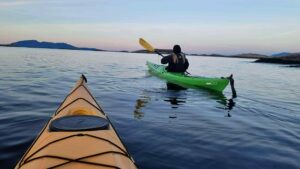
Husvær – a Paddlers’ Paradise
An indescribable island kingdom in the heart of the world’s most beautiful coastline. Here you’ll find calm channels, chalk-white beaches, and panoramic views of the Seven Sisters mountains. Perfect for both beginners and experienced paddlers.
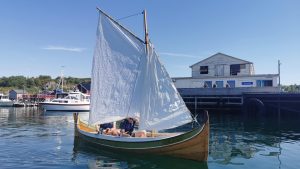
Himmelblå Brygge: Dining and accommodation at Ylvingen
To Norwegians, Himmelblå Brygge and the island of Ylvingen is well known from a popular TV programme. Fortunately, all visitors are welcome to dine and enjoy an overnight stay here. Some of the accommodation is unusual and the scenic surroundings are magnificent. And for young and old, Himmelblå Brygge offers lots of activities and great adventures!
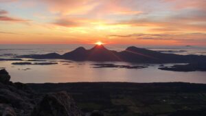
A hiking adventure: Queens Route in The Seven Sisters
The Queen’s Route takes you to the summits of the two northernmost peaks of The Seven Sisters: Botnkrona (1072 meters above sea level) and Grytfoten (1018 meters above sea level). It’s a magnificent hike, following the path that the Queen Sonja took when she visited the Seven Sisters for the first time.

Nordland Theatre – Magical Moments
Nordland Theatre offers magical moments that may leave a lifelong impression. The theatre is situated right in the centre of Mo i Rana. This is regularly the venue for new and exciting performances, with the Winter Light Festival (Vinterlysfestivalen); the highlight of the year.
YogaBiret – yoga experiences immersed in Helgeland’s nature
Experience yoga surrounded by the landscapes of Helgeland – whether through a full weekend of Ashtanga Yoga on Dønna or a single outdoor session in nature. These offerings create a unique blend of movement, calm and the natural world, adding meaning and depth to your journey through Helgeland.

Savory farm food from Vega
Get a true taste of Vega at Stavsmarken Gård. This small farm shop offers a mouthwatering selection of homemade cured meats and farm food, as well as a cozy summer café where you can savor all the Vega countryside has to offer.
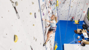
Stupbratt Klatreklubb – Climbing hall in Brønnøysund
Test your climbing skills, challenge yourself and each other, and reach new heights at Stupbratt Klatreklubb’s climbing hall. With over 60 routes in all difficulty levels, auto belay, a bouldering wall, and a Kilter Board, there’s something for everyone—regardless of age or experience.
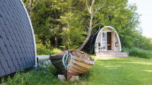
Elfis Sjøstuer – An idyllic stay in rorbu cabins
Elfis Sjøstuer is beautifully situated by a small cove on the northern part of the island of Herøy. This is the place to come for a tranquil holiday in scenic surroundings. Guests enjoy a fine view that spans from the Seven Sisters mountains to the south and the peak called Dønnamannen to the north. Activities available include kayaking, fishing, hiking, cycling and island hopping.
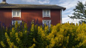
Træna museum
Træna Museum documents the this archipelago’s history going back to the Stone Age. Some of the archaeological discoveries displayed date back at least 9000 years. For this reason, Træna can rightfully call itself “the oldest fishing community in Norway”.
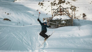
Glomfjord Alpine Centre – pure ski joy in the Meløy Alps
Glomfjord Alpine Centre offers a chairlift, varied slopes, and breathtaking views of the fjord and surrounding glaciers. This is a winter paradise for experienced skiers and freeride enthusiasts, surrounded by snow-covered peaks and a local team with a true passion for the mountains.
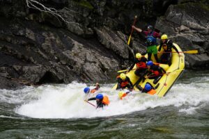
An exciting half-day rafting adventure at Trofors with RiverNorth
RiverNorth’s most popular excursion is the Half-Day Rafting Adventure. You get to challenge big waves – and see if you’re brave enough to dive from a cliff!
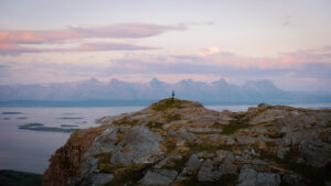
A hiking adventure: Åkvikfjellet 293 masl
Åkvikfjellet is a beautiful and easily accessible mountain for hiking, located on the border between Dønna and Herøy.
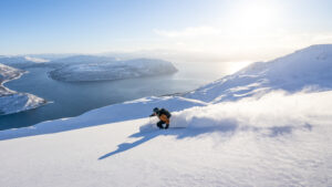
Ski & Sail along the enchanting Helgeland Coast
Join the thrill of a 6-day ski touring and sailing adventure along the enchanting Helgeland coast with Nordværs exclusive spring excursion charters. From March through May, you’ll embark on a five-night journey from Nordværs idyllic base in Seløy, setting sail aboard their state-of-the-art catamaran.
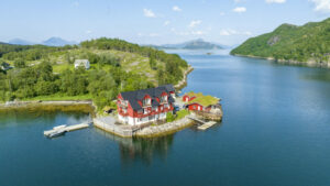
Brygga on Dønna
“Brygga” is nicely located in quiet surroundings on the north-eastern side of Dønna, 7 km from the ferry terminal at Bjørn. The wharf consists of 5 apartments of 60 square meters each located right next to the sea. They also offera a conference room, boathouse, grill, hot tub and a cabin (Rorbu).
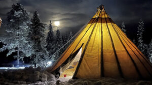
An evening wilderness adventure with a taste of Sámi culture
Come along for a wilderness adventure in Helgeland. With the moon and perhaps the glow of the Northern Lights illuminating our way, and equipped with headlights if needed, Hi North will guide you on a magical adventure!
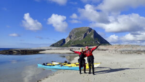
The kayakers paradise at Støtt
From Støtt, you can paddle in the beautiful and sheltered archipelago of Støttvær or indulge in the thrill of surfing waves and breakers along the open coast. Join a course, embark on a guided tour, or rent a kayak of your own.
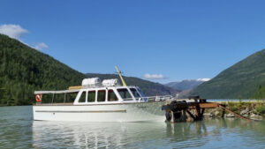
Boat to Austerdalsisen glacier – Svartisen in Rana
Looking for a unique nature experience? Austerdalsisen, Svartisen is located just north of Mo i Rana. Svartisdal takes you by boat across Svartisvatnet so you can witness this spectacular glacier.
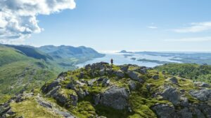
A hiking adventure: Gåsheia, the four peaks in Brønnøy
4 Peaks in One Hike – Gåsheia Hiking Area. Located about 12 km from Brønnøysund town centre, Gåsheia offers the option of hiking 1 or all 4 gentle summits in one trip.
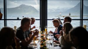
Tampen Café on Kvarøy
At the edge of the pier on Indre Kvarøy, you’ll find the bustling life at Tampen Café—a surprisingly urban lunch spot in the midst of an exciting, small coastal community.
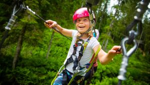
Krokstrand Fjellpark – Accommodation, food and a climbing park!
With holiday accommodation at Krokstrand, young and old can take the challenge in the “High & Low Climbing Park”, play mini-golf, hike the mountains or go fishing. Hunting in the nearby wilderness is also available. Rent a room or an entire holiday home, and dine on delicious home-cooked meals in the café.
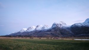
A cycling adventure: Cycling to The Seven Sisters
On this relaxed bike ride from Sandnessjøen to Søvik, you will enjoy views of this famous mountain range The Seven Sisters (De syv søstre) and the beautiful surrounding scenery.
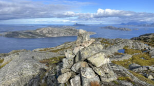
A hiking adventure: Himmelbergsteinen – Tonnesfjellet
Nice trip to the characteristic white “Himmelbergsteinen” or “Himmelberrsteinen” on Tonnesfjellet in Lurøy.
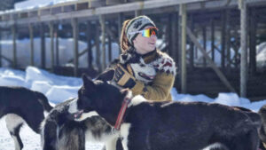
Dog Sledding with Freke Wilderness
Meet the sled dogs and embark on a magical winter adventure for nature lovers, dog enthusiasts, and adventure seekers of all ages!
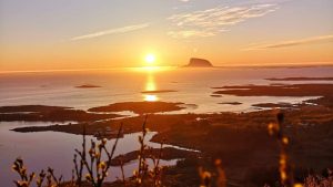
Hike description: Dønnesfjellet
The hike to Dønnesfjellet (the “Dønnes mountain”) is an easy and scenic trip located on the northern part of Dønna. With just 125 meters of elevation gain, you’ll be rewarded with breathtaking views of the islands along the Helgeland coast and, depending on the season, stunning sunsets or the midnight sun over the ocean.
Electric car chargers from Lad Opp
At the excellent charging stations provided by Helgeland Kraft, you can recharge both your and your car’s batteries. Your car’s batteries can be charged with renewable hydropower, while you can recharge with experiences in beautiful nature.

The Coast Coffee
At the coffee roastery The Coast Coffee at Lovund, the lively coastal culture and urban coffee culture meet at their best. Here you can enjoy an exquisite cup of coffee in what is the island’s own coffee bar and roastery, with a great atmosphere by the sea.
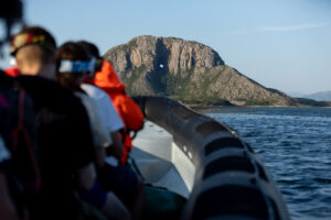
A RIB sea-rafting trip around Torghatten
Sea Adventure Helgeland offers to take you on an unforgettable RIB voyage around Torghatten, the legendary mountain with a hole through it. We will explore part of Helgeland’s magnificent coastal archipelago. The voyage is also an opportunity to see the birdlife and the coastal culture of Brønnøy up close.
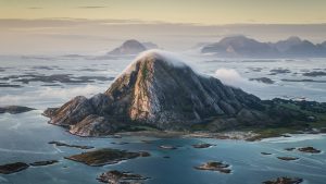
Bolga Brygge – Sleep to the soothing sound of waves
Bolga Brygge offers comfortable accommodation and good dining. Guest can enjoy fishing, kayaking the sheltered waters nearby, and hiking up a mountain that offers an amazing panorama of a large section of Helgeland.

Six‑day Cycling Holiday in Helgeland
A six‑day cycling trip starting and ending in Brønnøysund. Along the way, participants will experience several of the most scenic places on the Helgeland coast, with beautiful surroundings and pleasant stops throughout the journey.
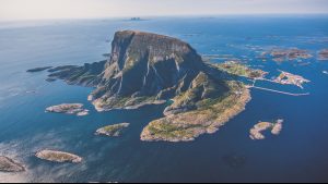
A hiking adventure: Summit hike to Lovundfjellet
Far out at sea, on the island of Lovund, is a striking mountain. The summit hike is rather demanding but you are rewarded with an amazing panorama of the Helgeland coast. And what other mountain welcomes you with a flower meadow at the top!
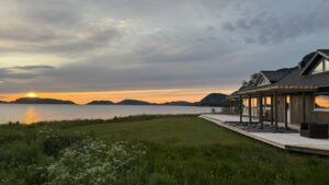
Grannen Lodge – a modern retreat by the Bindal Fjord
By the tranquil Bindal Fjord, surrounded by mountains and sea, lies a modern holiday home that offers both serenity and raw coastal nature. Here you can stay in comfort with panoramic views of the surrounding landscape – and with direct access to the sea right outside your door.
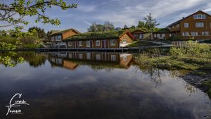
Vega Havhotell and restaurant
Vega havhotell is a small hotel in beautiful surroundings with the ocean close by. Vega Havhotell is located at the north-west part of Vega, at Viksaas between forests, mountains and seas.
City walk: Street Art Safari in Mo i Rana
Take a walk or bring the kids on a treasure hunt and explore the street art in Mo i Rana. Here, you’ll find graffiti art created by artists from all around the world.
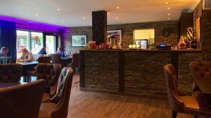
Restauranthuset Tipperary
Tipperary actually consists of three different establishments in a restaurant house that stands on a pleasant pedestrian street in the heart of Mosjøen.
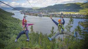
Mosjøen Zip-line
At the heart of Nordland County, in the geographic middle of Norway, is the friendly town of Mosjøen. On Storfjellet, right near Øyfjellet just outside town center, is Northern Norway’s most spectacular zip-line.
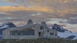
A hiking adventure: Rabothytta – Norway’s most impressive DNT cabin
The DNT cabin Rabothytta is impressively situated at 1200 meters altitude, by the very edge of Okstindbreen glacier. The cabin enjoys a stunning view of the glacier, as well as the Okstindan mountain range and its highest peak Oksskolten (1916), the tallest mountain in Northern Norway.
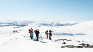
Ski touring: Kjerringtinden, 1395 m
Kjerringtind is a challenging peak by the large lake Røssvatnet, in the mountains of Helgeland. The trip is 4 km one way with an ascent of approx. 1000 meters of altitude, and takes approximately 3-4 hours to complete.
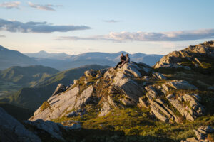
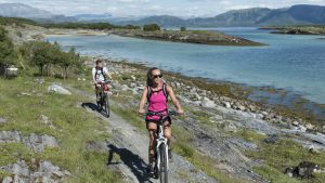
A cycling adventure: Torghatten – the iconic mountain with a hole in it
Hear the sounds from the sea and enjoy the coastal landscape on this nice bike ride from Brønnøysund to the legendary mountain Torghatten on the island Torget.
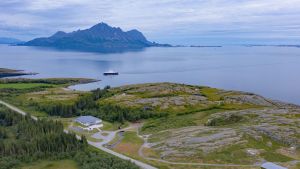
Grønsvik coastal fortress, Lurøy
If you want to see an unusual attraction and gain insights into World War II history, we recommend a visit to the old German coastal fortress at Grønsvik, which is now a museum. As you walk from the attractive parking lot and picnic area, you enter a dark chapter of European history.
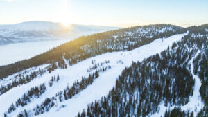
Skillevollen Alpine Center
Skillevollen Alpine Center is part of a larger winter activity center in Mo i Rana. Take the family skiing on the alpine slopes, the cross-country trail or on the ice rink in winter.
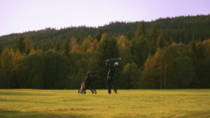
Gulljorda golf course – 9-hole golf course near Mosjøen
Play golf in picturesque surroundings at this beautiful 9-hole course, just a short drive from Mosjøen.
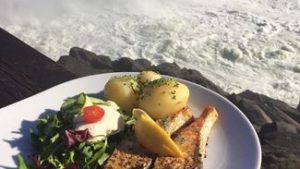
Laksforsen – Generations of tratidional food
Laksforsen is situated in Grane by highway E6, with a breathtaking panoramic view of a beautiful waterfall.
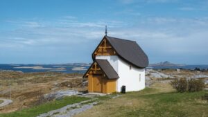
A hiking adventure: Culture walk on Husøya
Join us for a walk through the village and island of Husøy in Norway’s oldest fishing village, Træna. With a history dating back to the Stone Age and a vibrant cultural scene today, this is a pleasant stroll through a warm and creative island community
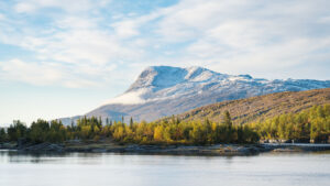
Hike description: Kjerringtinden (1395m)
Kjerringtinden near Røssvatnet is a popular peak for ski tours in winter and a rewarding hike for experiences hikers in summer and autumn. However, the route is steep, so it requires a good level of fitness.
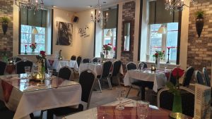
Restaurant Soprano – Wining and dining in Sandnessjøen
Restaurant Soprano offers a taste of Italy in rustic surroundings. During the summer, you can dine at an outdoor table, surrounded by trees, cobblestones and people strolling along the pleasant pedestrian street on which the cosy restaurant is situated.
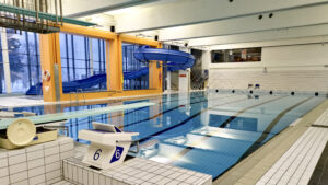
Kippermoen Pool and Sports Center
With a large exercise pool, hot therapy pool and paddling pool, diving board, and waterslide, the pool facility at Kippermoen Sports Center is excellent for your entire family. And at the rest of the sports center, you can find a squash court as well as a versatile outdoor sportspark.
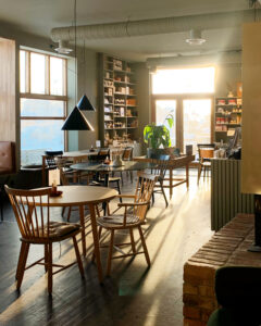
Skolo – an architectural gem in Herøy
The beautiful renovation of Seløy’s old school has been described in an article in “The Norwegian Review of Architecture”. Today, travellers can find accommodation here, drink quality coffee, eat pizza, browse books and buy artworks in the shop – and enjoy the panoramic view of The Seven Sisters mountains
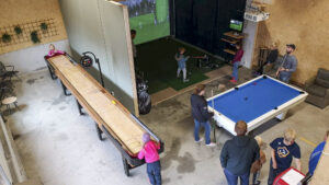
Kvarøy activity hall
Activity hall with shuffleboard, billiards, golf and hunting simulator, and much more fun for the whole family!

Løyle Farm – Petting Farm with alpacas, horses, dogs, and goats
At Løyle Farm, the whole family can meet farm animals such as horses and alpacas, goats and sheep, and of course, the loyal farm dogs. In the farm’s small play park, children can play and have fun, while adults can relax and enjoy country life with a cup of coffee.
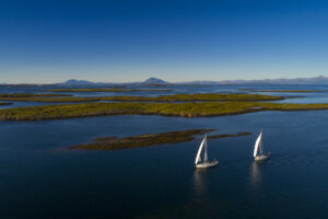
Sailing trips to Vega, Lånan and Torghatten
You are invited on an unforgettable sailing trip to the UNESCO World Heritage Area of the islands of Vega and the eider duck nesting site, Lånan, that for many generations has been protected by the islanders. Or choose a voyage to the legendary mountain with a hole through it, Torghatten.
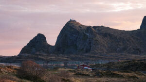
A hiking adventure: Gompen
An easy, yet nonetheless spectacular “summit hike” at the outermost reaches of the Helgeland coast. Here, you can follow the old construction road to the radar station on “Gompen” in the Trænafjellene, on the island of Sanna in Træna.

Skillevollen Sports Park
At Skillevollen Sports Park there’s so much to do for you who love being active outdoors, either if you’re coming by yourself or together with your family, and bring your cross-country skis, ice skates, or sleds. Here you can also find alpine slopes and a biathlon stadium.
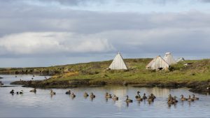
Eider ducks, luxurious down and the bird guardians of Lånan
The largest eider duck nesting site on the Helgeland coast is situated in the Vega World Heritage area. You can join us on a visit to the island of Lånan, where the nesting eider ducks and their bird guardians have a trusting and mutually beneficial relationship.

Hunting the Northern Lights at Støtt
Do you yearn for a truly magical winter adventure, and a respite from the hustle and bustle of everyday life? Between September and May, Støtt invites you to see the amazing celestial display of the Northern Lights! In addition, you will surely appreciate the subtle winter colours of our beautiful island realm.
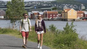
A hiking adventure: Marsøra – a lovely hike along the Vefsna river
Go on a nice stroll along the Vefsna river, with views over the wharves along the historic street, Sjøgata.
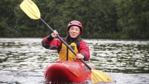
Learn whitewater kayaking with RiverNorth
Join an exciting river adventure and learn whitewater kayaking on the stunning Austervefsna river in the heart of Helgeland. Become confident in a whitewater kayak and experience the thrill and fun in wild and beautiful nature.
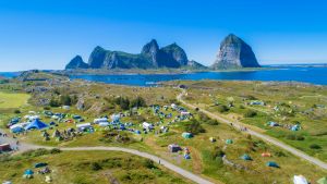
Trænafestivalen
Music festival in Træna
July 9th to 12th 2025
Trænafestivalen is a cultural experience as breathtaking and unique as the landscape it’s set in—beautiful Træna, located on the outer edge of the Helgeland coast. This is one of the most exciting opportunities to experience these remote islands at their most vibrant.
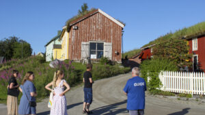
Guided city walk in Mo i Rana
Join a guided city walk and hear the story of life just below the Arctic Circle, at 66 degrees north.
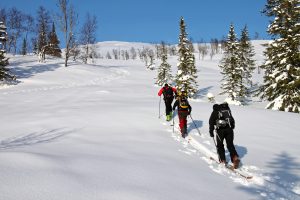
Ski touring: Bomfjellet 1311 m
Bomfjellet is a popular mountain for ski touring just outside Mo i Rana. After the nice climb, you can bask in the magnificent view from the top, overlooking the fjord below.
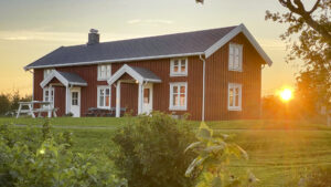
Cosy farmhouse stay at Stavseng Gård
Stavseng Gård is located in the northern part of the long, narrow island of Dønna. Here, you can rent a self-catering accommodation and experience life in the rural village of Stavseng.
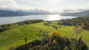
Polarsirkelen Golf – The Arctic Circle Golf
The Arctic Circle Golf course features a stunning 9-hole golf course just outside Mo i Rana, along with golf simulators for those looking to hone their skills off-season.
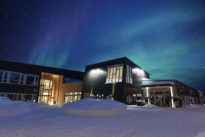
Fjellfolket Hus – in the middle of Hattfjelldal
Experience the beautiful natural areas along the Wilderness Road starting from the mountain village of Hattfjelldal. At Fjellfolkets Hus, you’ll find accommodation, tourist information, a museum, and a handicraft shop, allowing you to be close to both nature and culture in this fantastic mountainous region.
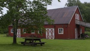
Sømna Bygdetun – An open-air museum
Sømna Bygdetun highlights how the lives of fishermen-farmers and their families changed in the course of the years 1800–1950.
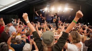
Rootsfestivalen
Music festival in Brønnøysund
July 16th to 19th 2025
In the height of summer, you can enjoy four days of a vibrant mix of local musicians, emerging talents, and well-known national and international artists.
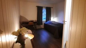
Brønnøysund Overnatting – Accommodation in the heart of town
Did you know there is cosy accommodation available within walking distance of the airport as well as the heart of Brønnøysund? It’s ideally situated with its proximity to good outdoor recreation areas, as well as the many excellent cafés and restaurants in this coastal town.
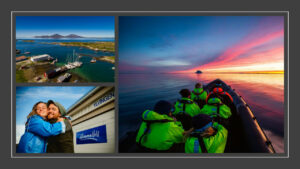
RIB Adventure to Himmelblå from Brønnøysund
Feel the thrill of the open sea, discover hidden gems, and get close to incredible wildlife on one of our RIB adventures to Himmelblå and Ylvingen.

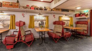
Sure Hotel by Best Western Ole Tobias
Sure Hotel by Best Western Ole Tobias offers accommodation in the town centre of Mo i Rana. The hotel is decorated with details from Norway’s railway history. Breakfast is served in “Spisevogna” (the Dining Car).
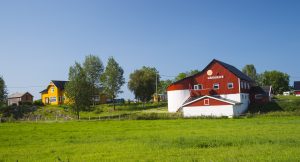
3 Kalver – Hearty dining at a farm restaurant
The farm restaurant called 3 Kalver (Three Calves), situated on the island of Dønna, offers satisfying dining in distinctive surroundings. The menu proudly features dishes based on quality local ingredients.

Moheia Bad – a modern swimming facility in Mo i Rana
Moheia Bad is a popular meeting place for people of all ages who want to swim, play, exercise, or simply relax. With four different pools, a water slide, saunas, and a café, everything is in place for an enjoyable experience – all year round.
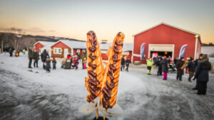
Christmas in the countryside
Christmas Market in Sandnessjøen
December 6th 2025
Join us in the countryside for a day filled with Christmas spirit. Christmas in the Countryside just outside of the cozy coastal town of Sandnessjøen is free for everyone, with activities like a hobby horse course, face painting, horse-drawn sleigh rides, and much more. Maybe Santa will drop by too?
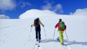
Ski touring: Tortenviktinden 1027 m
According to the magazine Fri Flyt in 2024, Tortenviktinden is considered one of Norway’s best backcountry skiing tours, thanks to its spectacular views of the Helgeland coastline and numerous downhill options.
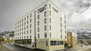
Strawberry Home Hotel Helma
The Strawberry Home Hotel Helma is centrally situated in the town Mo i Rana. The hotel offers accommodation designed to make you feel right at home. Its location is conveniently near the shops, the theatre, the science centre Vitensenter Nordland, and the town’s attractive Fjord Promenade. Breakfast, afternoon coffee and a hot supper are always included in the price.
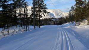
Cross-country skiing: Tovåsen and Randalen
At Tovåsen, a 10-minute drive from Leland in Leirfjord, you’ll find the Tovåsen and Randalen ski resort. Here you’ll find excellent, snow-sure ski trails suitable for the whole family.
Sømna Kro og Gjestegård
A welcoming inn offering comfort and a taste of local culture in the charming village of Vik, Sømna. Here, you can enjoy a pleasant stay and great food in peaceful surroundings, close to nature and a charming cultural landscape.
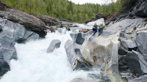
A hiking adventure: The Marble Castle (Marmorslottet)
Experience a fairytale landscape of carved marble near the town of Mo i Rana. The amazing natural marble formations know as Marmorslottet – “the marble castle”, has taken the river thousands of years to carve out. So please tread carefully and help us conserve this natural wonder.
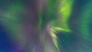
Norwegian Aquaculture Centre – Northern Lights Safari on the Helgeland Coast
Join an unforgettable Northern Lights experience along the southern part of the Helgeland coast. Aboard a comfortable yacht, we set out in search of the magical Aurora Borealis in one of Norway’s most scenic coastal areas. With the sea beneath us and the sky above, we glide silently across calm waters, far from city lights and noise.
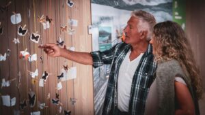
Nordland National Park Centre – fine art and natural history
There is much to learn about the amazing wilderness and national parks of Nordland County – and the exhibitions at the Nordland National Park Centre aim to inspire this and much more. The centre offers something for the whole family, with exciting activities for young and old, such as walking the trails in the beautiful surroundings.
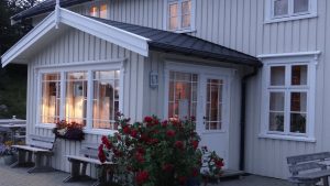
Klokkergården – Stay in nostalgic surroundings on the island of Rødøy
At the foot of the majestic mountain called Rødøyløva, is the stately Klokkergården, a sexton’s residence that dates back to 1904. Here you can enjoy warm hospitality in surroundings that recall a bygone era.
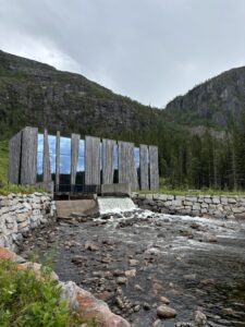
A hiking adventure: Øvre Forsland and Forslandsdalen
Welcome to Øvre Forsland! In the heart of the beautiful northern Norwegian landscape, where mountains meet the sky in a spectacular display of natural art, lies Øvre Forsland – a treasure waiting to be explored by nature lovers and adventurous souls.
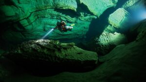
Plura Valley in Rana – A divers paradise!
Many experienced divers consider Plura Valley to offer world-class diving. Their facility offers everything you need for a perfect diving holiday. Moreover, they are situated right by the entrance of the underwater cave, Pluragrotta.
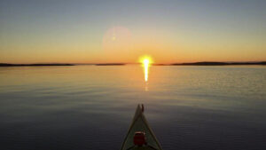
Padleheimen – Courses and guided tours in the beautiful Støttvær archipelago
Join a guided tour or kayak course in the stunning Støttvær islands. Enjoy birdwatching and the peaceful waters and striking landscapes, or challenge yourself in rougher seas along the outer edge of the islands.
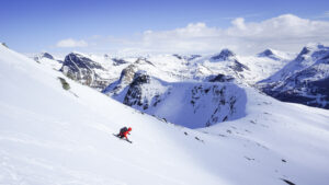
Incredible guided ski tours on the Helgeland Coast
Join MAD Mountain Guides for a dream ski adventure along the stunning and dramatic Helgeland coast. With unique accommodations, untouched slopes, and experienced professional guides, you’ll enjoy a custom-tailored ski vacation like no other.
Arctic Circle Classic Motorcycle museum
Visit a one-of-a-kind museum where vintage motorcycles meet a dramatic northern Norwegian setting. This unique museum combines a passion for two-wheelers with local World War II history, and is located in Storforshei, just north of Mo i Rana.
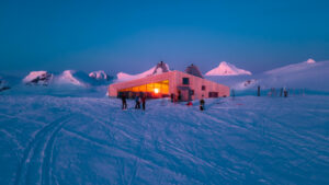
Ski touring: Rabothytta 1200 m.
If you’re used to traveling in the high mountains during winter, a ski trip to Rabothytta is a uniquely wonderful experience.
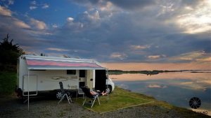
Sandnessjøen Camping
Sandnessjøen camping is located at Steiro along the Rv 17, 10 kilometers south of Sandnessjøen. Sandnessjøen Camping is just a short walk from the mountains De Syv Søstre and the local airport.
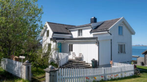
Jettehuset Bed and Breakfast – A Cozy Place to Stay on Sleneset
Jettehuset B&B is a charming guesthouse on Sleneset in the Solværøyene island group on the Helgeland coast. The guesthouse offers comfortable rooms and warm hospitality in an authentic old Nordland house.
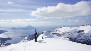
Ski touring gourmet weekend with Til Elise and MAD Mountain Guides
Join a first-class ski touring weekend with guided ski tours in the snow-covered Helgeland mountains, relaxing afternoons in the sauna, and exceptional culinary experiences.
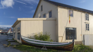
The Zahl building and the old sexton´s residence in Nesna
The main facility of the Nesna Museum is the building that once housed the business of the local Zahl family. This large and stately commercial building, which dates from 1907 and has Swiss-style decorations, has been expanded both in width and towards the rear. Nesna is amongst other things known for “Nesnalobben”, and an exhibition in the museum is dedicated to this footwear.

Raus Brewery
Discover Raus Brewery in Nesna, Helgeland. Join a guided tour, go beer tasting, or simply enjoy the warm hospitality of this local brewery, where yoy can indulge in craft beverages inspired by the nature of Helgeland.
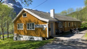
Accommodation at Glomfjord Overnatting
Meløy is a beautiful area for a wide range of holiday activities, year round. With a comfortable base at Glomfjord Overnatting, you have easy access to adventures on the sea and in the mountains.
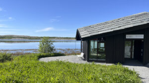
Ristning-Tjaalege, Vevelstad museum and bygdetun
Not far from the Forvik ferry terminal lies the new museum building Ristning–Tjaalege and the local heritage site, side by side with Vevelstad Church. Around the museum, you can find intriguing ancient monuments such as rock art (petroglyphs) and burial mounds from the Iron Age.
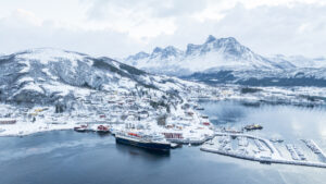
Ørnes Hotel
Ørnes Hotell offers comfortable accommodation in the heart of Helgeland’s stunning coastal landscape. With easy access to both nature and local experiences, it’s the perfect base for your journey.
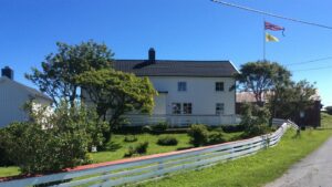
Nerstua Guesthouse- accommodation on Selvær in Træna
In the charming house Nerstua, on Selvær — at the outer edge of the Helgeland coast — you’ll find peace and a place to truly unwind. In this special island community, you can stay close to nature and the sea, and rest well between your big and small adventures.
Hike description: Markvollkulpen in the Seven Sisters
A short hike to Markvollkulpen for a refreshing swim is perfect if you’re looking for an easier adventure in the Seven Sisters on a warm summer day. You can also stop by on your way to or from the peaks of Skjæringen and Tvillingene.
Find accommodation, food, and activities nearby.
Ørnes Hotel
Ørnes Hotell offers comfortable accommodation in the heart of Helgeland’s stunning coastal landscape. With easy access to both nature and local experiences, it’s the perfect base for your journey.
Stay with a view of the stunning Svartisen glacier
Enjoy a memorable holiday at Engen Gård, surrounded by beautiful scenery and overlooking the Engenbreen glacier in Meløy. This location is perfect for couples, families, or groups of friends looking to spend quality time together.
Kayaking trips in the Meløy and Rødøy area
Meløy Adventure offers guided kayaking trips on the Glomfjord, to the Svartisen glacier, and on the waters near Rødøyløva (443 m), as well as longer excursions around the island of Mesøy. The company also rents out kayaks, and its experienced instructors offer a variety of kayaking courses.
Padleheimen – Courses and guided tours in the beautiful Støttvær archipelago
Join a guided tour or kayak course in the stunning Støttvær islands. Enjoy birdwatching and the peaceful waters and striking landscapes, or challenge yourself in rougher seas along the outer edge of the islands.
A weekend of high adventure on the lofty peaks!
The picturesque Meløy Alps offers some of the wildest off-piste skiing in Northern Norway!
More hiking adventures in the area

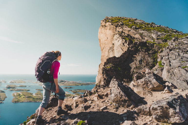

Explore more
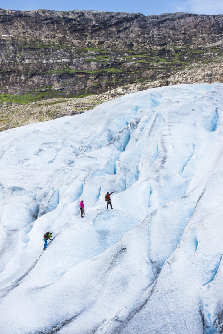 CH / Visit Helgeland
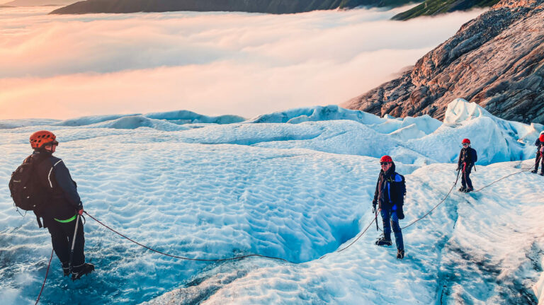 Meløy Adventure