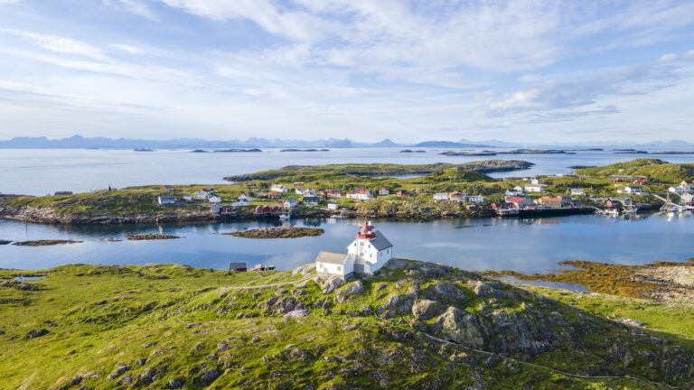
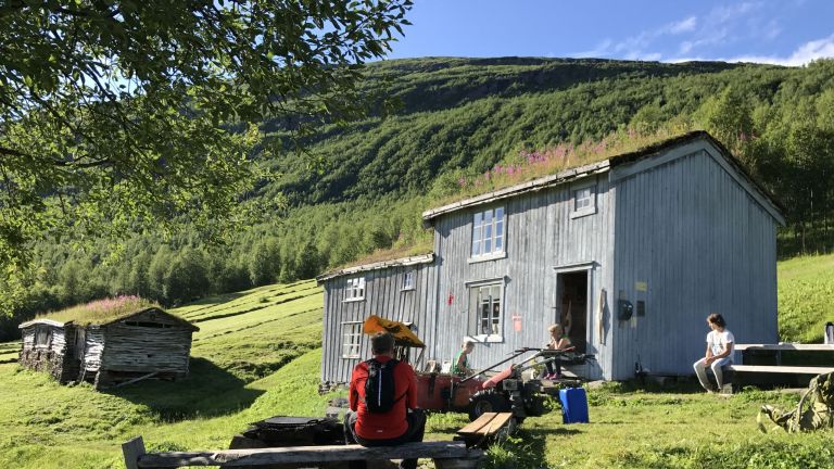
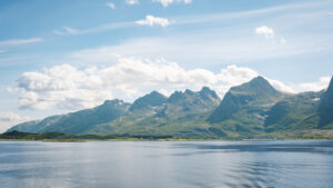
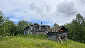
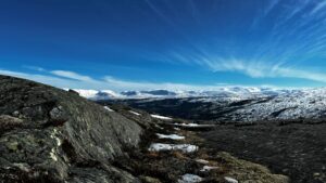
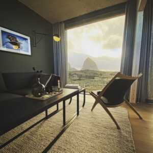
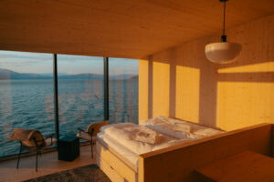
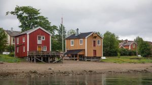
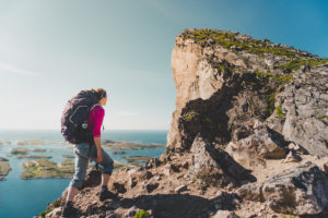
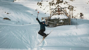
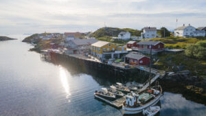
 Kristoffer Møllevik / Visit Helgeland
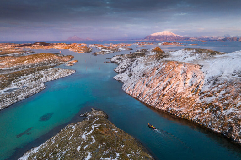
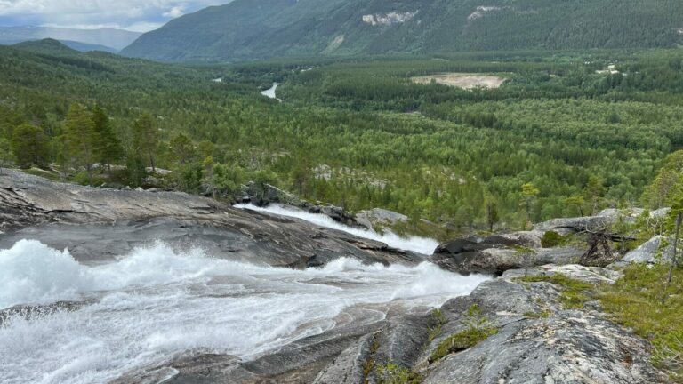
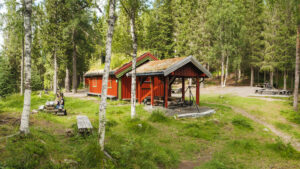
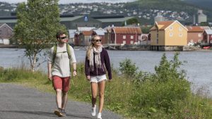
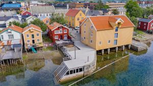
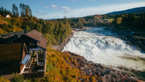
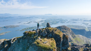
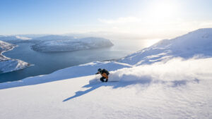
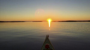
 Roger Brendhagen / Visit Helgeland
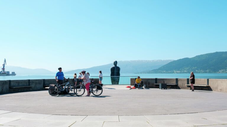
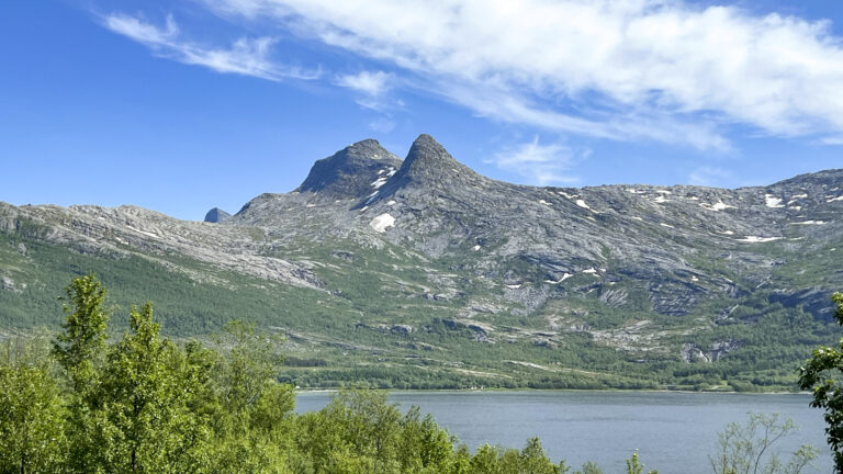
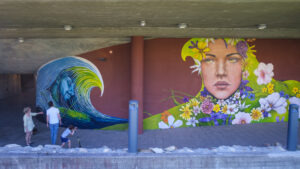
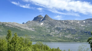
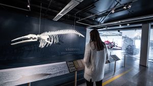
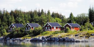
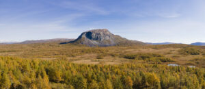
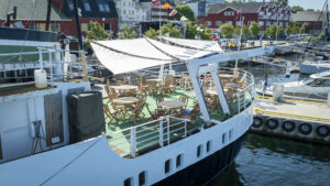
 Allan Berg / Vitensenter Nordland
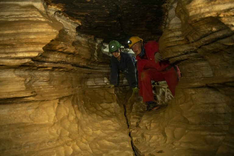
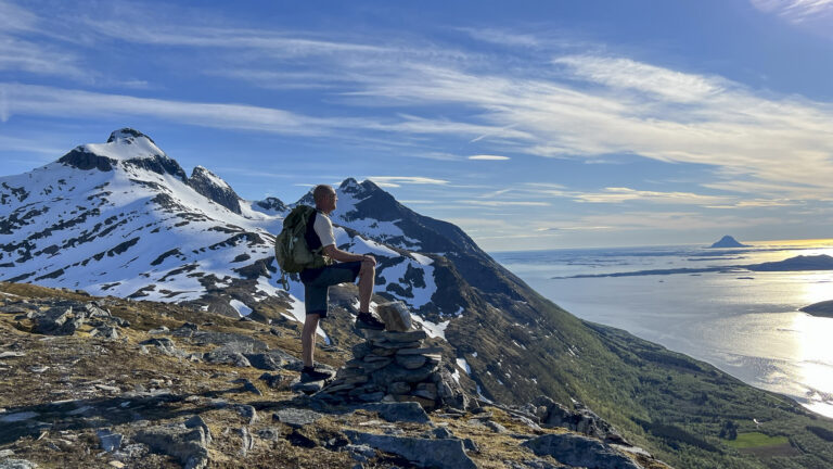
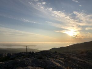
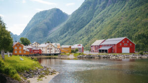
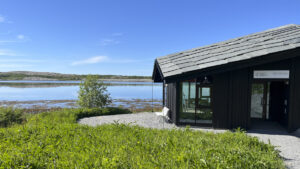
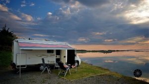
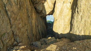
 Simon Fossheim / Visit Helgeland
 Visit Helgeland
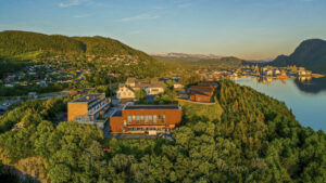
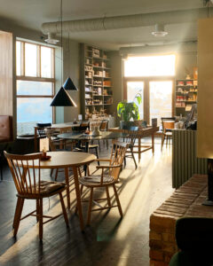
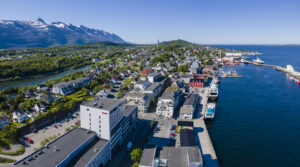
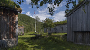
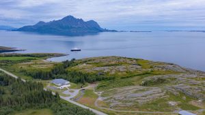
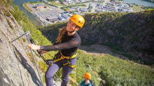
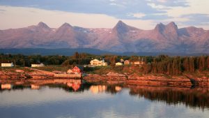
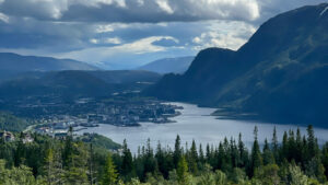
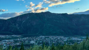
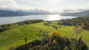
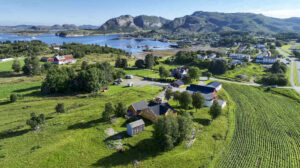
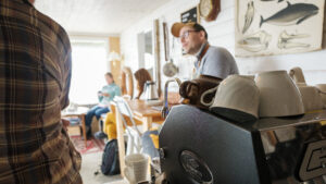
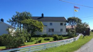
Right on the edge of the Arctic Circle, beneath Svartisen glacier and the Saltfjellet mountains, lies Mo i Rana – the largest town in Helgeland. Its history spans from being a trading post in the old days, to an industrial hub during the “ironworks era,” to the modern mini-metropolis it is today. The town offers cafés and a theatre, shopping centres, a bowling alley, a water park, a climbing centre, a science centre, museums, and concert venues, Mo i Rana has plenty to offer.
The town’s Tourist Information Office is situated at Jernbanegata 15, in the middle of the pedestrian street in the city center.
Telephone: +47 75 01 80 00
Mo i Rana is located along the E6 highway and has both a train station and an airport.
See Mo i Rana and get directions on Google Maps »
Plan your trip by train, bus or plan at EnTur.no »
Bus connections:
- Mosjøen
- Tonnes
- Nesna
Distance and driving time by car:
From Mosjøen: 87 km, 1 hour and 15 minutes
From Sandnessjøen: 109 km, 1 hour and 35 minutes
From Brønnøysund: 243 km, 3 hours and 30 minutes
From Bodø: 228 km, 3 hours and 10 minutes
From Trondheim: 474 km, 6 hours and 45 minutes
Accommodation and dining
Highlights and adventures
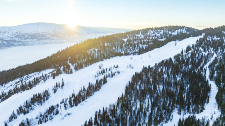
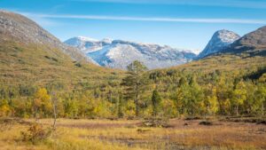
While you’re in Mo i Rana, make sure to experience the spectacular and distinctive nature surrounding the town – and check out some of the fun attractions in the centre, such as TP Bowling Centre, Moheia Bad, Rana Climbing Center, Vitensenteret, Rana Museum and Arctic Circle Classic Motorcycle museum and so much more.
 Elisabeth Kulseng / Visit Helgeland
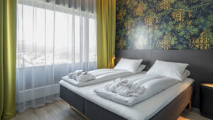
 Scandic Meyergården Hotell/Leif Karstensen
 Emilie Solbakken / Visit Helgeland
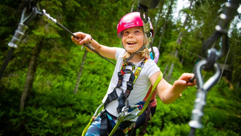 hoytlavt.no
 Tommy Mathisen
 Kristoffer Møllevik / Visit Helgeland
 TP Bowlingsenter
 Sofie Strand Klausen
 Kristoffer Møllevik / Visit Helgeland
 Roger Brendhagen / Visit Helgeland
 Krokstrand Fjellpark / Vegard Olsen
 Thon Hotels

 Marte J. Åsland / Visit Helgeland
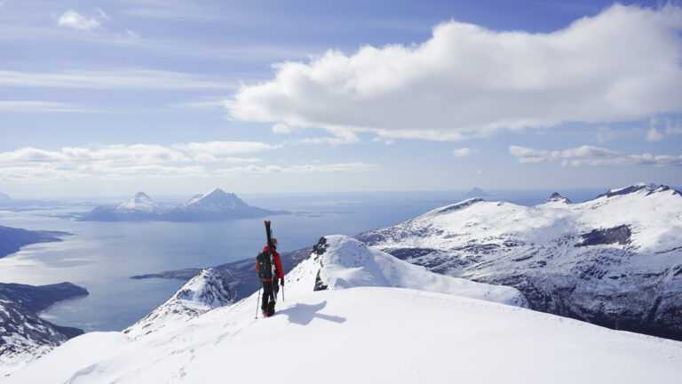
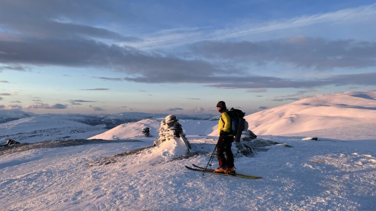
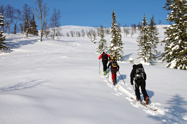
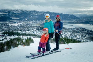
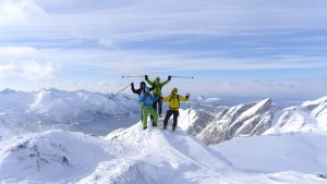
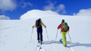
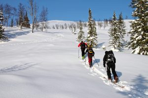
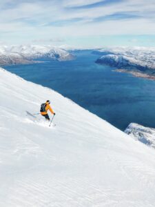
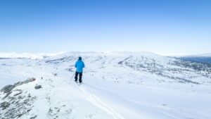
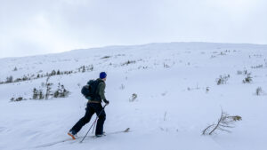
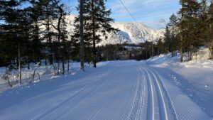
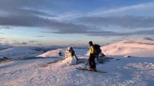
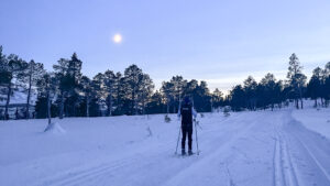
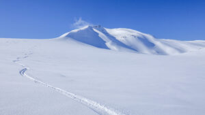
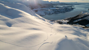
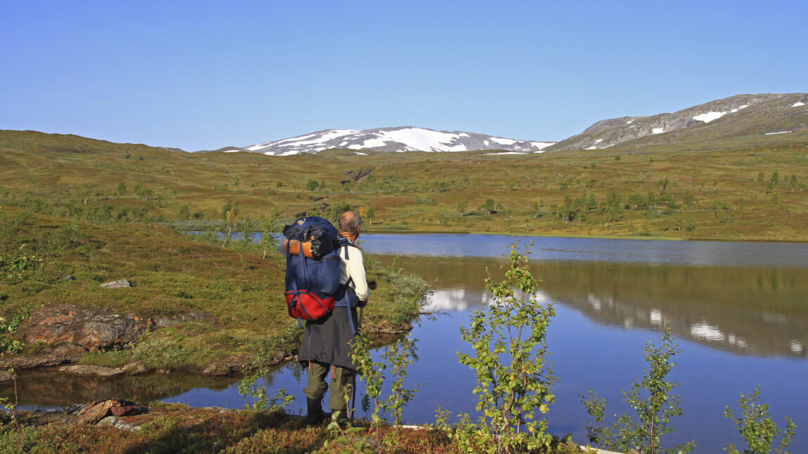
Great winter hikes and tours
 Kristin Johansen
 Kristoffer Møllevik / Visit Helgeland
 Kristin Johansen
 Kristoffer Møllevik / Visit Helgeland
 Stig Arve Johansen
 Kristin Johansen
 Kenneth Lauvås
 Kristoffer Møllevik / Visit Helgeland
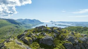
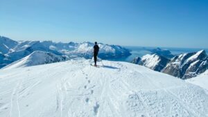
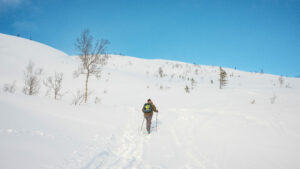
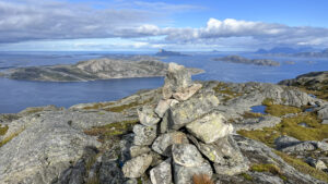
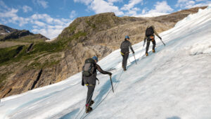
Great summer hikes and daytrips
 Lena Westman
 Kristin Johansen / Visit Helgeland
 Kristin Johansen / Visit Helgeland
 Kristin Johansen / Visit Helgeland
Kristoffer Møllevik / Visit Helgeland
Kristin Johansen / Visit Helgeland
Kristoffer Møllevik / Visit Helgeland
 Kristin Johansen
 Kristin Johansen
Practical information
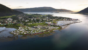
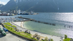
Hauknesstranda
A beach and recreational area on the south side of Ranfjorden, with walking trails, benches, barbecue areas, a volleyball court, and spots for fishing from the rocks. About a 10-minute drive or 20-minute bike ride on a cycle path from Mo i Rana.
View directions on Google Maps
Alternstranda
A popular sandy beach on the north side of Ranfjorden, about a 20-minute drive from Mo i Rana.
View directions on Google Maps
Mjølanstranda
A beach close to town with benches — about a 5-minute drive or 10–15 minutes by bike from the centre.
View directions on Google Maps
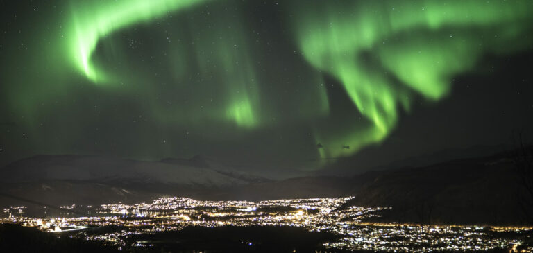
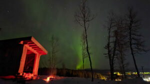
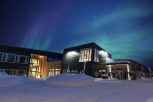
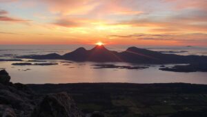
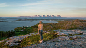
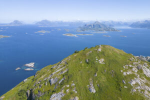
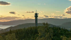
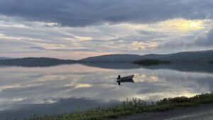
Surrounded by tall mountains, you’ll need to head up high to see the midnight sun — but its light can be seen from anywhere, high or low. And with vast hiking and wilderness areas nearby and little light pollution, you’ll find several great spots to watch the northern lights.
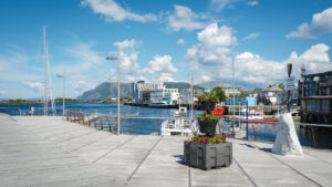
Sjøfronten
On the walkway along the Sjøfronten waterfront in the town centre, you’ll get a beautiful view of the evening sun over the fjord in summer, and the northern lights in autumn and winter.
View directions on Google Maps
Tjuvtrappa
Tjuvtrappa is an easy hike on a well-maintained trail, offering great views of the sunset or northern lights toward the northwest.
Read more about the hike
Fageråsen Ski Jumps
From the ski jumps in Fageråsen, you’ll get a great view of the fjord and the town. The trail to Appelsinhaugen starts nearby — a good option if you’re looking for a slightly longer hike.
View directions on Google Maps
Read more about the hike to Appelsinhaugen
Mofjellet
In summer, you can drive almost all the way up Mofjellet to go hiking or simply enjoy the view from the car park near the top.
View directions on Google Maps
The Right to Roam allows you to camp in the open countryside throughout Norway, as long as you keep at least 150 metres away from cabins and houses.
We recommend staying at a campsite, where you’ll have access to showers and toilets, waste disposal, parking, and activities.
If you still prefer wild camping or travelling with a motorhome, we suggest these spots:
Motorhome Parking in Mo i Rana
A parking area with overnight motorhome parking just outside the town centre.
View directions on Google Maps
Umskardtjønna
A mountain fishing spot with wheelchair-accessible toilet and a lean-to shelter.
Read more at UT.no
Hauknes Marina
Paid motorhome parking at Hauknes Marina, just south of Mo i Rana.
View directions on Google Maps
Moholmen Marina
View on Google Maps
Read more at Vel I Havn (only written in norwegian)
Hauknes Marina
View on Google Maps
Read more at Vel I Havn (only written in norwegian)
LAD OPP in Utskarpen
Charging station from Lad Opp with up to 180 kW ultra-fast charging, located at the Joker store in Utskarpen — about 35 kilometres from Mo i Rana, on the way to Nesna and the Coastal Route (Kystriksveien).
View directions on Goolge Maps
LAD OPP Umbukta
Charging station from Lad Opp with up to 180 kW ultra-fast charging, about 35 kilometres from Mo i Rana along the E12 towards Sweden.
View directions on Goolge Maps
Tesla Supercharger
Large charging station located near Circle K, Obs Hypermarked, XXL, and other shops.
View directions on Google Maps
Amfi shopping mall
View on Google Maps
Byporten shopping mall
View on Google Maps
Mosenteret
View on Google Maps
Obs, XXL, Thansen
View on Google Maps
Langneset
Seasonal waste disposal station along the E6 on the south side of Mo i Rana.
View directions on Google Maps
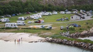
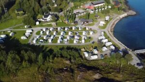
Mo i Rana Camping
Campsite east of Mo i Rana town centre.
View directions on Google Maps
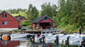
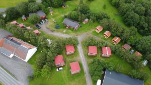
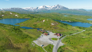
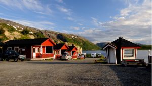
Krokstrand Fjellpark
Café, accommodation, and climbing park with spots for motorhomes and tents — located along the E6 about 50 minutes north of Mo i Rana.
View directions on Google Maps
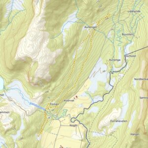
Explore Mo i Rana by map
Nordlysjakt i Hattfjelldal
Bli med på en stemningsfull nordlysjakt hos GoExtreme – en enkel og nær naturopplevelse der du vandrer fra Hattfjelldal Hotell og opp til en gapahuk med vid utsikt over bygda og fjellene rundt. Her ligger forholdene til rette for en kveld med ro, varme og kanskje naturens eget lysshow.
Turbeskrivelse: Åkvikfjellet 293 moh.
Åkvikfjellet er et flott og lettgått turfjell på grensa mellom Dønna og Herøy.
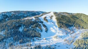
Kjemsåsen alpinsenter
Med barnebakke, en lang grønn løype og tøffe røde og svarte løyper, er Kjemsåsen alpinsenter virkelig et skisted for hele familien, og for skikjørere på alle nivåer. Her finner du utfordringer og moro for både nybegynnere og fremtidige alpinister.
Lille Herstrand – Feriehus på stranden langs Helgelandskysten
Lille Herstrand er et moderne feriehus noen meter fra havet, i Meløy helt nord på Helgelandskysten, hvor du kan nyte naturen og de fredelige omgivelsene, kanskje fra kajakken eller båten?
Skillevollen Alpinsenter
Skillevollen Alpinsenter er en del av Skillevollen Idrettspark på Båsmoen i Mo i Rana. Ta med familien i alpinbakkene, langrennsløypa eller på skøytebanen om vinteren.
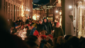
Førjulshelg i Julebyen Mosjøen
I den lune julebyen Mosjøen kan du bli med på en førjulshelg fylt med hjertevarme opplevelser. Den første helga i desember viser Mosjøen seg fra sin beste side og du får bli med dit gater og hus fylles med nisser, musikk og julelys! Julepakken er full av god gammeldags julestemning fra både handelsboder fylt med lokale varer, bålkos i lavvo og en finere julemiddag.
I Ro og Mak ved Straumen gård
Hjertevarmt opphold og overnatting i den koselige Bestemorstua. Finn roen tett på naturen og det enkle livet på landet.
RIB-turer med Meløy Adventure
Bli med Meløy Adventure på RIB-tur til Rødøya og Rødøyløva, Myken med whiskydestileriet, vakre Nordfjorden eller spektakulære Træna. Utgangspunkt for turene er fra Ørnes i Meløy, men du kan avtale å bli plukket opp andre steder på ruta.

Turbeskrivelse: Lomtjønna og Gråsteintinden
Familievennlig kultursti til Lomtjønna og fin trimtur videre opp til Gråsteintinden i Utskarpen, omtrent 40 kilometer vest for Mo i Rana.
Fjellfolkets Hus midt i sentrum av Hattfjelldal
Opplev de vakre naturområdene langs Villmarksveien med utgangspunkt i fjellbygda Hattfjelldal. I Fjellfolkets Hus finner du både overnattingssted, turistinformasjon, museum og husflidsbutikk og du er tett på både naturen og kulturen i dette flotte fjellområdet.
Nordland nasjonalparksenter – opplevelsessenter for kunst og natur
Lær om naturen og nasjonalparkene i Nordland gjennom de flotte kunst- og naturutstillingene hos Nordland nasjonalparksenter. Med spennende aktiviteter for store og små og fine turer i nærområdet, finner hele familien noe som fenger her.
Toppen Panorama Mosjøen – Overnatting i rolige omgivelser
Sommerhotellet Toppen Panorama byr på panoramautsikt til både by og fjord. Her kan du bo tett på naturen i vakre og rolige omgivelser, og likevel ha Mosjøen sentrum bare en kort kjøretur unna.
RIB-tur rundt Torghatten
Sea Adventure Helgeland tar deg med på en uforglemmelig RIB-tur rundt det vakre sagnfjellet Torghatten, og lar deg oppleve en nydelig del av Helgelands vakre skjærgård. Turen går fra Brønnøysund, og tar deg tett på naturen, fuglelivet og den flotte kystkulturen i Brønnøy.

Sommervandring til historiske Bredek fjellgård
I juli og august kan du møte Helgeland museum på den vakre, historiske fjellgården Bredek, like ved foten av Saltfjellet-Svartisen Nasjonalpark. Da får du også kjøpt snacks og bålkaffe, slik at det blir ekstra trivelig å gå den vakre Bredekrunden.
Arkitektur- og interiørperlen Skolo på Seløy
Seløys gamle skole er renovert med stor omtanke, senest omtalt i The Norwegian Review of Architecture. Her kan du overnatte, drikke kvalitetskaffe, spise pizza, finne utvalgte bøker og kunst i butikken – og nyte panoramautsikten til fjellkjeden De syv søstre.
Selsøyvik Handelssted i Rødøy
Selsøyvik Handelssted er et av Helgelands eldste og mest ærverdige overnattingssteder. Øya Selsøyvik ligger nydelig til langs skipsleia, omkranset av Rødøyløva, Hestmannen og Svartisen. Her finner dere overnatting, en stor og flott gjestehavn, landhandel og kafé.
Utforsk Himmelblå-øya Ylvingen med kajakk
Hos Himmelblå Brygge på Ylvingen kan du ta både introkurs og grunnkurs, leie kajakk og melde deg på guidet tur rundt den vakre Himmelblåøya like sør for Vega.

Nordlysjakt på Støtt
Drømmer du om å dra fra mas og jag til en vinterverden hvor nordlyset og vinterlyset skaper magiske øyeblikk? På Støtt kan du la deg fascinere av nordlyset helt fra september til april, og på vinteren kan du også oppleve det fargerike lyset som er spesielt for den kalde årstiden i nord.
Vassås kulturminneløype – Lydguide
En lett og tilgjengelig tur som passer for både lokalbefolkning, historieinteresserte og turister som ønsker å oppleve Nordlands skjulte skatter til fots.
Utforsk Sandnessjøen sentrum med lydguide – Kulturhistorisk vandring
Sandnessjøen og Alstahaug har en rik kulturhistorie, fra Sigrid på Sandnes og Petter Dass, yrende liv i havneindustri og base for olje og energinæring. Denne lydguiden viser deg skulpturer i sentrum av Sandnessjøen og forteller deg historier fra vikingtiden, til dagen i dag.

Turbeskrivelse: Vetfjellet 244 moh.
En fin og lett tur hvor du kommer deg litt opp i høyden og får mye igjen for innsatsen med utsikt i flere retninger.
Toppturhelg i Meløyalpene
Et av Nord-Norges råeste skikjøringsområder venter på deg i de ville og vakre Meløyalpene!

Vinter på Støtt – Top of Helgeland
Reis til toppen av Helgelandskysten og opplev det spektakulære nordlyset med noen du er glad i, prøv ut en ny hobby eller bare nyt det gode liv i sjarmerende omgivelser. Senk skuldrene med god plass, spennende historier fra lokalbefolkningen og et unikt kystlandskap pyntet i vinterlys.
Villmarksaften i Kjemåsen
Opplev magien med å være ute i villmarka på Helgeland. Langt fra folk og støy, med hodelykta, månen og nordlyset som lyser veien opp. Hi North tar deg med på en helt spesiell naturopplevelse du ikke vil gå glipp av.
Turmål: Hoppesteinene i Trælvikosen
Trælvikosen er en rasteplass fra Nasjonale turistveger med et morsomt stykke landskapsakritektur: En rekke hoppesteiner som strekker seg ut i vannet og som oversvømmes og avdekkes av flo og fjære. Hvis du er der på akkurat riktig tidspunkt, kan du gå på dem som om du går på vannet.
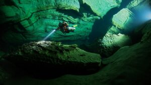
Plura Valley – undervannseventyr i verdensklasse!
Plura Valley er av mange ansett som grottedykkingens Mekka. Like ved inngangen til Pluragrotta finnes alt du behøver for den perfekte dykkeferie.
Turmål: Sundshopen rasteplass i Sømna
Sundshopen er en del av Nasjonale turistveger og er en nydelig og godt tilrettelagt rasteplass langs Nasjonal Turistveg Helgelandskysten, eller Kystriksveien, gjennom Sømna. Her finner du benker og toaletter, og en lang, fin steinbrygge uti vannet.
Turmål: Fallosen på Dønna
Marmorfallosen på Glein på Dønna er den største i Nord-Europa og står på Nord-Norges største gravhaug. Fallosen ligger like ved veien og er en fin tur med sykkel og bil.
Sykkeltur: Kultur-tur på Dønna
Denne kultur-turen gir deg en nydelig reise gjennom den store øya Dønna, med små og store kulturhistoriske pauser som beriker turen som skatter langs veien.
Turbeskrivelse: Dronningruta i De Syv Søstre
Dronningruta tar deg til toppen av de to nordligste Søstrene: Botnkrona (1072 moh) og Grytfoten (1018 moh). Det er en flott tur, og ruta dronning Sonja gikk da hun besøkte Søstrene for første gang.
Turbeskrivelse: Fottur til Kjerringtinden (1395 moh.)
Kjerringtinden ved Røssvatnet er et populært fjell for toppturer på vinteren, og en fin fottur sommer og høst. Men turen er bratt, så fjellformen bør være grei.
Turbeskrivelse: Skarsåsen krigsminne i Brønnøy
Skarsåsen Festningsanlegg med gapahuk og bålplass
Turbeskrivelse: Gåsheia, de 4 toppene i Brønnøy
4 topper på en tur – Gåsheia turområde ligger ca 12 km fra Brønnøysund sentrum. Her kan du velge mellom 1 eller 4 snille topper på turen.
Turbeskrivelse: De Syv Søstre – Alle syv topper på en og samme tur
En av de tøffeste og hardeste turene du kan gå på Helgeland, er alle toppene på De Syv Søstre på en og samme tur! Dette er en tur du bør være godt forberedt til, og som kommer til å gi deg en naturopplevelse du sent vil glemme!
Turbeskrivelse: Dønnesfjellet
Turen til Dønnesfjellet er en enkel og fin tur nord på Dønna. Med bare rundt 125 høydemeter får du en fantastisk utsikt mot øyene på Helgelandskysten og solnedgangen eller midnattssola over havet.
Turbeskrivelse: Markvollkulpen i De Syv Søstre
En kort tur opp til Markvollkulpen for et bad er perfekt for deg som vil ha en enklere tur i De Syv Søstre på en varm sommerdag. Eller du kan dra innom på veien til eller fra toppene Skjæringen og Tvillingene.
Falch Gamle Handelssted i Rødøy
Falch Gamle Handelssted ligger nydelig til helt nede ved Tjongsfjorden, en liten avstikker fra FV17 (kystriksveien). Handelsstedet har hatt mange funksjoner i samfunnet og har vært både fiskemottak, trandamperi, landhandel, legekontor, medisinutsalg og notbøteri.
Turbeskrivelse: Øvre Forsland og Forslandsdalen
Turen inn til Øvre Forsland kraftverk går langs grusveien opp gjennom den vakre Forslandsdalen, langs Dalvatnet og Forslandselva. Det er en fin og forholdsvis enkel tur til fots eller med sykkel, og ved kraftverket finnes det gapahuk, benker og grillplass.
Handelshuset Zahl og Klokkergården i Nesna
Hovedvirksomheten til Nesna museum ligger i Zahls gamle forretningsbygg. Bygningen fra 1907 var stor og staselig med enkelte sveitserelementer, og er senere bygd på både i bredden og bakover. Nesna er blant annet kjent for Nesnalobben og en egen utstilling i museet er selvsagt viet denne.
Bergh-brygga og Gammelskolen i Leirfjord
Leirfjord museum holder til i den gamle Bergh-brygga på Leland. Besøk også den vakre Gammelskolen som var i drift til midten av 1950-tallet. Velkommen til en reise i tid!
Hemnes bygdetun
Hemnes bygdetun ligger vakkert til langs E6 mellom Mo i Rana og Mosjøen. Det har bodd folk på tunet i ca. 500 år og du får lære om hvordan våre forfedre, både fattige og rike, bodde og levde.
Herøy bygdesamling
Bygdesamlinga finner du på den vakre øya Herøy på Helgeland. Her kan du bli kjent med den lokale kulturhistorien og embetsmannshistorien i regionen. Museet forvalter til sammen syv fredede eller verneverdige bygninger på stedet.
Grane bygdetun på Trofors
Grane Bygdetun formidler historien om tømmerfløting i elva Vefsna samt dramatiske hendelser under 2. verdenskrig. Her får du også historien om Norges nest største sølvgruve, som var i drift i Grane.
Hattfjelldal museum
Landskapet i den vakre bygda preges av store fjellområder, skog, innsjøer og elver. Menneskene i denne fjellnaturen har over tid skapt en markant innlandskultur der levesett og tradisjoner er knyttet til ressursgrunnlag og klimaforhold.
Nordvika Gamle Handelssted på Dønna
Handelsstedet i Nordvika er et av de eldste og mest intakte i Nordland. Museet ligger vakkert til mellom høye fjell på øya Dønna, en fergetur fra nærmeste by som er Sandnessjøen.
Velfjord bygdemuseum
Brønnøy og Velfjord har en lang historie med bonde-, fiske- og sørsamisk kultur. Ved Velfjord bygdemuseum kan du oppleve de ulike kulturene i det gamle Samvirkelaget, og på Minnetun har museet en sørsamisk kåte, derhvie-gåetie.
Turbeskrivelse: Kvasstind på De Syv Søstre
Kvasstinden er kanskje den mest krevende av toppene i De Syv Søstre, siden turen opp er så bratt. Med rundt 1000 høydemeter som skal tas på rundt 3 kilometer, kan dette bli tøft for både legger og lår.
Turbeskrivelse: Klampen i Leirfjord
Klampen i Leirfjord er en flott tur for deg som ønsker en fjelltur eller topptur som ikke er så bratt, men som likevel gir en fantastisk utsikt.
Bindal museum og Bindal bygdetun
I hovedbygget på Bindal Museum i Terråk formidles historie og kunnskap om lokal bruk av tre som materiale. Bindal Bygdetun, som ligger på Vassås, 2,5 kilometer nord for Terråk, er også en del av Museet.
Turbeskrivelse: Klubben og Åstuva i Aldersundet
Fra Åstuva og Klubben har du panoramautsikt over det vakre Aldersundet og Helgelandskysten. Det er ikke uten grunn at den var en av finalistene til Nordlands flotteste fjelltur i NRK Nordlands sommerkonkurranse.
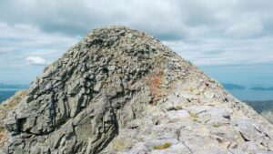
Turbeskrivelse: Tjuvtrappa
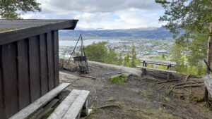
Tjuvtrappa er et av Mo i Ranas mest populære bynære turmål. Det er en kort tur på skogsvei og sti, som byr på en flott utsikt over byen og fjorden.
Turbeskrivelse: Silforsen og Breidal Fjellgård
Familievennlig tur til fine badeplasser og den nedlagte fjellgården Breidal. Turen starter fra Krokstrand Fjellpark og er i området ved Saltfjellet-Svartisen Nasjonalpark.
Turbeskrivelse: Mostjønna i Mosåsen
Dette er et av Mosjøens mest populære turområder, med godt tilrettelagte turstier og turveier, og fine friluftsområder med bord og benker.
Turbeskrivelse: Gatekunstsafari i Mo i Rana
Ta deg en gåtur eller ta med barna på en liten skattejakt og sjekk ut gatekunsten i Mo i Rana. Her finner du graffitikunst laget av kunstnere fra hele verden.
Turbeskrivelse: Storrunden ved De Syv Søstre
Hvis du ønsker å gå en enklere tur i De Syv Søstre er Storrunden ved sørsiden av Breitind (Stortind), en fin tur for deg som ønsker en rundtur med variert terreng og fantastisk utsikt!
Turbeskrivelse: Marsøra – en hyggelig gåtur langs Vefsna
Ta en koselig gåtur langs elva Vefsna med utsikt til bryggene i vakre Sjøgata.
Turbeskrivelse: Smaltinden
Med Smaltind som mål kan du nyte en flott utsikt over Helgelandskysten nesten hele veien til toppen!
Sykkeltur: Mosjøen – Hundåla – Sandnessjøen
1-2 dagers sykkeltur, hvor en får oppleve en reise fra innlandet til kysten.
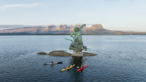
Turmål: Petter på skjæret
«Petter på skjæret» er en 10 meter høy statue av dikterpresten Petter Dass, som viser dikterprestens ritt på Fanden selv over havet. Statuen står på et skjær i havet mellom Herøy og Sandnessjøen og må nås med båt eller kajakk.

Turbeskrivelse: Kjølen og Hammarøyfjellet
Fra Kjølen i Nesna kan du nyte midnattsola eller en vakker solnedgang. Du kan også forlenge turen til toppen av Hammarøyfjellet.
Turbeskrivelse: Tortenkøta
Turen til Tortenkøta er et lett turmål langs Kystriksveien ved Flostrand. Ved køta er det flere små kulper og naturlige vannsklier hvor familien kan bade og kose seg.
Turbeskrivelse: Himmelbærsteinen
Turen til Himmelbærsteinen starter på utkikkspunktet på Kleivhalsen langs Kystriksveien i Lurøy. Fra toppen har du en flott utsikt over øyene på Helgelandskysten.
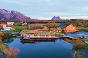
Hotell Sjyen – med utsikt mot fjord og fjell
Midt i kystbygda Nesna, med utsikt mot fjordlandskapet og øyene Tomma, Hugla og Handnesøya, ligger det nyåpnede Hotell Sjyen.
Turbeskrivelse: Heilhornet 1058 moh.
Heilhornet ruver 1058 meter over havet og det lavere kystlandskapet sør på Helgeland og nord i Trøndelag. Det er en flott, men tøff tur i bratt og krevende terreng.
Turbeskrivelse: Stortuva 98 moh.
Det er få andre «fjell» på Helgeland som kan skilte med en like god panoramautsikt etter en bare 15-20 minutters gåtur.
Turbeskrivelse: Kvigtind – Børgefjell
Topptur til Kvigtinden/Voenjelensnjurhtjie – Børgefjells høyeste topp
Turbeskrivelse: Reinesaksla 380 moh.
Toppen på Reinesaksla i Leirfjord gir deg en fantastisk utsikt over Syv Søstre, Dønnamannen, Lovund og Helgelandsbroa.
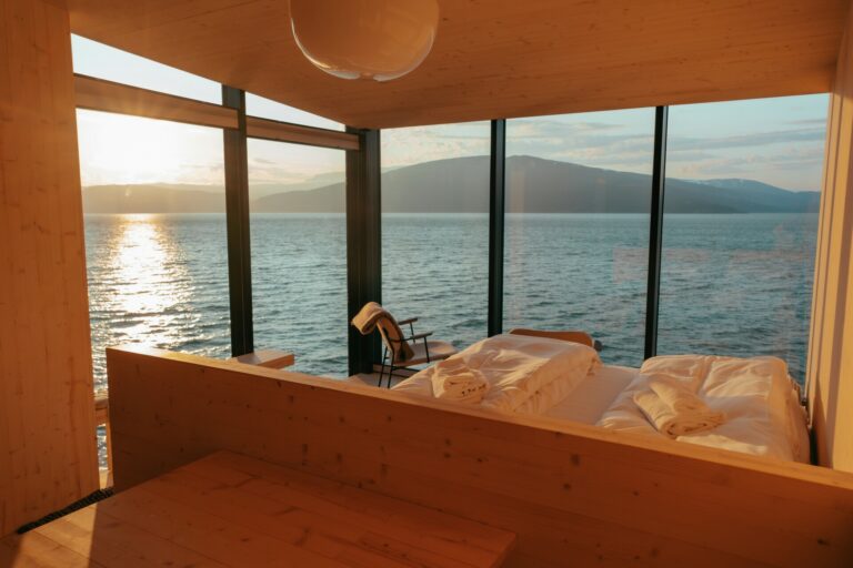
House by the Sea – unik overnatting på Træna
Med en flott utsikt fra innovativ arkitektur, i svært naturskjønne omgivelser, er de tre spesielle hyttene til House by the Sea perfekte for deg som vil kombinere naturopplevelser med unik overnatting.
Jacobsenbrygga og bygdetunet i Mosjøen
Vefsn museum har en rekke innholdsrike utstillinger og lokasjoner som omhandler alt fra by- og bygdehistorie til våpensmugling og motstandsarbeid. Du kan også få en historisk omvisning i den unike og stadig levende bydelen Sjøgata fra 1800-tallet.
Rana museum, Stenneset og Bredek
Rana har en spennende historie, og i utstillingene i det nye museet i sentrum, Moment, får du oppleve denne gjennom alle sansene. På Stenneset friluftsmuseum kan du vandre mellom 20 historiske bygninger og Bredek fjellgård er et yndet turmål.

Sømna bygdetun
På Sømna Bygdetun formidles den lokale kulturhistorien med vekt på bondens og fiskerbondefamiliens hverdag i perioden 1800-1950. Tunet med sine tolv bygninger har et småbyaktig preg, og kjøkkenhagen med gamle kornsorter, kulturplanter, urter og grønnsaker er vel verdt et besøk.
Ristning- Tjaalege, Vevelstad museum og bygdetun
Ikke langt fra Forvik fergeleie ligger det nye museumsbygget Ristning – Tjaalege og bygdetunet side om side med Vevelstad kirke. Rundt museet finnes spennende fornminner som bergkunst (helleristninger) og gravhauger fra jernalderen.
Helgelandsidyll – Rangsundøya
Like nord for Polarsirkelen ligger Helgelandsidyll på Rangsundøya i Rødøy. Her kan du overnatte i en koselig leilighet, bo i glampingtelt eller i den lille unike hytta «Ørnedomen» og nyte en majestetisk utsikt over Helgelandskysten. Lei båt, kajakk eller SUP og nyt dagene på vannet eller i fjellene på øya, og nyt kveldene i badstua. Her kan du finne stillheten og roen, uten mange andre turister.
Petter Dass-museet i Alstahaug
Petter Dass-museet og Alstahaug er Nordland fylkes tusenårssted. På Alstahaugtunet finner du Alstahaug kirke og flere hundre år med arkitektur- og kulturhistorie. Området er rikt på kulturminner og er et populært turområde for både lokalbefolkning og turister.
Træna museum
På museet på Træna er steinalderkultur og arkeologiske funn fra naboøya Sanna i fokus. Funnene har blitt datert hele 9000 år tilbake i tid, og det er på grunn av disse funnene at Træna kan kalle seg «Norges eldste fiskevær».
Kråkeslottet – unik ulldesign på Hemnesberget
Klesbutikken Kråkeslottet på Hemnesberget er en liten severdighet i seg selv, med spennende, håndlagede ullklær som designes og produseres i butikken. Flotte ullkåper og kjoler, deilige babydresser, lette og varme turklær og mye, mye mer.
Turbeskrivelse: Appelsinhaugen og Grotneshytta på Mofjellet
Ta en pust i naturen og nyt utsikten over Mo i Rana og fjellene rundt på denne lett tilgjengelige fjellturen like utenfor byen.
Sykkeltur: Villmarksveien
Bli med på en vakker sykkeltur nært på naturen i hjertet av Helgeland, med utsikt til både Børgefjell og Okstindan.
Lovund Hotell – overnatting og mat
Lovund er en av de mest spennende øyene på Helgelandskysten. Her får du oppleve et unikt øysamfunn i vekst, samtidig som du har kort vei til naturen, fjellet, fjæra og fuglelivet. På vakre Lovund Hotell kan du oppleve øya, og sove og spise godt, med en utsikt mange bare kan drømme om.
Hotell Scandic Syv Søstre – Overnatting og restaurant i Sandnessjøen
Overnatting og restaurant med en flott utsikt til eventyrlige fjell og et bredt utvalg av naturopplevelser. Med hotell Scandic Syv Søstre som base kan du utforske store deler av Helgelandkysten på øyhopping fra Sandnessjøen.

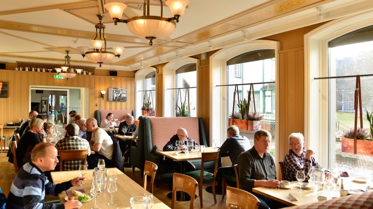
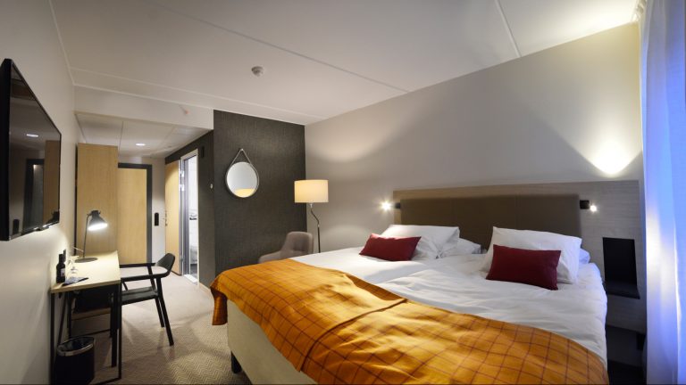
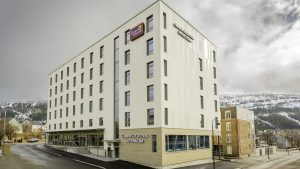
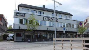
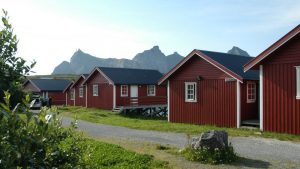
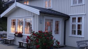
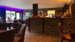
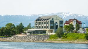
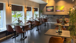
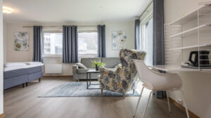
Scandic Meyergården Hotell – spis og bo i Mo i Rana
På Scandic Meyergården Hotell overnatter du sentralt i Mo i Rana og nyter kortreist mat i restauranten. Hit drar du med familien så vel som med kolleger og har nærhet til turmål som Rabothytta og Svartisen.
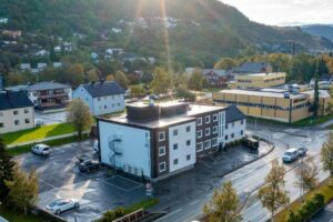
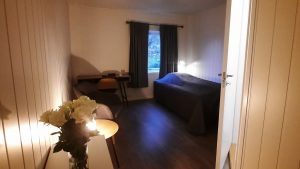
Strawberry Home Hotel Helma
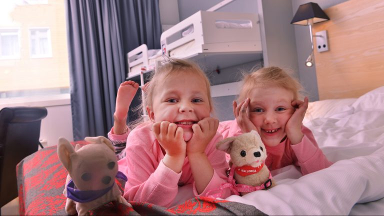
Strawberry Home Hotel Helma ligger sentralt i Mo i Rana. Her bor du i hjemmekoselige omgivelser med kort vei til butikker, teater, Vitensenter Nordland og promenaden langs sjøfronten av byen. Frokost, ettermiddagskaffe og et varmt kveldsmåltid er alltid inkludert i prisen.
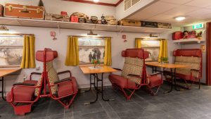
Sure Hotel by Best Western Ole Tobias
På Sure Hotel by Best Western Ole Tobias overnatter du sentralt i Mo i Rana. Hotellet er innredet med detaljer fra gamle dagers toghistorie. Frokosten serveres i «Spisevogna».
Mosjøen Hotell
Mosjøen Hotell er et koselig lite hotell beliggende flott til ved E6. Det er kort vei til opplevelser og severdigheter og hotellet egner seg godt som base for dagsutflukter til både kyst og innland.
Vega Havhotell og restaurant – midt i Verdensarven
På Vega Havhotell vil du merke at det viktigste for vertskapet et at du som gjest kjenner på den gode atmosfæren! At du senker skuldrene, finner roen og nyter gode matopplevelser, naturen og lyset.
Corner Hotell i Brønnøysund
Corner Hotell ligger i hovedgata i den lille kystbyen Brønnøysund. Hotellet passer godt for deg som ønsker å prioritere nærhet til opplevelsene når du er i Brønnøysund. Her bor du med kort vei til flere gode spisesteder, Hurtigrutekaien, flyplassen, bussterminal og hurtigbåt-kai.

Guidede fjellturer på Dønna og De Syv Søstre
Bli med på en guidet fjelltur til tre av de fineste turmålene i Dønna og Sandnessjøen. Herøy Kajakk & Sykkel kan guide dere på en lett tur til Åkvikfjellet eller Markvollkulpen, eller bli med opp til toppen av det spektakulære fjellet Dønnamannen.
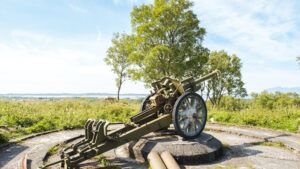
Grønsvik kystfort i Lurøy
Vil du oppleve noe spektakulært og lærerikt anbefaler vi en stopp ved Grønsvik kystfort og museum. Fra en vakker parkering og rasteplass kan du gjøre dine første historiske steg inn til et mørkt kapittel av Europas historie.
Turbeskrivelse: Fjellgårdene Bredek og Granneset
Bredek og Granneset er to unike fjellgårder fra 1800-tallet i Saltfjellet-Svartisen nasjonalpark. Hit kan du ta med familien og kombinere natur- og kulturopplevelser i fantastiske omgivelser.
Turbeskrivelse: Simskardrunden i Børgefjell
Opplev en smak av Børgefjell på Simskardrunden med et stopp innom Simskardhytta for å nye en kopp kaffe til matpakken.
Sykkelutleie i Brønnøysund
Turistinformasjonen i sentrum av Brønnøysund har sykler til leie og alt utstyr du trenger til lange og korte sykkelturer.

Topptur: Høgtuva 1276 moh.
Ranværingenes nasjonalfjell blir den kalt av lokale entusiaster. Denne karakteristiske toppen er synlig fra store deler av Rana og gir en fantastisk utsikt mot hav, øyfjell og Svartismassivet.
Topptur: Tortenviktinden 1027 moh.
Fri Flyt regner Tortenviktinden som en av Norges beste toppturer (Fri Flyt 2024), takket være en spektakulær utsikt mot Helgelandskysten og mange nedkjøringsmuligheter.
Topptur: Bomfjellet 1311 moh.
Bomfjellet er et populært toppturfjell like utenfor Mo i Rana. Etter en moderat tur opp kan du nyte utsikten til fjorden nedenfor og fjellene rundt.
Topptur: Tomskjevelen 922 moh.
Tomskjevelen er en kystnær og luftig topptur som tilbyr fantastisk utsikt. Mange regner Tomskjevelen som en av de absolutt fineste toppene på hele Helgeland. Her blir du møtt med enestående utsikt mot de kjente kystfjellene i nord og nordvest, mens du i sørøst får en usedvanlig god utsikt mot Okstindan og Okstindbreen.
Øyfjellgrotta – inn i det mørke og ukjente
Øyfjellgrotta er en 500 meter lang kalksteingrotte som ligger i byfjellet som rager over den vakre småbyen Mosjøen.

Sykkeltur: Torghatten – det ikoniske trollfjellet
Helgelandskystens vidstrakte skjærgård er av mange kalt verdens vakreste. Det kan de ha rett i. 10045 øyer som brer seg utover en grunn strandflate, så langt øyet ser. Et drømmeland med verdensarv og trollfjell, spor av fordums kontinenter og vitnesbyrd om øyfolkets nøysomme liv. Med kajakk, sykkel eller til fots kan du reise nærmest lydløst gjennom landskapet og komme tett på unik natur og kulturlandskap.
Fiskebruket – matopplevelse på Myken
Ytterst i havgapet på Myken finner du restauranten Fiskebruket. Her får du middag basert på råvarer fra havet, lokal fauna og bønder i nærområdet. Stian Floer og Tuva Sætnøe er klare for å gi deg smaksopplevelser i verdensklasse.
Storli Camping og Aernie – overnatting og samiske opplevelser
Hos Aernie kan du få mat- og kulturopplevelser basert på sørsamisk historie og tradisjon. Du kan overnatte i en luksusgamme eller i hytte, bobil, campingvogn eller telt. Storli Camping og Aernie ligger ved E6, 20 minutters kjøring nord for Mo i Rana.
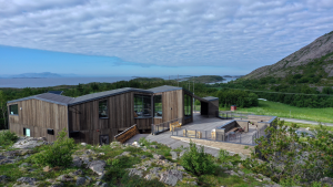
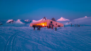
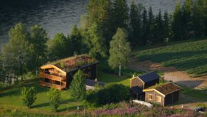
Krokstrand Fjellpark – klatrepark, mat og overnatting
Med base på Krokstrand Fjellpark kan liten og stor boltre seg i Høyt & Lavt klatrepark, spille minigolf, vandre i fjellene eller dra på jakt- og fisketur. Du kan leie rom eller feriehus og spise god hjemmelaget mat i cafeen.
Turbeskrivelse: Lovundfjellet
Langt til havs finner du øya Lovund med det karakteristiske Lovundfjellet. Her får du en sjeldent god utsikt over Helgelandskysten, og kanskje det eneste fjellet som ønsker deg velkommen med stor blomstereng på toppen.
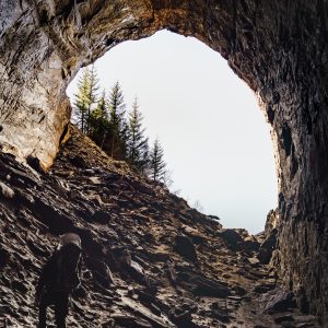
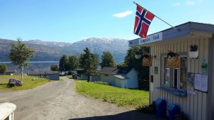
Turbeskrivelse: Tonnesgrotta
OBS: All ferdsel på eget ansvar.
Tonnesgrotta eller «Hellarhølet» er en enorm åpning i fjellet som ligger en kort (men litt bratt) spasertur fra Tonnes. Grotten er nesten 200 meter dyp, men så åpen at du kan ha sollyset med deg hele veien inn.
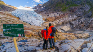
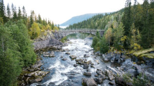
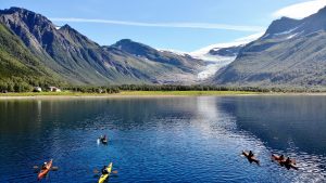
Turbeskrivelse: Engabreen, Svartisen i Meløy
Engabreen, eller Engenbreen, er en bretunge fra isbreen Svartisen i Meløy. Turen fra fjorden til brekanten er fin, langs det blågrønne Engabrevatnet og opp over bergene isen har skuret glatte over tusener av år.
Turbeskrivelse: Kulturvandring på Husøy
Bli med på en vandring gjennom bygda og øya Husøy i Norges eldste fiskevær, Træna. Med en historie som strekker seg tilbake til steinalderen, og et rikt kulturliv den dag i dag, er dette en hyggelig spasertur gjennom et varmt og kreativt øysamfunn.
Turbeskrivelse: Gompen
En enkel, men like fult spektakulær “topptur” ytterst på Helgelandskysten. Her kan du følge den gamle anleggsveien til radarstasjonen på «Gompen» på Trænfjellene, på øya Sanna i Træna.
Turbeskrivelse: Bolgtinden 338 moh. og Bolgbørra
Bare 338 meter over havflata under kan du nyte en helt fantastisk utsikt over øya Bolga og skjærgården i Meløy.
Tjøtta Gjestegaard – overnatting og kafé i historiske omgivelser
Overnatt nært naturopplevelsene i historiske omgivelser på Tjøtta Gjestegaard, med kort avstand til De Syv Søstre, kulturstier og kulturminner, og gode fergeforbindelser for dagsturer til øyene langs Helgelandskysten.
Kvarøy Sjøhus – rorbuferie på Indre Kvarøy i Lurøy
Fra de flotte, moderne rorbuene til Kvarøy Sjøhus, ligger noen av Helgelandskystens flotteste reisemål for dine føtter. Her kan du overnatte, leie båt eller dra på dagstur til øyene rundt. Med en kort båttur krysser du Polarsirkelen.
Skitur: Fra Fjellstua til Snøtuva
Dette er en fin fjellskitur fra Korgfjellet Fjellstue til Snøtuva. Turen går gjennom et variert og småkuppert terreng på toppen av Korgfjellet, og følger snøscooter-løypene mesteparten av veien.
Træna Rorbuferie
Hos Træna Rorbuferie overnatter du i rorbu eller sjøhus ved vannkanten med en fantastisk utsikt. I det lille øysamfunnet på Husøy i Træna kommer du tett på lokalbefolkningen.
Brønnøysund overnatting – rom midt i byen
Med gangavstand til flyplassen og sentrum av Kystbyen Brønnøysund finner du et koselig overnattingssted. Et godt utgangspunkt for de sentrumsnære turområdene og de mange gode spistedene i regionsenteret.
Himmelblå Brygge – mat og overnatting på Ylvingen
Himmelblå Brygge, kjent fra den berømte NRK-serien «Himmelblå» lever enda i beste velgående. De holder til på den lille vakre øya Ylvingen. Her kan du spise godt i restauranten, overnatte i annerledes omgivelser i havgapet eller ha god plass til hele familien på deres familierom. I tillegg har de spennende aktiviteter og arrangementer for store og små gjennom hele sommeren.
Ravnfloget Vega Via Ferrata og Vegatrappa
“Å klatre i Ravnfloget har vært en drøm for mange. Et barskt fjell som stort sett har vært lekeplass for ravn og havørn.” Ravnfloget Via Ferrata er en spektakulær klatreløype som tar deg til toppen av fjellet Ravnfloget, helt ute på vestsiden av øya Vega.
KRED Pub & Cafè – Storstua i Brønnøysund
Her finner du musikkscenen for de lokale artistene, og stor-kanonene. Spisested med godt kjøkken og en Pub med storbypreg. KRED er Quiz-krybba, fotballpuben og standupscenen i Brønnøysund.
Plahtes eiendommer – jakt- og fiskeglede i villmarka
Naturopplevelser, jakt og fiske i en storslagen villmark sør på Helgeland. Hos en av Norges største private eiendommer, vil du finne en forsiktig utnyttelse av naturressursene, tilrettelagt med hytter, båter og alt som hører med for at du skal få en vellykket ferie i utmarken.
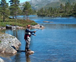
Velfjordferie, for deg som elsker å fiske!
Velfjordferie ligger flott til ved fjorden. Her bor du midt i naturen, med kort vei til fiskeplasser og fjellturer! Området er like sør for polarsirkelen og det betyr at du får lys døgnet rundt fra midten av mai til slutten av juli. Ofte er det vindstille om natten så bli med og kast deg på trenden med nattfiske.
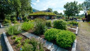
Hildurs Urterarium- Matopplevelser
Hildurs Urterarium er ikke bare en restaurant, men et frodig sted fylt med personlighet og særpreg. Dette er stedet for deg som ønsker et avbrekk fra hverdagen og en smaksopplevelse sammen med dine. Restaurant Sagastuen og den gamle finstuen gir en egen atmosfære av fjerne tider.
Hildurs Urterarium- Sov godt
Hildurs Urterarium – et 3 generasjoners livsverk full av personlighet og særpreg! Mest kjent for sine gode matopplevelser, men nå kan du også sove godt på Tilrem.
Norsk Havbrukssenter- det norske Lakseeventyret
Norsk Havbrukssenter ligger flott til ved Toftsundet og selve oppdrettsanlegget er kun en landgang fra land. Er du fasinert av norsk matproduksjon og lurer på hvordan laksen lever og blir passet på, er dette stedet for å lære mer om dette.
Vega Verdensarvsenter
Verdensarvsenteret på Vega ligger vakkert til på Gardsøy. Her får du lære om livet ute i Vegaøyan, om hvordan ærfugldrift og fiskerbondeliv ga Vegaøyan UNESCOs Verdensarvstatus. Bli med å oppleve utstillingen Ville Vakre Vega.
Norsk Havbrukssenter- Rorbu i sjøkanten
Tar du turen til vakre Helgelandskysten, er du midt i smørøyet for en av Norges viktigste næringer. Langs vannkanten i Toftsundet ligger Norsk Havbrukssenter, midt i laksens rike. Her får du oppleve laksens liv på nært hold. Visningsanlegget ligger lett tilgjengelig fra land, rett ved rorbuene, den historiske utstillingen innendørs og stedets restaurant. Et ypperlig sted for å bo tett på sjøen, skape gode ferieminner sammen, i ramsalte omgivelser.
Skogmo Familiecamping – overnatting i naturskjønne omgivelser
Skogmo Familiecamping ligger idyllisk til i rolige og landlige omgivelser, 12 km sør for Brønnøysund. Her får du og dine en familievennlig atmosfære tilbaketrukket fra byen, hvor barna kan leke fritt.
Torgarhaugen Gjestehus
Torgarhaugen ligger vakkert til ved foten av det mytiske fjellet Torghatten. Her ønsker vertskapet deg velkommen til – tid for rom- rom for tid. Med sine lyse fine lokaler hvor sola slipper inn fra alle himmelretninger, kan du virkelig senke skuldrene og bare nyte. Tiden, fargene, lydene og omgivelsene, og gjerne med en god kopp kaffe og en hjemmebakt kake.
Handelsstedet Forvik
Handelsstedet Forvik ligger på Helgelandskysten og har vært et samlingsted i mer enn 200 år. Her bor du i Grålåna, i rom med sjel og atmosfære. Handelsstedet ligger helt ved sjøen, så her er stedet du kan nyte de lyse sommerkveldene i lag med dine beste. Gode matopplevelser får du på stedets restaurant Naustloftet, og et besøk i kaffebrenneriet anbefales.
Padlerute: Rundtur på Støtt
Støtt består av et fantastisk øyrike som egner seg ypperlig for padling. Støtt er i den stille fjæring hvor det også er vindstille når det mange andre steder er vind fra sørøst.
Torghatten Camping, fisking, matopplevelse og mye mer
Torghatten Camping ligger idyllisk til ved foten av det ikoniske fjellet Torghatten. Her kan du leie leiligheter og hytter av høy standard, teltplass eller oppstillingsplass for campingvogn/bobil. Strandrestauranten er stedet for den gode matopplevelsen.
Torghatten Strandrestaurant – en matopplevelse tett på råvarene
Torghatten Strandrestaurant ligger idyllisk til ved foten av fjellet Torghatten,15 km fra Brønnøysund sentrum. Mange har latt seg overraske av den flotte restauranten som ligger rett ved sjøen og med nydelig utsikt utover fjorden.
SeilNorge – Seileventyr på Helgelandskysten
SeilNorge er landets ledende arrangør av seilturer, ekspedisjoner og seilkurs. Bli med på en aktiv ferieuke høyt og lavt langs Norges vakreste kystlinje; Helgelandskysten. Blant tusenvis av øyer, holmer og skjær som kulisse, lærer du kunsten å seile, enten du er nybegynnere eller erfaren.

Svang restaurant og vinbar i hjerte av Brønnøysund
Et koselig sted med fokus på lokal mat, for både store og små anledninger. Hos Svang ønsker vertskapet deg velkommen innom for et godt måltid, litt snacks eller noe godt i glasset.

Glomfjord Overnatting
Meløy er et nydelig område for en aktiv ferie året rundt. Med base hos Glomfjord Overnatting har du kort vei til opplevelser på hav og fjell.
Kajakkturer i Meløy og Rødøy
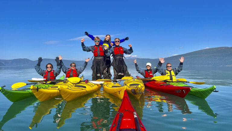
Meløy Adventure tar det med på guidet kajakktur på Glomfjorden, til Svartisen, ved Rødøyløva eller på en lengre tur rundt Mesøy. Har du våttkort kan du også leie kajakk og dra på egenhånd. Du kan også være med på kurs.
Yttervik – idylliske omgivelser ved Ranfjorden
På Yttervik bor du i idylliske omgivelser ved Ranfjorden samtidig som du har kort vei inn til sentrum av Mo i Rana. Området innbyr til mange varierte aktiviteter for hele familien.
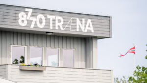
8770 Træna
Reiser du til Husøy i Træna, bor du godt på det koselige lille hotellet 8770 Træna. I Træna møter du et levende lokalsamfunn, koselige spisesteder og en slående vakker natur.
Træna Arctic Fishing
Ytterst i havgapet i det koselige fiskeværet Selvær i Træna, kan du overnatte i topp moderne bryggleiligheter og oppleve den vakre Helgelandskysten. Lange lyse sommernetter, godt fiske, tusenvis av holmer og skjær og et rikt fugleliv er noe av det som møter deg.
Myken Seng og Suppe
Myken, et lite fiskevær i Rødøy kommune på Helgeland, ligger midt i et eventyrrike. Øya har ingen biltrafikk og kun 800 meter vei, men her får du oppleve midnattssola, havet og naturen på sitt beste.
Til Elise fra Marius – fra beite til bord
I bygda Utskarpen mellom Mo i Rana og Nesna har Elise og Marius bygd opp en matdestinasjon. Her får du ekte matopplevelser basert på råvarer med kortest mulig vei fra beite til bord. Du kan også overnatte i sjarmerende rom i landlige omgivelser.
Stekvasselv Gård
Bo midt i fjellheimen med et mangfold av turmuligheter, enten du vil vandre til fots, bestige høye fjelltopper eller dra på småviltjakt. Går du langs Nordlandsruta er dette et godt sted å overnatte.
OscarBrygga – mat og overnatting
Hos OscarBrygga på Tonnes spiser du i en ombygd gammel fiskebrygge og bor i rorbuer eller rom rett ved havkanten. Her kan du nyte midnattssola eller solnedgangen fra balkongen til lyden av bølgeskvulp.
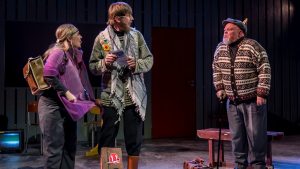
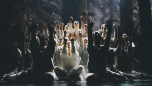
Nordland Teater – Magiske Øyeblikk
Nordland Teater gir deg et magisk øyeblikk du tar med deg resten av livet. Du finner teateret midt i sentrum av Mo i Rana. Her skjer det stadig noe nytt og spennende, og Vinterlysfestivalen er årets høydepunkt.
Klokkergården på Rødøy
Rett under den majestetiske Rødøyløva på Helgelandskysten ligger den herskapelige Klokkergården fra 1904. Her får du oppleve varme og gjestfrihet i nostalgisk miljø.
Korgfjellet Fjellstue
På toppen av Korgfjellet, midt mellom byene Mo i Rana og Mosjøen, finner du Korgfjellet Fjellstue. Her kan du bo i nye moderne hytter, enkle rom på fjellstua eller i egen campingbil/campingvogn. Inne på fjellstua kan du spise et godt måltid i restauranten.
Støtt – Top of Helgeland
På det koselige gamle handelsstedet Støtt kan du tilbringe ferien og oppleve noe av det flotteste Helgelandskysten har å by på året rundt, med herskapelig overnatting og lokal mat fra et svært godt kjøkken.
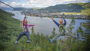
Mosjøen Zipline – Hi North
Vil du ha spenning, litt sug i magen, kanskje en luftig opplevelse og kjenne på adrenalinet? Da er Zipline i Mosjøen noe av det mest spennende du kan gjøre på Helgeland!
Mosjøen Via Ferrata – Hi North
I Mosjøen finner du Nord-Norges første Via Ferrata. Bli med på en bratt, luftig og spennende opplevelse med garantert gåsehud og kribling i magen!

Hattfjelldal Hotell – GoExtreme
Hotellet ligger rett utenfor sentrum og har fantastisk utsikt over Hattfjelldal, en vakker kommune i fjellriket Helgeland.
Topcamp Havblikk
Med opphold på Topcamp Havblikk på Nesna kan du tilbringe tid sammen med familie eller venner og skape nye minner gjennom varierte aktiviteter. Campingen er godt tilrettelagt for bobil, caravan og telt. Ønsker du heller å leie hytte eller rom er alternativene mange.
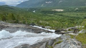
Turbeskrivelse: Kjemåforssen ved Svartisen-Saltfjellet Nasjonalpark
Rundtur til Kjemåfossen som slynger seg ned den bratte lia fra Kjemåvatnet på Saltfjellet.
Dønnes Gård – overnatting i historiske omgivelser
Nyt herskapelig overnatting i autentiske værelser fra 1800-tallet med kulturarven bokstavelig talt i veggene. Hør om godsets historie på omvisning i middelalderkirken og tilhørende gravkammer ved gårdstunet. Her får du servert tradisjonsrike retter laget av kortreiste råvarer.
Røssvoll Camping
På Røssvoll Camping bor du i stille og rolige omgivelser ved Ranelva, ca 13 km nord for Mo i Rana sentrum. Fra campingen har du kort vei til populære attraksjoner som Polarsirkelen, Svartisen og Grønligrotta. Vil du heller kjøre inn til byen, kan hele familien utforske og lære om natur, teknologi og matematikk på Vitensenter Nordland.
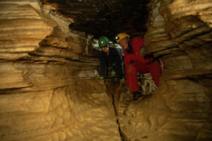
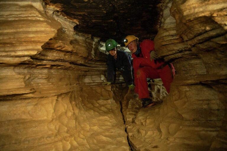
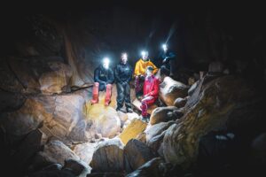
Setergrotta – en aktiv tur inn i fjellet
I Setergrotta i Mo i Rana får du se og oppleve fjellet fra en helt ny side – innsiden. Dette er en aktivitet som passer for barn og voksne, enten du kommer alene eller i en gruppe. Du kan bli med på en guidet tur hver dag hele sommeren på faste tidspunkter.
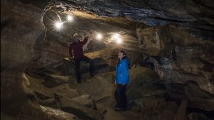
Grønligrotta
Som den eneste grotte i Norden med innlagt lys, har Grønligrotta gjennom 100 år blitt en av Nordens mest besøkte kalksteinsgrotte. I Grønligrotta i Mo i Rana kan du oppleve et nettverk av ganger med flotte formasjoner, som vann og is har brukt 700.000 år på å grave ut. Dette er en aktivitet som passer for alle aldre.
Bolga Brygge – et lyspunkt i havet
På Bolga Brygge kan du bo godt, spise godt, dra på fisketur, padle i skjermet farvann eller dra på fjelltur med utsikt over store deler av Helgeland.
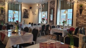
Restauranthuset Tipperary i Mosjøen
Restauranthuset Tipperary ligger midt i gågata i Mosjøen og er et innholdsrikt hus med sine 3 ulike bevertningssteder.
Aspnes Camping, Fustvatn
Velkommen til Helgeland og Aspnes Camping som ligger flott til ved Fustvatn, ca 13 km nord for Mosjøen.

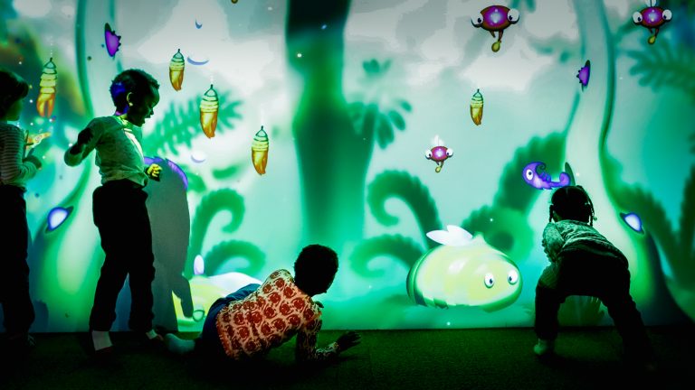
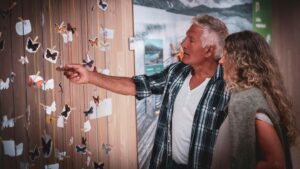
Vitensenter Nordland – lek og læring for hele familien
På Vitensenter Nordland kan du eksperimentere, utforske og lære om natur, teknologi og matematikk. Utstillingene er interaktive, så du kan røre og gjøre, ikke bare se. Her er det spennende aktiviteter for hele familien.
Sæterstad gård i Hattfjelldal
Er du på jakt etter en annerledes opplevelse? En opplevelse der natur og kultur møtes og etterlater inntrykk i alle dine sanser? Da skal du ta en tur til Sæterstad Gård sommer som vinter, vakkert beliggende 400 meter over havet, ved foten av Krutfjellet i Hattfjelldal.

Gilles Cafe & Restaurant i Mosjøen
Denne koselige kulturkaféen i Mosjøen ligger ved «starten» av Sjøgata og byr på god mat og kaffe, og store og små konserter gjennom hele året.
Restaurant Soprano – Mat og vinhus i Sandnessjøens gågate
Her får du servert god mat i en eldre postgård fra 1923 med rustikk atmosfære i gågaten i Sandnessjøen. Nyt måltidet innendørs eller utendørs mellom brostein og trær i gågaten.
Det Romantiske Huset – Dobbeltrom på Herøy
Her får du romantisk atmosfære omgitt av naturen med utsikt mot Dønnamannen og vakker solnedgang. Velg deg din favorittsuite for en koselig overnatting omringet av vakker natur.
Kvitneset Camping – idylliske rorbuer med båtutleie
Kvitneset Camping i Leirfjord kommune på Helgeland, byr på overnatting i naturskjønne omgivelser ved en idyllisk bortgjemt fjord. Herfra har du nydelig fjordutsikt samt utsikt til fjellkjeden De syv søstre fra baksiden.
Halibutskole Vandve – Feriehus med båtutleie og glassblåseri
Hos Halibutskole Vandve får dere overnatting i feriehus midt i smørøyet for fiskeopplevelsene. Her bor dere i umiddelbar nærhet til det lille glassblåseriet på Vandve.
Kulturverkstedet i Mosjøen
Kulturverkstedet i den gamle bydelen Sjøgata i Mosjøen, byr på et særegent miljø der fortid og nåtid knyttes sammen.
Gjestehusene i Sjøgata i Mosjøen
I Mosjøen leies det ut gjestehus i den gamle bydelen Sjøgata, fra 1800-tallet. Dette er fullt utrustede leiligheter – koselig innredet og møblert i gammel stil. Her får du en genuin mulighet til å kjenne deg hjemmehørende i en tid da menneskene ikke hadde det så travelt som i dag.
Laksforsen – tradisjonsmat i generasjoner
Laksforsen ligger ved E6 i Grane med panoramautsikt over det vakre fossefallet med samme navn.
Offersøy Camping Helgeland- overnatting, båt og sykkel
Med Offersøy Camping som base for din ferie får du utforsket Helgelandskystens øyriket på øyhopping, være aktiv tett på naturen, og få innblikk i sterk historie og rik kultur kun noen kilometer unna.
Sandnessjøen Camping – overnatting ved De Syv Søstre
Her får du overnatting i naturen ved sjøen med utsikt til fjellkjeden de Syv Søstre kun 3 km unna oppstigningen til den sørligste toppen Breitinden.
Elfis Sjøstuer – Idyllisk overnatting i rorbuer
Hos Elfis Sjøstuer får du idyllisk overnatting i sjarmerende rorbuer omgitt av naturen litt bortgjemt nord på Herøy med Elfis badestrand, Elfis Galleri og utsikt mot Dønnamannen.
Dønna Rorbuer Bøteriet – sjarmerende restaurant og leiligheter
I vakker natur på bryggekanten finner du Dønna Rorbuer Bøteriet. Her får du oppleve gode matopplevelser i sjarmerende lokaler, overnatting og guidet båtturer fra bryggekanten.
Brygga på Dønna – Overnatting i idyllisk natur
Ønsker du å slappe av, glemme hverdagsstresset og være tett på naturopplevelsene så er kanskje overnatting på Dønna i Idylliske omgivelser på byggekanten som skapt for deg?
3 Kalver – Gode matopplevelser på gårdsrestaurant
Hos 3 Kalver får du smakfulle matopplevelser servert i særegen gårdsrestaurant med kortreiste og lokale råvarer.
Blomsterbua Mat & Vin i Mosjøen
I den historiske delen av Mosjøen, i Sjøgata, finner du Blomsterbua Mat & Vin. Denne meget koselige restauranten er flott utsmykket med et lekkert interiør som passer enhver anledning.
Dønnesfjellstua – Fjelltoppservering på Helgelandskysten
Opplev 360 graders eventyrlig utsikt til Helgelandskysten med fjelltoppservering av lokalproduserte råvarer.
Augustbryggo – overnatting på Seløy
Om du kommer til Seløy på Herøy med padletak, sykkeltråkk, bilveien eller sjøveien ønsker Augustbryggo deg velkommen.
Høvdingsete på Sandnes – Omvisning og middag i vikingtiden
Skap gode minner sammen med venner, nære slektninger eller kollegaer og inviter til en skikkelig kulturfest med fordypning i vikingopplevelser på Høvdingsetet på Sandnes.
Fru Haugans Hotel i Mosjøen
Ærverdige Fru Haugans Hotel, som tilhører kjeden «Heimr Collection», ligger i enden av Sjøgata, den gamle verneverdige bydelen i sentrum av Mosjøen.
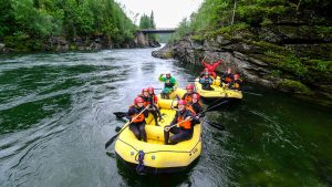
Spennende familierafting med RiverNorth på Trofors
Hos RiverNorth kan du bli med på morsomme aktiviteter både i elva og på land!
Turbeskrivelse: Hjartåsen
Hjartåsen gir en flott utsikt over Vefsnfjorden og Mosjøen, og er en lett tur som passer ypperlig til både store og små.
Turbeskrivelse: Skjæringen og Tvillingan – Familieruta i De syv søstre
De Syv Søstre er absolutt en av favorittene på Helgeland, og et av Norges mest spektakulære fjellområder. Det er høye, krevende fjell, men turen til Skjæringen og Tvillingan er den snilleste ruten og passer godt for førstegangsbestigere.
Turbeskrivelse: Rødøyløva
Rødøyløva er en av Helgelands mest kjente og fineste fjellturer, og Nord-Norges første nasjonale turististi. Fjellet er ikke veldig høyt, og turen er ikke lang, men fra toppen får du likevel en fantastisk utsikt over det vakre kystlandskapet, fra Lofotveggen i nord til Vega i sør.
Turbeskrivelse: Dønnamannen
Med sine 858 meter over havet, ut mot Helgelandskysten, er utsikten fra Dønnamannen til å få gåsehud av. Fra toppen får du en panoramautsikt som du kan nyte i timesvis, og du vil se kjente landemerker som Trænfjellene, Lovund og De Syv Søstre.
Turbeskrivelse: Hatten i Hattfjelldal / Aarpije
Fjellet Hatten topper 1128 meter over havet og er et vakkert syn der den troner over det flotte landskapet øst for kommunesenteret i Hattfjelldal.
Turbeskrivelse: Torghatten
Torghatten er et av Helgelands mest berømte fjell, med sitt særpregede hull tvers gjennom berget. Turen gjennom hullet er Nasjonal turiststi og svært godt tilrettelagt med sherpatrapp og benker for en pust i bakken.
Turbeskrivelse: Rabothytta – Norges råeste turisthytte
Rabothytta er plassert over 1200 meter over havet, helt inntil brekanten på Okstindan. Stedet er fantastisk vakkert med utsikt til Okstindbreen og til Nord-Norges høyeste fjell, Oksskolten.
Turbeskrivelse: Høyholmstindan i Vevelstad
Fra toppen av Høyholmstindan, 1015 moh., får du en fantastisk utsikt over Vevelstad og Helgelandskysten i vest, Vistenfjorden mot nord og Lomsdal-Visten i øst.
Turbeskrivelse: Vegatrappa – «Nordlands flotteste fjelltur»
Turen opp Vegatrappa er kåret til «Nordlands flotteste fjelltur» av NRK Nordland. Og det er ikke så rart, for trappa tar deg fra strandkanten til toppen av Ravnfloget, med en utsikt som blir bedre og bedre for hvert trinn du tar. Men selv om det er enklere å ta seg opp fjellsiden i en trapp, er det likevel en utfordring for lårene. Spar litt energi til nedturen også!
Turbeskrivelse: Helgelandstrappa i Mosjøen
Med sine 4055 trinn er Helgelandstrappa verdens lengste steintrapp. Den går fra elva Vefsna like utenfor Mosjøen sentrum, og opp til toppen av Øyfjellet, 818 meter over fjorden og byen under.
Thon Hotel Brønnøysund
I sentrum av den idylliske kystbyen Brønnøysund, helt sør på Helgelandskysten, finner du Thon Hotel Brønnøysund. Hotellet har nye lekre rom, restaurant med a la carte servering og en stor gratis parkeringsplass for deg som kommer med egen bil. Overnatting her gir deg et godt utgangspunkt for opplevelser i Brønnøy regionen. Hotellet garanterer deg selvsagt den gode Thon-frokosten før du skal ut og utforske stedet.
Sjokoladebrygga på Dønna
Heidis Sjokoladedrøm er trolig en av verdens minste sjokoladefabrikker. Hos Heidis Sjokoladedrøm på den sjarmerende sjokoladebrygga kan du få oppleve en rolig atmosfære, godt vertskap, vakker natur fra brygga og en overraskende variasjon av lokalprodukter fra nærområdet.
Duna, ærfuglene og folket på Lånan
Helgelandskysten største egg- og dunvær ligger i Vega Verdensarvområde. Bli med ut til øya Lånan, der fugelvokterne og Ea (ærfugl-hoa) har et gjensidig, varmt forhold til hverandre.
Helgeland Havhus
Hos Helgeland Havhus overnatter du ikke ved havet, men på havet. Unn deg et opphold i særklasse og nyt sommerkvelden til duften av saltvann og lyden av sjøfugl.
Båt til Austerdalsisen – Svartisen i Rana
På jakt etter en naturopplevelse utenom det vanlige? Austerdalsisen, Svartisen ligger rett nord for Mo i Rana. Svartisdal tar deg med båt over Svartisvatnet slik at du kan oppleve denne spektakulære breen.
Turbeskrivelse: Brurskanken 1447 moh.
Brurskanken ruver den som den nest høyeste toppen i Vefsn, og byr på en rå og vid utsikt fra Sverige i øst til Helgelandskysten i vest.
Sykkeltur: De Syv Søstre
Opplev den kjente fjellkjeden og den flotte naturen rundt fjellene, på denne koselige sykkelturen fra Sandnessjøen til Søvik.
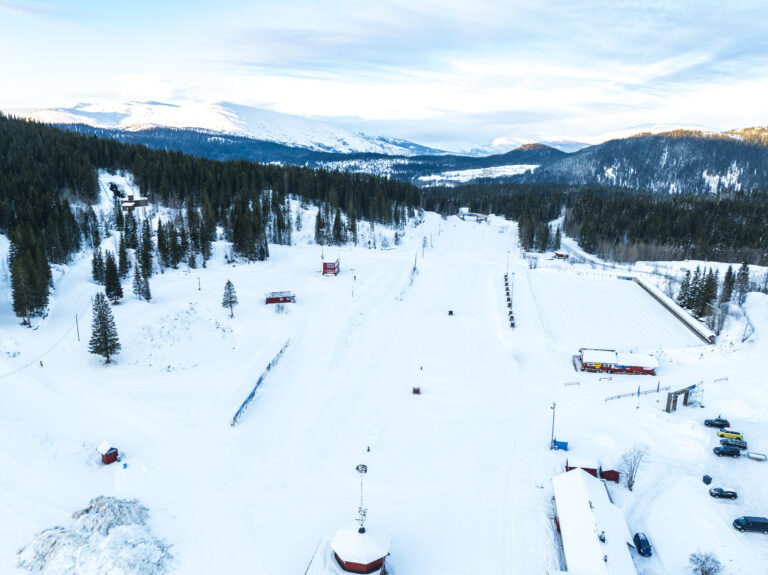
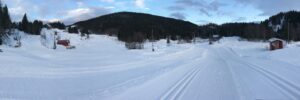
Skitur: Skillevollen og Båsmofjellet
På Skillevollen, rett utenfor Mo i Rana sentrum, finner du en flott skiarena som holder nasjonal standard. Tren i den 5 kilometer lange lysløypa, eller ta en lengre tur i de til sammen 40 kilometerene med oppkjørte tursporene i skogen.
Topptur: Steinlikammen 617 moh.
En populær topptur med fine linjer for både nybegynnere og erfarne skikjørere, kun en liten halvtime unna Mosjøen.

6 dagers bilpakke på Helgeland
Opplev Helgelandskysten med våre unike bilpakker, skreddersydd for å gi deg en uforglemmelig reise langs en av verdens vakreste kystveier.
Skitur: Tovåsen og Randalen
På Tovåsen, 10 minutters kjøring fra Leland i Leirfjord, ligger Tovåsen og Randalen skianlegg. Her finner du fine, snøsikre skiløyper som passer for hele familien.
The Mountain Way
Bli med til Rabothytta i det mektige fjellmassivet Okstindan, mens du går i fotsporene til fjellfolkene og pionerene som først utforsket og besteg toppene og tindene her. Med lokal mat og bakst i sekken, guides du på en reise gjennom stor og vill natur, til roen og stillheten som finnes dypt inne i fjellheimen. Store naturopplevelser møter den gode historiefortellingen i denne pakketuren fra The Trail Way.
Topptur: Tverrfjellet 949 moh.
Denne toppturen tjuvstarter med å ta stolheisen opp i Glomfjord Alpinsenter, slik at du bare må gå de siste 400 høydemeterne. Kanskje du rekker to turer på en dag?

6 dagers sykkeltur på Helgeland
Sykkeltur på 6 dager som starter og slutter i Brønnøysund. På turen får du oppleve flere av de fineste stedene langs kysten, med naturskjønne omgivelser og hyggelige stopp underveis.
Topptur: Snøfjellet, Innerstøtten 744 moh.
Det er ikke tilfeldig at Snøfjellet har akkurat dette navnet. Denne toppen er et mekka for toppturfolk og en av de mest snørike toppturene i Rana. Den ligger lett tilgjengelig og nært byen.

Camping med hytter og bobilplass ved Kjelleidet i Bindal
Langs Kystriksveien i Bindal tilbyr Kjelleidet Camping hytter, bobilplass og teltområde – med enkel adkomst og naturnær beliggenhet. Et stille og praktisk stoppested for reisende.

Overnatting og hjemmelaget mat i Terråk
Terråk Gjestegård tilbyr overnatting med lokal sjarm og hjemmelaget mat – midt i vakre Bindal.
Alo restaurant
Velkommen til en autentisk smak av Helgeland, i en behagelig atmosfære.
Turbeskrivelse: Panorama i Mosjøen
Som navnet tilsier, er Panorama et utkikkspunkt og gir flott utsikt over byen.
Turbeskrivelse: Tårnet i Mosjøen
Dolstadåsen i Mosjøen er et populært nærturområde, med Tårnet som et flott turmål med utsikt mot Vefsnfjorden.
Skitur: Klokkaråsen skianlegg
Klokkaråsen ligger en kort kjøretur fra Brønnøysund, og byr på fire kilometer lysløype, med preppa spor for både klassisk og skøyter. Løypa tar deg gjennom i variert terreng med passelig bratte bakker. Du finner også et fint, familievennlig skitrekk her, sammen med kaféen til det lokale idrettslaget.
Skitur: Kvervet
Kvervet skianlegg ligger utenfor Berg i Sømna. Her venter en 3,7 kilometer lang lysløype i fint, men kuppert skogsterreng, som snor seg innover fin liten gryte av flotte fjell.
Skitur: Kjærstad langrennsløype
Ti minutter utenfor Mosjøen kan du gå på langrenn i flott terreng og opplyste skiløyper, og er du riktig heldig, kan du også møte på alpakka vandrene i løypa.
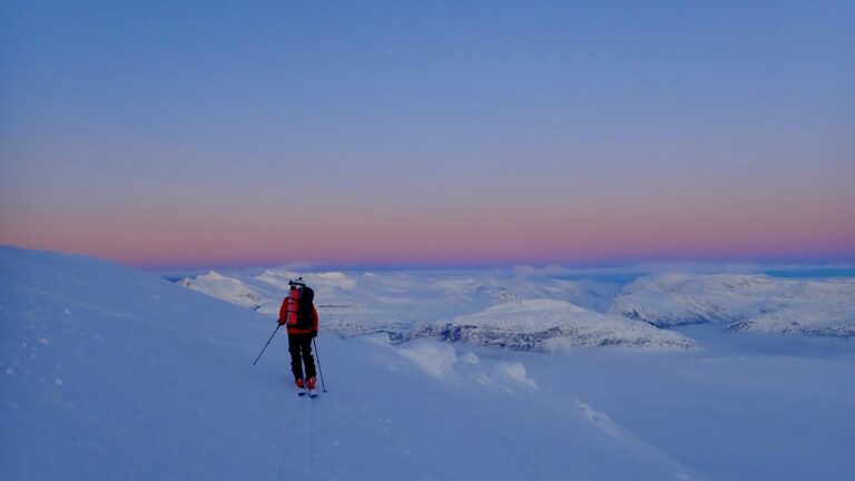
Skitur: Rabothytta, 1200 moh.
Hvis du er vant til å ferdes i høyfjellet på vinteren, er en skitur til Rabothytta en sjeldent flott opplevelse.
Topptur: Kveldstuva 765 moh.
Denne populære toppturen i Vefsn byr på det meste for både nybegynnere og for den erfarne skikjører bare en liten halvtime utenfor Mosjøen.
Topptur: Middagstuva, 1236 moh.
Middagstuva er et av Meløys snillere toppturfjell, som likevel byr på gode muligheter for spennende linjer for de som vil. Turen starter på omtrent 400 moh., så her er det mulig å finne god snø både tidlig og sent i sesongen.
Turbeskrivelse: Himmelberrsteinen – Tonnesfjellet
Fin tur til den karakteristiske hvite “Himmelberrsteinen” eller “Himmelbergsteinen” på Tonnesfjellet i Lurøy.

Basseng- og filmhelg på Scandic Syv Søstre
Nyt en avslappende helg i Sandnessjøen med to netter på Scandic Syv Søstre. Ta en forfriskende dukkert i Kulturbadets moderne basseng, og rund av dagen med en koselig film på kino. Den perfekte blandingen av komfort, kultur og kystsjarm.
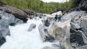
Turbeskrivelse: Marmorslottet
Marmorslottet er en populær naturattraksjon utenfor Mo i Rana. Her kan du se hvordan elva over tusenvis av år har skapt et spennende skulpturlandskap i marmoren. Men trå varsomt og besøk stedet med den respekten et slott fortjener. Vær også oppmerksom på at stien har bratte, utfordrende partier som kan være vanskelig å gå, særlig når det er vått i terrenget.
Topptur: Ronsfjellet, 990 moh.
Ronsfjellet er en snill klassiker blant de spektakulære Meløyalpene, som byr på nesten 1000 høydemeter med nydelige skiterreng fra fjord til tind. Turen går for det meste under 25°, med noen brattere partier.

Holm camping
Holm Camping ligger ved kysten i Bindal, med utsikt mot majestetiske Heilhornet – et ideelt sted for ro, natur og eventyr i Helgeland.
Bogen feriehus
Bogen Feriehus ligger idyllisk til ved fjorden i Bindal og tilbyr komfortabel overnatting i naturskjønne omgivelser. Her kan du bo i fullt utstyrte leiligheter eller en romslig hytte, med kort vei til sjø, fiske og turmuligheter.
Skitur: Klokkerhagen langrennsløype
Klokkerhagen ligger sentrumsnært i Mo i Rana. Her er det opplyste skiløyper i lett terreng.
Turbeskrivelse: Lurøyfjellet 689 moh.
Lurøyfjellet byr på en av Helgelandskystens fineste fjellturer med utsikt til nesten alle de ikoniske eventyrfjellene og de flotte øyene i Lurøy.

Turbeskrivelse: Husmannsplassen Lapplia
Turen til den gamle husmannsplassen Lapplia går på en bratt, men fin og godt tilrettelagt sti opp gjennom skogen og dalsiden, ved siden av E6, et lite stykke nord for Mo i Rana.
Arrangementer i Mo i Rana
I arrangementskalenderen på MoiRana.com får du full oversikt over alle byens arrangementer, fra idrettsarrangementer og markeder til konserter og festivaler.
Arrangementer i Mosjøen
I arrangementskalenderen på iMosjøen.no får du full oversikt over alle byens arrangementer, fra idrettsarrangementer og markeder til konserter og festivaler.
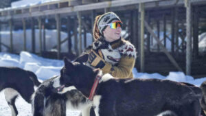
Hundekjøring med Freke Wilderness
Møt sledehundene og bli med på et nydelig vintereventyr for villmarkinger, hundeelskere og eventyrlystne i alle aldre!
Holm kulturminneløype – Lydguide
Holm kulturminneløype er en 3 kilometer lang rundtur i ytre Bindal, der du kan oppleve spor etter mennesker som levde her for over 1500 år siden. Løypa starter ved forsamlingshuset Solvang, går ned til den gamle kirkegården på Solstad, videre til fjæra og gjennom et område med gravhauger fra jernalderen – før den vender tilbake til Holm Camping.
Topptur- og gourmetweekend fra Til Elise og MAD Mountain Guides
Bli med på en toppturweekend fra øverste hylle, med guidede turer i snøsikre fjell og avslappende ettermiddager med badstue og matopplevelser i toppklasse.
Husvær – Padlernes paradis
Et ubeskrivelig øyrike midt i verdens vakreste kyst. Her finner du stille sund, kritthvite strender og panoramautsikt mot De Syv Søstre. Perfekt for både nybegynnere og erfarne padlere.
Tømmerstua, helårs tømmerhus hos Strandli Gård
Bo i et autentisk tømmerhus ved foten av Børgefjell med utsikt inn til nasjonalparken og fjellriket i Fiplingdalen.
Guidet snøscootersafari og nordlysjakt
Hi North tar dere med til villmarken like utenfor Mosjøen til snøscooterløypene og knallgode lysforhold. Dyktige guider gir dere opplæring og tar dere med på en morsom og spennende snøscootersafari i spektakulære omgivelser.
Jettehuset Bed and Breakfast – Et koselig overnattingssted på Sleneset
Jettehuset B&B er et koselig gjestehus på Sleneset i øygruppen Solværøyene på Helgelandskysten. Gjestehuset tilbyr komfortable rom og stor gjestfrihet i et autentisk gammelt Nordlandshus.
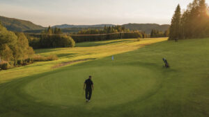
Polarsirkelen Golf
Polarsirkelen Golfklubb har en nydelig 9-hulls golfbane like utenfor Mo i Rana og golfimulatorer for deg som vil terpe på teknikken utenfor sesongen.
En helg med smak og teater: Fortellingen om Peer Gynt
Gi dere selv en dose vinterlys og opplevelser i Mo i Rana! Opplev Fortellingen om Peer Gynt med Kåre Conradi, smak Helgelandskystens beste råvarer og nyt komfortabel overnatting ved Ranfjorden – midt i festivalstemningen.
YogaBiret – naturnære yogaopplevelser på Helgeland
Muligheten til å oppleve yoga midt i Helgelands natur – enten gjennom en helg med Ashtanga-yoga på Dønna eller en enkelt yogatime ute i det fri. Tilbudene gir en unik kombinasjon av bevegelse, ro og naturopplevelser som gjør reisen til Helgeland enda mer meningsfull.
Træna Lodge – overnatting ved havet på Helgeland
Bo tett på havet og øylivet på Husøy i Træna. Træna Lodge er et moderne bryggehus med fire soverom, egen flytebrygge og kort vei til fiske, kultur og hverdagsliv i verdens vakreste øyrike.
Glomfjord Alpinsenter – ren skiglede i Meløyalpene
Glomfjord Alpinsenter byr på stolheis, varierte nedfarter og rå utsikt mot fjorden og isbreene. Her finner erfarne skiløpere og frikjøringsentusiaster sitt vinterparadis – omgitt av snødekte topper og lokalt vertskap som virkelig brenner for fjellet.
RIB tur til Himmelblå fra Brønnøysund
Føl spenningen av åpent hav, oppdag skjulte perler og kom tett på fantastisk dyreliv på en av våre RIB turer til Himmelblå og Ylvingen.

Ytri Island Retreat – mer enn et hotell
Ytri Island Retreat i Træna er et eksklusivt landskapshotell med 38 rom og suiter, bar, sjømatrestaurant, møterom, saunaer, utendørs velværeavdeling, båthus, gjestehavn og sandstrand.

Restaurant Sjyen
Med god mat, god vin, nydelig utsikt og elegant avslappet atmosfære, er Sjyen et godt valg for et like godt måltid til hverdags som til fest. Her får du moderne varianter av det beste havet (eller «sjyen», som de lokale sier) har å by på.
Grannen Lodge – et moderne fristed ved Bindalsfjorden
Ved den stille Bindalsfjorden, omkranset av fjell og hav, ligger et moderne feriehus som byr på både ro og rå natur. Her bor du komfortabelt med panoramautsikt til kystlandskapet – og med direkte tilgang til sjøen rett utenfor døra.
Ski & Seil på Helgelandskysten
Bli med på et spennende 6-dagers ski- og seileventyr langs den fortryllende Helgelandskysten med Nordværs eksklusive vårutflukt. Fra mars til mai kan du være med på en fem-netters reise fra Nordværs idylliske base på Seløy, ombord på deres topp moderne katamaran.
Træna Badstue-Naust
Bli god og varm i den vedfyrte badstuen i Trænas eldste naust, og ta et forfriskende bad i det krystallklare havet rett utenfor.
Gårdsidyll på Dønna
3 Kalver ligger på den store øya Dønna på Helgelandskysten, og er et perfekt mål for deg som vil bo og spise i idylliske, rolige omgivelser, samtidig som du har det beste kystnaturen rundt Dønna kan by på for dine føtter.
Furøy Camping ved Svartisen i Meløy
Furøy Camping ligger like ved Kystriksveien i Meløy, med kort vei til isbreen Svartisen. Campingplassen har hytter, plass for bobiler, campingvogner og telt.
Lyngvågen Kafé og hagebesøk i Gjerøyhamn
På Lyngvågen Kafé kan du spise god hjemmelaget sjømat og overnatte. Over sundet kan du besøke Jonny i Gjerøyhamn. Her finner du en nydelig besøkshage, salgsutstilling i Losviklåven og et privat museum i den gamle lensmannsgården.
Gulljorda golfbane – 9-hulls golfbane ved Mosjøen
Spill golf i naturskjønne omgivelser, på denne nydelige 9-hulls golfbanen, en kort kjøretur fra Mosjøen.
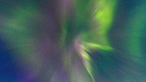
Norsk Havbrukssenter – Nordlysjakt på Helgelandskysten
Bli med på en uforglemmelig nordlysopplevelse langs den sørlige delen av Helgelandskysten. Ombord i en komfortabel yacht legger vi ut på jakt etter det magiske nordlyset – Aurora Borealis – i et av Norges mest naturskjønne kystområder. Med havet under oss og himmelen over, glir vi stille over rolige farvann og nyter utsikten, langt unna byens lys og støy.
Utforsk Brønnøysund med lydguide – en vandring gjennom 10 000 år
Brønnøysund er mer enn en vakker kystby – det er et levende historiebok, med spor etter mennesker, handel og havliv gjennom ti tusen år. Med denne audioguiden får du en personlig og fleksibel vandring gjennom byens mangfoldige fortid og nåtid, midt mellom 10 000 øyer, holmer og skjær.
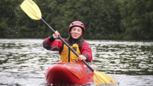
Lær elvepadling med RiverNorth
Bli med på et spennene elve-eventyr og lær elvepadling i den fantastiske elva Austervefsna i hjertet av Helgeland. Bli trygg i elvekajakk og opplev spenning og moro i vill og vakker natur.
Gildevangen konditori – lunsj, kaffe og kaker
Hos Gildevangen konditori på Olderskog i Mosjøen kan du spise en god lunsj, kose deg med kaffe og iste og kanskje en kakebit eller tre.
Træna Kaffekollektiv – Koselig kaffebar på Træna
Træna Kaffekollektiv er en liten og koselig kaffebar med nydelig utsikt over Trænfjorden og den beste kaffen i havgapet.
Topcamp Mosjøen
Topcamp Mosjøen ligger sentralt ved E6 ved innkjøringen til Mosjøen, like ved noen av Mosjøens fineste frilufts og aktivitetsområder. Campingen har en stor lekeplass, er godt tilrettelagt for bobil, caravan og telt, og har fine hytter og leiligheter til leie.
Førjulsmoro for hele familien i Mo i Rana
Ta med familien på en aktiv miniferie med opphold på Scandic Meyergården Hotel, inngang til Vitensenter Nordland og en hel dag på Max Arena for klatring og buldring. Bowling, badeland og smakfulle middager er bare et steinkast unna – midt i hjertet av Mo i Rana. Den perfekte førjulsopplevelsen for både barn og foreldre!
Myken Apartments – Ferieleiligheter og hus på Myken
Hos Myken Apartments kan du velge mellom flere typer overnatting på den lille øya lang ute mot havet. I leilighetene i Myken Brygge bor du helt nede ved hurtigbåtkaia med en vakker utsikt over sundet og innseilingen til Myken. Eller du kan bo i et hus.
Padleheimen – Kurs og guidede turer i vakre Støttvær
Bli med på guidede turer og kajakkurs i den fantastiske øygruppen Støttvær. Nyt fuglelivet og den fantastiske naturen i rolig vann, eller test deg selv i tøffere sjø på yttersiden av øyene.
Sommerkafé på ærverdige Gamle Helgeland
Midt i Sandnessjøen sentrum ligger en sjelden perle for deg som vil en pause i sjøkanten: kaféen om bord på den verneverdige kystskipet Gamle Helgeland. Her byr de på lave skuldre, god lokalmat og servering med alle rettigheter i Sandnessjøens sjarmerende havnemiljø.
Polarsirkelsenteret – Suvenirbutikk og kafé ved Polarsirkelen
Med matservering og stor suvenirbutikk, er Polarsirkelsenteret et naturlig stoppested på ferden over Saltfjellet og Polarsirkelen.
Sommerkafè og kamkakebaking
Gjør en stopp på Hemnes Bygdetun på Bjerka og se se hvordan den lokale baksten «kamkaka» lages. I sommerkafèen Storfjøsen kan du smake på baksten.
Doktorgården på Lurøya
Et historisk og sjarmerende overnattingssted midt i øyriket, med utsikt til fjell, hav og levende lokalsamfunn. Doktorgården på Lurøya er et innbydende valg for deg som vil oppleve Helgelandskysten på nært hold, enten du reiser alene, med familie eller venner.
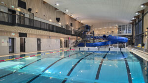
Moheia bad – et moderne badeanlegg i Mo i Rana
Moheia bad er et populært møtested for små og store som vil bade, leke, trene eller bare slappe av. Med fire ulike bassenger, vannsklie, badstuer og kafé, ligger alt til rette for en hyggelig opplevelse – året rundt.
Base Camp Vega – overnatting, kajakk og klatring
Hos Base Camp Vega kan du overnatte i de unike «e-husene»; mini-hytter inspirert av de lokale ærfugl-husene på Vega, eller du kan ta natta på en av de fine teltplassene. Her er du rett ved Vegatrappa og Ravnfloget Via Ferrata, og en nydelig skjærgård å utforske med kajakken.

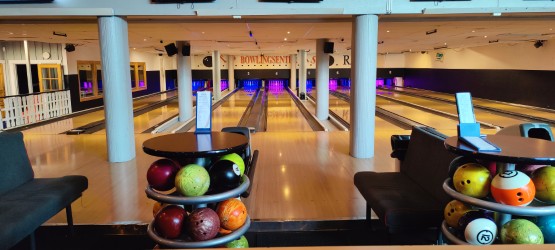
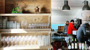
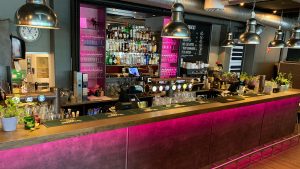
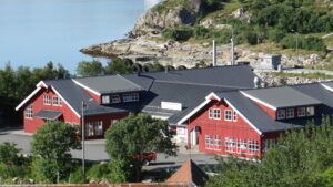
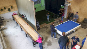
TP Bowlingsenter – aktivitet og sosialt samlingspunkt i Mo i Rana
Midt i sentrum av Mo i Rana ligger TP Bowlingsenter – et populært møtested for både fastboende og tilreisende som ønsker en sosial og aktiv pause i hverdagen eller ferien.
Brevandring på Svartisen med Meløy Adventure
Bli med på guidet bretur på Engabreen i Meløy. Erfarne guider fra Meløy Adventure sørger for en trygg og rå opplevelse på blåisen.
Myken Handel – møteplass og butikk ved kaikanten
På øya Myken, ytterst i havgapet, finner du en liten butikk med stor betydning. Myken Handel er mer enn en dagligvare – det er et naturlig samlingspunkt for fastboende og tilreisende, bare et steinkast fra hurtigbåt kaia.
Augustbryggo – restaurant med lokal mat på Seløy
Opplev den intime restauranten på kaikanten med spektakulær utsikt og lokale råvarer.

Raus Bryggeri på Nesna
Raus Bryggeri ligger ved ferjeleiet på Nesna. Her kan du komme på omvisning og ølsmaking, og ta en kald brus eller øl på uteserveringen. Og du kan handle til veien videre i bryggeriets eget øl- og brusutsalg.
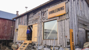
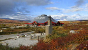
Arctic Circle Classic Motorcycle museum
Besøk et unikt museum med veteranmotorsykler i en spektakulær nordnorsk ramme. Museet kombinerer sin utstilling med tohjulinger og andre verdenskrig. Museet ligger på Storforshei, rett nord for Mo i Rana.
Rauvassgården fjellgård i naturskjønne omgivelser
Den historiske Rauvassgården er en perle i fjellene utenfor Mo i Rana, perfekt for større grupper på tur sammen, eller mindre grupper som ønsker god plass.
Thon Partner Hotel Mo i Rana
På Thon Partner Hotel Mo i Rana bord du komfortabelt ved fjordkanten – midt i Mo i Rana sentrum.
Festspillene Helgeland
Kulturfestival i Mosjøen
4. juli – 11. juli 2026
Bli med når kultur og Nord-Norsk sommer forenes med over hundre arrangementer, tretti utstillinger og én uke fylt med musikk, kunst, samtaler og byliv. Festspillene Helgeland er en av Nord-Norges største kulturfestivaler, og trekker publikum fra hele landet til Mosjøen.
Storsletta – naturskjønn overnatting langs Vefsna i Grane
Med elven Vefsna som nærmeste nabo ligger det eventyrlige huset på Storsletta i naturskjønne områder.
Nerstua Gjestehus – overnatting på Selvær i Træna
I det koselige huset Nerstua, på Selvær, ytterst på Helgelandskysten, finner du roen og kan kjenne at skuldrene senker seg. I dette spesielle øysamfunnet kan du bo nært naturen og havet, og sove godt mellom de store og små opplevelsene.
Dønnes Skolestua – Overnatting og bobilplass
I 1922 ble den gamle skolestua satt opp for å gi et trygt og godt tak over hodet til skolebarna som hadde for lang hjemvei. Nå, hundre år senere, huser den deg som vil oppleve roen og den vakre naturen nord på Dønna, midt på Helgelandskysten.
Løkta Museum
Ta gjerne turen innom Løkta Museum. Stedet ligger vakkert til på vestsiden av øya. Der kan du se og oppleve hvordan tilværelsen artet seg på et småbruk i gamle dager. Området er åpent for alle. Her finner du rasteplass, bålpanne og et lite utedo.
Rødøy Kysthandel og Kaffekroken – kafé og døgnåpen dagligvare
Hos Rødøy Kysthandel finner du både en trivelig kafé og døgnåpen, selvbetjent dagligvarebutikk, slik at du kan få tak i det du trenger når du trenger.
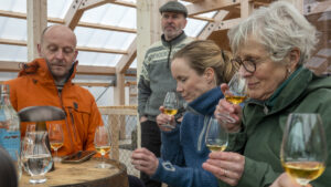
Whiskykatedralen på Myken
Bli med på Whiskysmaking med historiefortelling på en guidet tur gjennom Mykens egen Whiskykatedral.
Guidet tur til toppen av Trænstaven
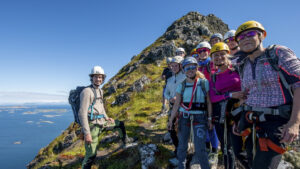
Bli med Rana Spesialsport på en spennende tur til toppen av det ikoniske fjellet Trænstaven, ytterst i havgapet.
Hansinestua og Hagland – overnatting i historiske hus på Gjerøy
Midt i det vakre øyriket i Rødøy kommune ligger Gjerøy – ei levende øy med rundt 50 fastboende, omkranset av storhavet og lune viker. Her kan du senke skuldrene, utforske kystlandskapet og overnatte i autentiske, historiske hus – hvert med sin sjel og sin utsikt.
Tampen Kafé på Kvarøy
Ytterst på kaikanten på Indre Kvarøy, finner du det yrende livet på Tampen kafé. Et overraskende urbant lunsjsted midt i det spennende, lille kystsamfunnet.
Mosjøen bystrand
Mosjøen bystrand er en sentral badeplass, ikke langt unna sentrum i Mosjøen, som tilbyr både kritthvit sand, palmer og lekeplass for de minste
Kvarøy aktivitetshall
Aktivetshall med shuffleboard, biljard, golf- og jaktsimulator og mye mer moro for hele familien!
Aktivitetsferie på Ylvingen
Dette er fire-dagers ferien du trenger, med overnatting, måltider og aktiviteter på den vakre «Himmelblå-øya» Ylvingen.
Opplev Meløy fra Ørnes Hotell
Ørnes Hotell tilbyr komfortabel overnatting midt i det vakre kystlandskapet på Helgeland. Med nærhet til både natur og opplevelser er vi et perfekt utgangspunkt for din reise.
Lettsekktur fra Børgefjell til Okstindan
Dette er en av de flotteste og heftigste turene Nord-Norge har å by på, langs grensefjell og nasjonalparker, reinbeiteområder, åpne vidder, ville daler og store fjellmassiv. Og nå kan du gå den med bagasjetransport fra hytte-til-hytte.
Brevandring på Svartisen med Explore Svartisen
Bli med på en eventyrlig brevandring på bretunga Engabreen i Svartisen i Meløy.
Krambua Kafé i kaffebrenneriet på Handelsstedet Forvik
Midt mellom hav og historie, langs Kystriksveien i Vevelstad, ligger Handelsstedet Forvik – et levende minne om nordnorsk kystkultur og et av Helgelands mest sjarmerende stoppesteder. Her kan du oppleve den koselige kaféen, butikken og kaffebrenneriet i den gamle kramboden, og nyte en stund med gode smaker og lukter i den historiske atmosfæren.
Historisk vandring på Myken
Hårek, som er født og oppvokst på Myken, tar deg med på en vandring på den lille øya. Her får du en unik mulighet til å se tilbake i Mykens historie og lære om livet på det lille øysamfunnet, langt ute mot havet.
Fotballgolf på Tømmervika Opplevelsessenter
På Tømmervika Opplevelsessenter kan hele familien og vennegjengen utfordre hverandre i fotballgolf – en sosial og morsom aktivitet som kombinerer det beste fra fotball og minigolf.
Aloha Cafe på Træna
Aloha Cafe ligger sentralt på Høusøy i Træna, og har lunsjmat, kaffe, salater og ikke minst Træna-Hawaiiburgere, oppkalt og inspirert av den spesielle forbindelsen mellom to øysamfunn på hver sin ende av verden.
Sykkelutleie på Træna
På Træna Turistkontor på Husøya kan du leie sykkel for å komme deg rundt på den vakre øya.
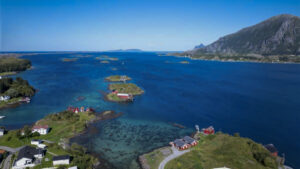
Lurøy Rorbuer
Nyt lange, fine sommerdager eller en vakker vintertur på Onøy og Lurøy. Opplev øylivet, kystkulturen og øyas fine turområder. Dra på turer i kajakk i den skjermede skjærgården, besøk naboøyer som Lovund, Træna, og Hestmannøy. Og rund av dagen med kveldssol på bryggekanten og eller en rolig stund i den fine badstua.

Restaurant Gammelbutikken – autentisk lokal sjømat
Restaurant Gammelbutikken er Støtts storstue og oser av autentisk kystkultur. Her får du smake det beste som øya og havet har å by på av lokale matskatter. De følger hele verdikjeden fra ingrediensene høstes i naturen på øya og fisken dras ute på Vestfjorden, til den serveres i restauranten.
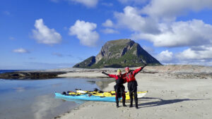
Padleparadiset Støtt
Fra Støtt kan du padle i den vakre og skjermede skjærgården i Støttvær, eller leke deg med surfing i bølger og brott i den åpne kysten rett utenfor. Bli med på kurs, dra på guidet tur eller lei egen kajakk.
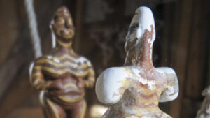
Fruktbarhetsutstilling ved Fallosen på Dønna
På Glein på Dønna kan du se Nord-Europas største marmorfallos og få omvisning i Fruktbarhetsutstillingen; en samling av fruktbarhetssymboler fra hele verden som strekker seg hele 25 – 30 000 år tilbake i tid.
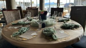
Havkanten Gjestehus Restaurant og overnatting – sjømat og lokale smaker i Herøy
Havkanten restaurant – kombiner middagen med spa og badstu på brygga, RIB-tur i solnedgang eller vinsmaking med lokale smaker.

Guidede turer og kurs i Okstindan
Opplev vakre Okstindbreen og Oksskolten med MAD Mountain Guides og bli med på spennende breturer og kurs i et flott brelandskap. Med sine 1916 meter over havet er Oksskolten Nord-Norges høyeste fjell og et imponerende skue i et vilt og vakkert fjellmassiv.
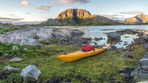
Brønnøysund Kajakk – kurs og utleie av kajakk, SUP og båt
Brønnøysund Kajakk har alt du trenger for å utforske de vakre havområdene og øyene rundt Brønnøysund, enten du vil gjøre det med kajakk, SUP eller båt.

Løyle Gård – Besøksgård med alpakka, hester, hunder og geiter
Hos Løyle Gård kan hele familien møte gårdsdyr som hest og alpakka, geit og sau, og selvsagt de trofaste gårdshundene. I gårdens lille lekepark kan ungene leke og kose seg, mens de voksne kan slappe av og nyte livet på landet med en kopp kaffe.
Etcetera – botaniske utskeielser
Bli med inn i en botanisk eventyrverden og en butikkopplevelse for livet, hvor det bugner av blomster og dekor, interiør og kreativ kunst. Og lakris, sjokolade, is og kaffe. Dette er en fryd for alle sanser du sent vil glemme og ikke vil gå glipp av.
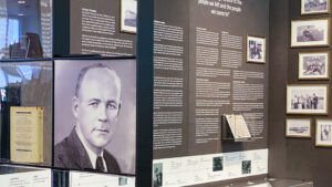
Utstilling: Ole Edvart Rølvaags liv og virke
Ole Edvardt Rølvaag emigrerte fra Dønna til USA på slutten av 1800-tallet. Her skrev han flere romaner om å utvandre fra Norge og å være innvandrer til USA på denne tiden. I utstillingen til Dønna kan du lære mer om forfatterens liv og virke, og se den komplette samlingen av førsteutgavene til Ole Edvart Rølvaag.

Onkel Oskar – pub, mat og ølsmaking
Bli med inn på Onkel Oskar, hvor nye ansikter blir møtt med den samme lune gjestfriheten som gamle stamgjester. Her kan du kose deg med varm mat og kald drikke, sport på storskjerm og god stemning. Eller ta turen på den månedlige ølsmakingen, som gir deg mulighet til å utforske nye smaker fra et rikholdig utvalg.
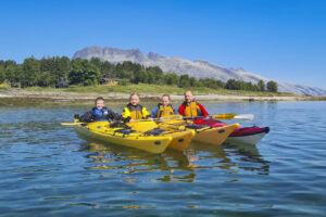
Kajakk rundt Sandnessjøen og Herøy – kurs og guidede turer
Opplev storslått natur og levende kystkultur med Tømmervika Opplevelsessenter rundt Sandnessjøen, Tjøtta og Offersøya. Her kan du bli med på familievennlige dagsturer og spennende langturer i Herøy og Vegaøyan, og runde av med en gøyal runde fotballgolf.
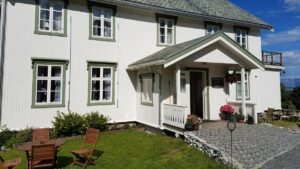
Vevelstad gjestegård og rorbuer
Vevelstad Gjestegård tilbyr overnatting med frokost i historiske omgivelser like ved sentrum av Vevelstad, en liten kommune rett nord for Brønnøysund. Gjestegården byr på hjemmelaget lokal tradisjonsmat og gårdsbutikk på stabburet.
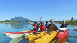
Guidede kajakkturer i Herøy
Bli med på en guidet tur i noen av de fineste padleområdene på hele Helgeland.
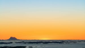
Nordvær – Arktisk seilas
Nordvær Sailing på Seløy tilbyr seilcharter inspirert av villmark og kulinariske opplevelser langs Helgelandskysten i Nord-Norge.

Guidet øyhopping med sykkel til Dønna og Herøy
Bli med på en nydelig, guidet sykkeltur fra Sandnessjøen ut til de vakre øyene i Dønna og Herøy, med stopp på koselige kaféer og spennende butikker.
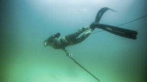
Fridykking og snorkling i Træna – opplev livet under vann
Bli med ned under vannflaten til Trænas fantastiske undersjøiske verden. Blant krystallklart sjøvann, tareskoger og sandbunner oppdager dere et eventyrlig dyreliv med fiskestimer i tareskogen, kamskjell og flyndrer på sandbunnene og mye mer. Enten du vil fridykke, snorkle eller padle mellom øyene, finner du utstyret og opplevelsene på Kranberget på Husøy.
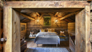
Inderdalen Gård – overnatting, kamkakebaking og kulturhistorie
Ved foten av Okstindan i Hemnes Kommune finner du en skattekiste av en fjellgård fra 1600-tallet. På Inderdalen Gård kan du overnatte i Gjestehuset og få oppleve gårdens rike kulturhistorie og fantastiske vertskap i naturskjønne omgivelser.
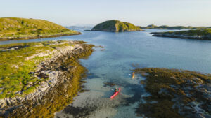
Utleie av kajakk og sykkel i Herøy og Sandnessjøen
Herøy er et fabelaktig sted for kajakkpadling, med sine holmer, skjær og vakre strandlinjer. Enten du ønsker å oppleve øya fra land eller vann, har Herøy Kajakk & Sykkel det du trenger. Her kan du leie kajakker, el-sykler og SUP-brett, eller du kan utforske Herøy med kjente og erfarne kajakkpadlere med en guidet padletur.
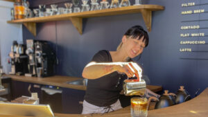
The Coast Coffee
På kaffebrenneriet The Coast Coffee på Lovund møtes levende kystkultur og urban kaffekultur på sitt beste. Her får du en utsøkt kopp kaffe i det som er øyas egen kaffebar og kaffebrenneri, med en god atmosfære nede ved sjøen.
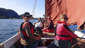
Seilas med nordlandsbåten Faragut
Bli med på seilas i den flotte nordlandsbåten Faragut, og opplev Helgeland fra havet slik menneskene her har gjort helt tilbake til vikingetiden. Nordlandsbåten er en åpen, lav og stødig trebåt som har sine røtter helt tilbake til vikingeskipene, og det er en opplevelse å få være med å stå ved roret når vinden fyller seilet.

Brasserie 8622
7. september 2023 åpnet Brasserie 8622 dørene i nyoppussede lokaler i Mo i Rana sentrum. Menyen er inspirert av det franske kjøkken, laget på lokale råvarer av ypperste kvalitet.
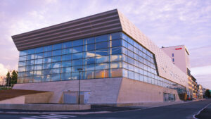
Kulturbadet i Sandnessjøen
Med basseng, kino, bibliotek og teater under samme tak, har Kulturbadet i Sandnessjøen aktiviteter for hele familien og enda noen til!
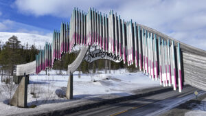
Porten til Nord-Norge – butikk og gatekjøkken
Start reisen gjennom Helgeland med et godt måltid og et besøk i butikken som har alt du trenger for opplevelsene som venter i Nord-Norge.

Hytta på Øksningsøya – Koselig feriested i Bindalsfjorden
Bo stille og fredelig i privat hytte på Øksningsøya, kort båttur fra Terråk.

Med kjærlighet til håndverksmat – Stavsmarken Gård
På Stavsmarken Gård finner du en liten gårdsbutikk med deilig hjemmelaget spekemat og kjøttvarer. Du kan også besøke den sommeråpne kaféen, der du kan smake på alt det gode gården har å by på.
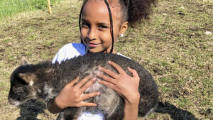
Bitteliten gård, kjempestor opplevelse
Senk pulsen og finn roen i møte med de koselige dyrene på Bitteliten Gård, på Handnesøya utenfor Nesna.
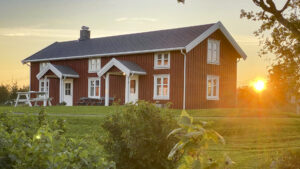
Koselig bestemorhus på Stavseng Gård
Stavseng Gård ligger nord på den langstrakte øya Dønna. Her kan du leie overnatting med selvhushold og oppleve livet på bygda Stavseng.

Overnatting mellom himmel og hav på Myken Fyr
I 1918 satte de opp et fyr på fiskeværet Myken, ytterst ute mot storhavet. Voktet og stelt av en fyrvokter, hans kone, deres fem barn og en ku. I 1975 ble fyret automatisert, og i 2018 ble det pusset opp av Eventyrlig Oppussing. Nå kan dere bo der, og oppleve den helt spesielle stemningen man kan få på sin egen, lille øy på Helgelandskysten.
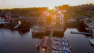
Sjøhuset Dønna, overnattinger ved havet på Dønna
Stort sjøhus, fin rorbu og koselig hytte i vakre omgivelser mellom hav og hei nord på Dønna.
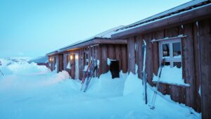
Korgfjellet Lodge
Kom og bo midt i smørøyet i et nydelig fjellområde, i hjertet av Helgeland. Fra Korgfjellet Lodge har du et nydelig turområde rett utenfor hyttedøra, sommer som vinter. Perfekt for dere som vil gå på fjelltur eller skitur, fiske i fjellvann, jakte eller plukke bær.
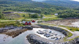
Velfjord Panorama Caravan Camp – overnatting og fiske
Hos Velfjord Panorama Caravan Camp i Velfjorden bor du i naturskjønne omgivelser nede ved sjøen, hvor du kan føle naturens energi og nyte sola hele kvelden. Her kan du campe med bobilen, bli med på båttur, gå tur i fjellet, sykle, padle kajakk, og sove godt i koselige rom.
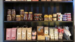
Lokalmat på Sømna
Butikken til Sømna Kro og Gjestegård er fylt opp ost og honning, lakris og krydder, ketchup, dressing og mye mer fra lokale matprodusenter.

Guidet kajakktur i Mo i Rana
En guidet padletur med utsikt over Moholmens eldre bebyggelse, Mjølanstranda, Mo i Ranas industri samt Ranfjorden.

Terråk Gjestegård – komfortabel overnatting og god mat i Bindal
Hos Terråk Gjestegård kan dere bo på komfortable rom og spise middag i restauranten Færingen Spiseri, med kort vei til alt Terråk og Bindal har å by på av fine opplevelser på fjord og fjell.
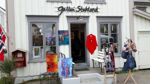
Galleri Stokland i Mosjøen
I et sjarmerende gammelt trehus fra 1852, i hjertet av Sjøgata i Mosjøen, finner du Galleri Stokland. Her møter du fargeglad energi og kreativitet i lokal billedkunst og håndverk av tekstil, strikkeprodukter, keramikk og glass.
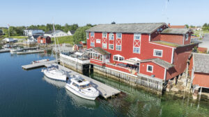
Herøy Brygge – god mat og gode senger
På Herøy Brygge kan du overnatte i nydelige, nyoppussede rom ved sjøen, i egen båt ved gjestebrygga, eller dra innom for en hyggelig middag på bryggekanten. Med god mat, gode senger og godt vertskap får du gode dager i det vakre øyriket.
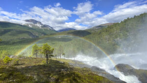
The Geopoetic Way
Vi kaller det «urørt natur». Men når du vet hva du skal se etter, ser du at den er full av fortellinger og spor. Geologiske spor etter isbreer og gamle elveløp. Arkeologiske spor og kulturminner fra menneskene før oss. På denne turen fra The Trail Way får dere lære mer om disse sporene, hvordan vi oppdager dem, og hvordan vi tar vare på dem.
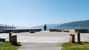
The Power Way
Hvordan bruker vi naturen godt? Hvordan skaper man en by? Hvordan høster vi skånsomt? Dette er viktige spørsmål som dere utfordres til å reflektere over, på denne turen til og gjennom Mo i Rana, jernverksbyen som skal bli Norges grønne industrihovedstad. Opplev byen, maten, menneskene og historien, i denne pakketuren fra The Trail Way.
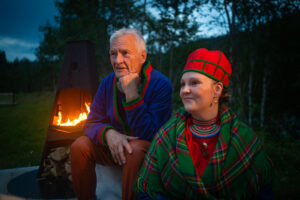
The Sami Way
Ved foten av det mektige Saltfjellet, ved bredden av Ranelva, finner du Storli Camping og Aernie; «ildstedet». Her får dere en smak av livet blant fjellene under Polarsirkelen, slik det var og er i samisk og lokal kultur. I denne pakketuren fra The Trail Way kombineres autentiske mattradisjoner med levende kulturformidling.

Trixie – God mat og blide folk på Trofors
Med sin nydelige plassering mellom Vefsnavassdraget og E6 rett utenfor fjellbygda Trofors, ligger Trixie like vakkert som praktisk til for reisende, lokale, turfolk og større grupper.
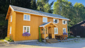
Bakarstuo, helårs gjestehus hos Utpå Neset
Bo i et autentisk tømmerhus fra 1860 på bredden av elva Vefsna.
The Stair Way
Pakk turskoene og byskoene, og bli med til kafébyen Mosjøen. Her får du oppleve den historiske Sjøgata, maten og atmosfæren på ærverdige Fru Haugans Hotell, og den flotte turen opp Helgelandstrappa, verdens lengste fjelltrapp og en av Helgelands mest populære naturattraksjoner.
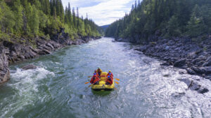
The River Way
Bli med på en spennende reise gjennom rå natur, med fart og spenning, laksefiske og ekte tradisjonsmat på menyen. Store naturopplevelser møter den gode historiefortellingen i denne pakketuren fra The Trail Way, hvor dere får oppleve hvordan elven og skogen en gang var både ferdselsvei og levevei.
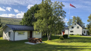
Møteplass Børgefjell
Møteplass Børgefjell ligger nydelig til i Susendalen, på dørstokken til Børgefjell Nasjonalpark. Dette er et vilt og vakkert naturområde med nær uendelige muligheter for aktivt friluftsliv, enten du vil drive fiske eller jakt, gå fjellturer, padle kano, gå skiturer og toppturer.
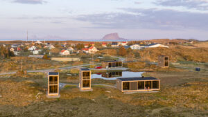
Dugnadsturisme på Træna
Nå kan du bli dugnadsturist på Træna og få gratis overnatting hos House by the Sea.
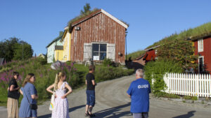
Guidet byvandring i Mo i Rana
Bli med på en guidet byvandring og hør fortellingen om livet under Polarsirkelen, 66 grader nord.
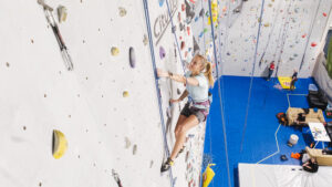
Stupbratt Klatreklubb – Klatrehall i Brønnøysund
Test klatreferdighetene, utfordre deg selv og hverandre og nå nye høyder i klatrehallen til Stupbratt Klatreklubb. Med over 60 ruter i alle vanskelighetsgrader, selvsikring, buldrevegg og kilter board har hallen noe for alle, uansett alder og erfaring.
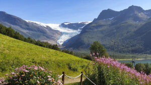
Bo med utsikt til fantastiske Svartisen
Nyt en eventyrlig ferie på Engen Gård i flotte omgivelser med utsikt til Engenbreen i Meløy. Stedet passer godt for både par, familier eller en vennegjeng som vil bruke tid sammen.

Dinner in the dark – en uvanlig sanseopplevelse
Velkommen til en kveld der smak, duft og lyd står i sentrum – og synssansen er satt helt ut av spill!
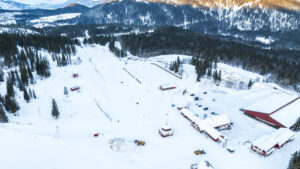
Skillevollen Idrettspark
I Skillevollen Idrettspark er det mye å finne på for deg som er aktiv, enten du kommer alene eller sammen med familie. På vinteren kan du ta med langrennsski, skøyter eller akebrettet, og på sommeren finner dere turløyper, rulleskibane, disc golf, tennisbane og skateramper.
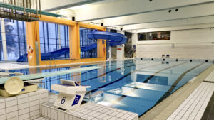
Kippermoen basseng og idrettsenter
Med et stort treningsbasseng, varmt terapibasseng, plaskebasseng, stupebrett og vannsklie, er badeanlegget på Kippermoen Idrettssenter ypperlig for hele familien. Og i resten av idrettsanlegget finner dere squashbaner og en innholdsrik utendørs idrettspark med volleyball, disc golf og mer.
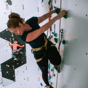
Rana Klatresenter
Opplev utfordringene og spenningen i klatreveggen på Rana Klatresenter. Enten du er en nybegynner som bare vil teste noe nytt, eller en erfaren klatrer på vei mot nye høyder; her finner du ruter som passer ditt nivå.
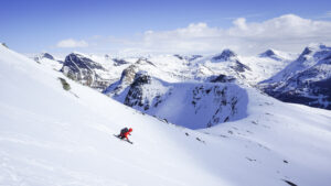
Fantastiske guidede toppturer på Helgelandskysten
Bli med MAD Mountain Guides på en drømmetur av en skiopplevelse langs den vakre og spektakulære Helgelandskysten. Med særegne overnattingsteder, urørte fjellsider og erfarne, profesjonelle guider får du skreddersydd din ultimate skiferie.
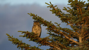
Naturopplevelser og overnatting i vakre Solværøyan
Hos Solværøyan Birds and Beds får du overnatting og naturopplevelser av de sjeldne i et av Helgelandskystens fineste fugleparadis. Sleneset er en del av Solværøyan.
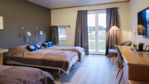
Sømna Kro og Gjestegård
Trivelig kro og komfortabel overnatting i vakre Vik, i Sømna. Her kan du bo og spise godt i rolige omgivelser, nært den vakre naturen og det koselige kulturlandskapet.
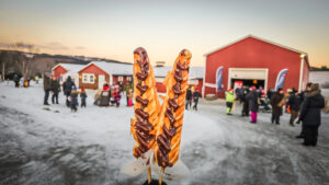
Jul på landet
Julemarked i Sandnessjøen
6. desember 2025
Kom å få julestemning sammen med oss på landet. Jul på landet er gratis for alle, og her er det alt fra kjepphestløype, ansiktsmaling, tur i hesteslede, og mye mer. Kanskje kommer nissen også?
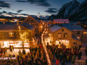
Julebyen Mosjøen
Julemarked i Sjøgata i Mosjøen
5.-7. desember 2025
Sjøgata er pyntet til jul, og Julebyen i Mosjøen inviterer til ei hyggelig førjulstid i hele desember med juleverksted, konserter, forestillinger og ikke minst verdens lengste julegrøtbord med julestemning for store og små.
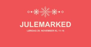
Julemarked på Rana Museum
Julemarked i Mo i Rana hos Rana Museum
29. november 2025
Kom å få magisk førjulsstemning på Rana Museums julemarked. Her blir det salg av både julebakst, lokal mat, kunst og andre lokale håndlagde julegaver. Det blir også juleverksted for de minste, og om vi er snille kommer kanskje fjøsnissen i år også?
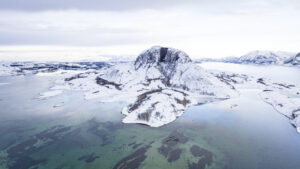
Jul i Brønnøysund
Julemarked i Brønnøysund
28.-29. november 2025
Velkommen til ei helg med ekte julehandel med hjertevarme – midt i sentrum av Brønnøysund. Her blir det pyntede gater, levende musikk, aktiviteter for store og små, og et marked fylt med mat, drikke, servering, håndverk, tradisjon og lokal stolthet.
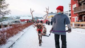
Jul på Berget
Julemarked på Hemnesberget
22.- 23. november 2025
I november er det igjen klart for førjulskos på Jul på Berget. Her kan du får den lokale, autentiske julestemningen gjennom mat, musikk og samvær, og kanskje få gjort unna den siste julegaven du mangler i samme ærend!
Verket
Musikkfestival i Mo i Rana
28. og 29. august 2026
Musikkfestivalen Verket arrangeres årlig på tampen av sommeren i Mo i Rana. Festivalen finner sted på Revelen, i gangavstand fra Mo sentrum og noen hundre meter fra Mo Industripark, tidligere AS Norsk Jernverk, som har gitt festivalen dens navn.
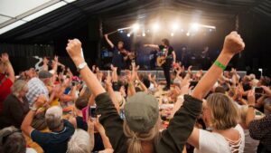
Rootsfestivalen
Musikkfestival i Brønnøysund
15. til 18. juli 2026
Midt på sommeren kan du gjennom fire dager oppleve en fantastisk blanding av lokale musikere, nye talenter og kjente nasjonale som internasjonale artister.
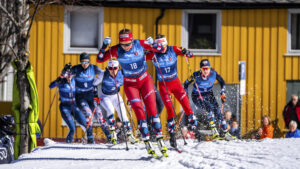
Bysprinten
Idrettsarrangement i Mosjøen
23. – 25. April 2026
Bysprinten i Mosjøen er en folkefest av et skirenn, der verdenseliten, lokale stjerner og lovende talenter går sammen gjennom Mosjøens sentrum. Med skiglede og god sportsånd i fokus, musikk, stor stemning og fulle hus, skaper Bysprinten alltid en ypperlig anledning til å besøke Mosjøen.
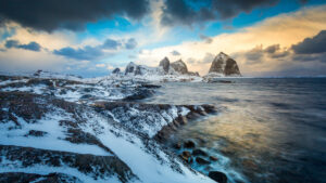
Vinterfestivalen Ta Træna med Storm
Kulturfestival i Træna
19. til 22. februar 2026
Bli med ut til Havfolket i Træna når vintervindene uler, til en kulturopplevelse like mangfoldig og frisk som øyriket rundt, ytterst på Helgelandskysten. Her samles landkrabber og øyfolk rundt mat, musikk, formidling og naturopplevelser gjennom foredrag, fellesturer, gode måltider og varme møter.
Vinterlysfestivalen
Kulturfestival i Mo i Rana
7.-13. februar. 2026.
Vinterlysfestivalen i Mo i Rana er en av Norges største teaterfestivaler, og et kulturelt lyspunkt i de mørke vinterukene. Ta med familie og venner og opplev et mangfold av magiske kulturopplevelser for store og små.