Itinerary: The Norwegian Scenic Route along the Helgeland coast
 Kristoffer Møllevik / Visit Helgeland
The road that hugs the coast of Helgeland is considered one of the world’s premier scenic routes. That’s not just our claim; National Geographic Magazine listed it as one world’s 101 most beautiful drives. And Lonely Planet listed it as one of the Top 10 highlights in all of Norway – in fact, they called this scenic adventure a must-do recommendation for anyone travelling in Northern Norway. Naturally, we couldn’t agree more!
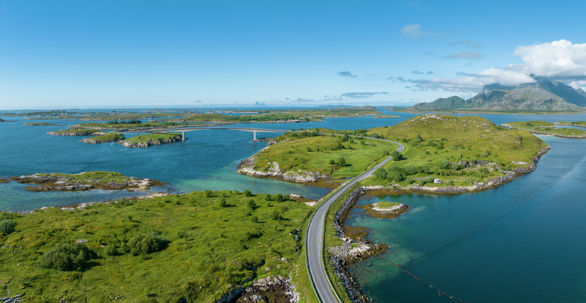
Your road map of Norway marks the Norwegian Scenic Route Helgelandskysten only as Fv17, meaning County Road No. 17, although it’s better known as the Coastal Highway (Kystriksveien). On the map, it winds like a red thread from Steinkjer to Bodø, but the most beautiful stretch is along the Helgeland coast, from Holm in Bindal municipality to Ureddplassen far north in Meløy municipality. That’s the part of it that has status as a Norwegian Scenic Route, which means more than just scenery. The Norwegian Road Authority has facilitated the scenic experience of travellers by establishing great viewpoints, attractive picnic areas and public toilets.
The Coastal Highway Fv17 is the longest of the Norwegian Scenic Routes. In addition to magnificent scenery along the route, there are many great detours to tempt you. You should set aside at least two or three days for this adventure, although considering how much the Helgeland coast has to offer, you can easily spend a week or more. Below is a suggested itinerary, which you can expand or compress according to your desires and holiday schedule. But be warned: many visitors have become so enchanted that they never left!
Tour info
Length: About 423 kilometers
Recommended duration: 7 to 10 days
Stopping points:
Heilhornet
Brønnøysund
Vega
Forvik
Sandnessjøen
Rødøy
Meløy
And several recommended detours
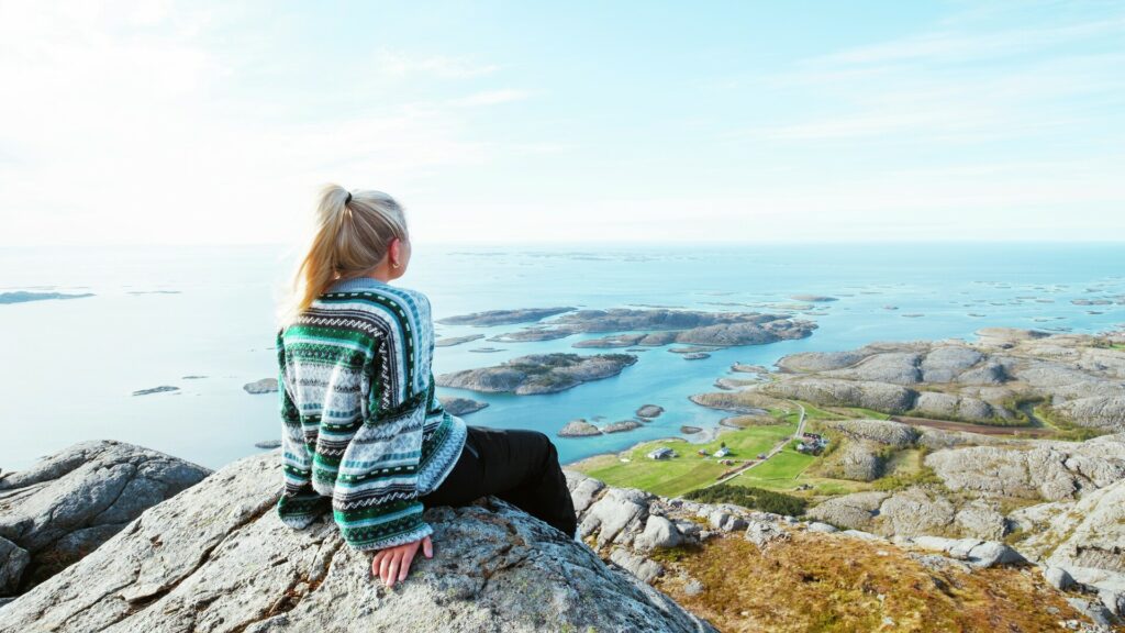
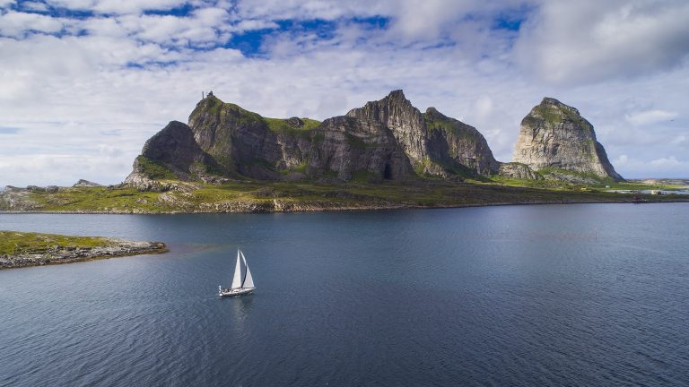
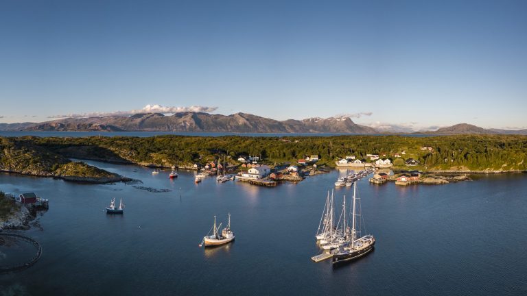
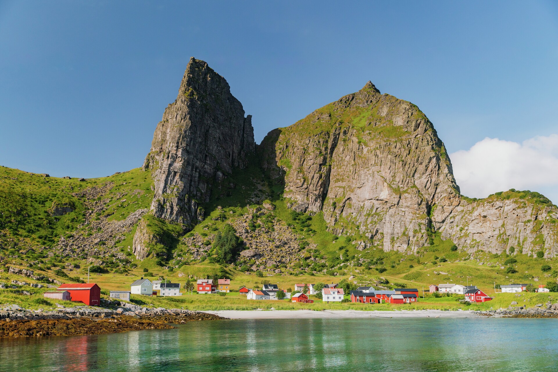
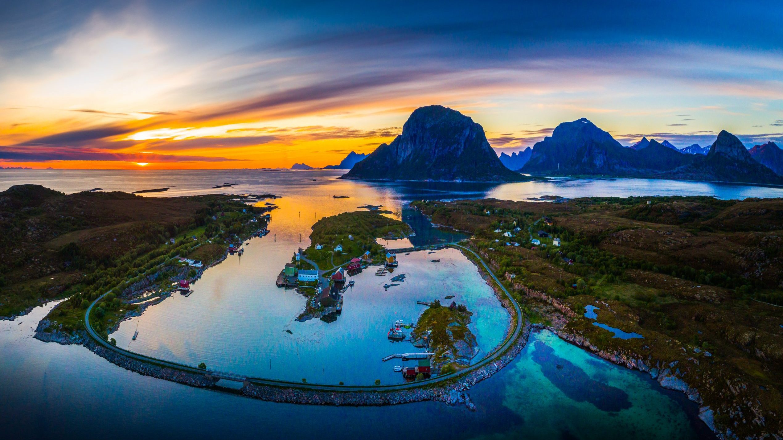
Stage 1 – From Bindal to Brønnøysund
 Kristoffer Møllevik / Visit Helgeland
About 90 kilometers
View the stage in Google Maps
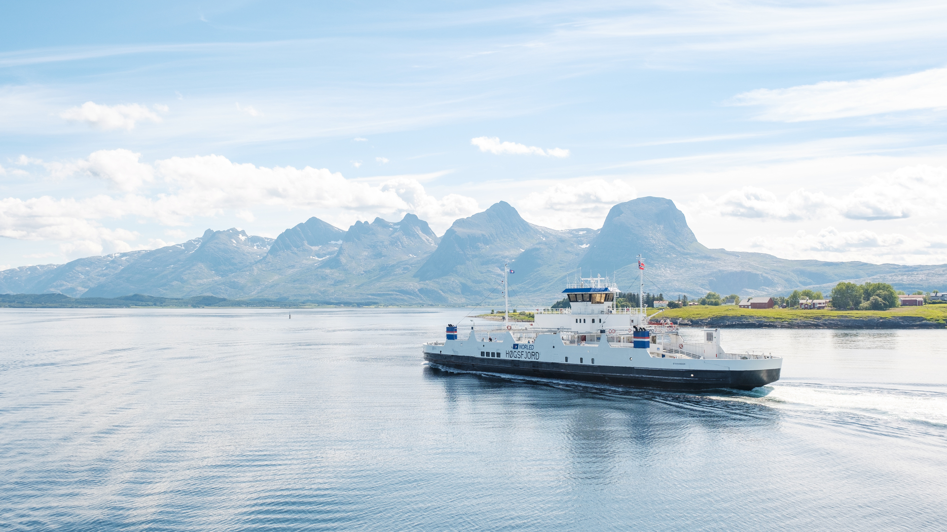
See ferry times for the ferry from Holm to Vennesund
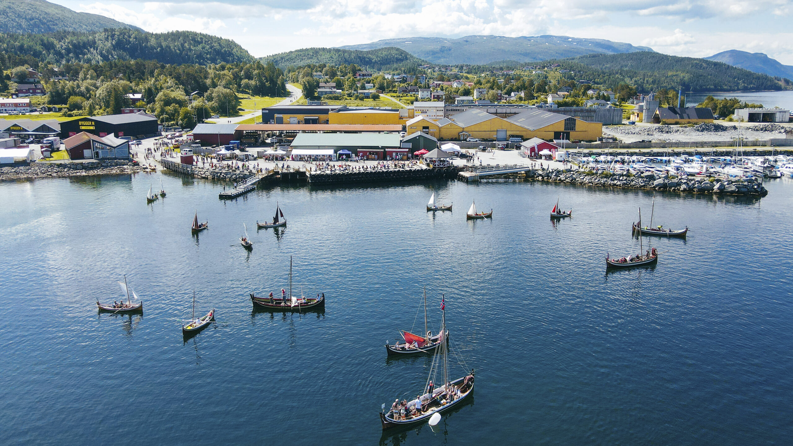
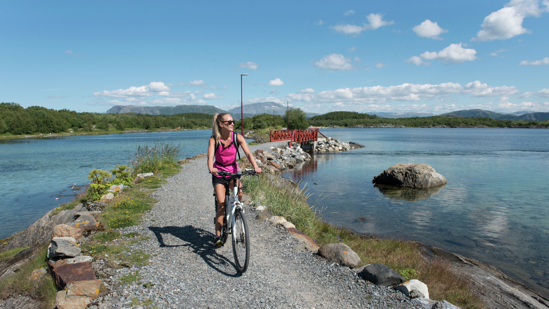
The Coastal Route begins in Bindal, at the southern edge of the Helgeland coast, where the Nordland boat regatta and the Heilhornet mountain are the main attractions. Bindal has a long history of building Nordland boats using traditional clinker methods—a boatbuilding craft recognized by UNESCO and still kept alive by the locals. Each summer, you can see these beautiful wooden boats in their element during the Nordland boat regatta in Terråk.
If you’re up for a hike, heading to the top of Heilhornet is well worth it. It’s the mountain in Bindal—a towering peak in an otherwise open landscape, offering wide views of the area you’re about to explore further north. And if you’ve brought a bike, a short detour to Bindalseidet is a great way to see more of the area on two wheels. Just keep an eye on the ferry schedule between Holm and Vennesund if you’re planning to reach Brønnøysund the same day.
From here, the road continues through Sømna, a green farming municipality with an open coastal and cultural landscape. There are lots of smaller side roads that are fun to explore, whether by bike or car, and mountains like Kjørsvikfjellet, Sømnesfjellet, and Lysingen offer great viewpoints without being too challenging. If you’re after a break, the charming Sømna Bygdetun heritage site is worth a visit, or you can stop at the lovely picnic area at Sundshopen—perhaps with a lunch made from local specialties bought at the shop at Sømna Kro og Gjestegård?
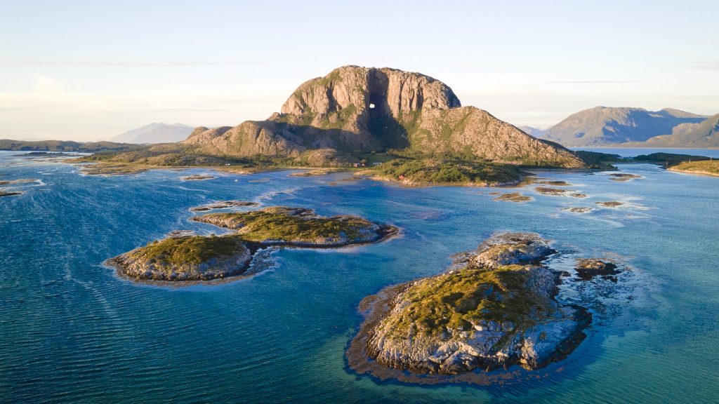
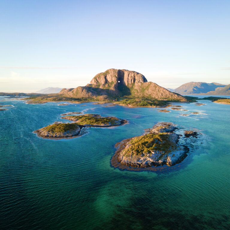
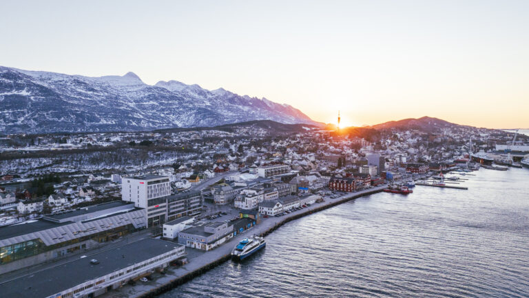
When you arrive in Brønnøysund, we recommend leaving the car and either cycling or paddling a kayak to the legendary Torghatten mountain. Torghatten is the mountain with a hole straight through it. It’s 35 metres high at the tallest point, and according to legend, it was made when the troll Hestmannen shot an arrow through the hat of the troll king Skarsfjellgubben. In reality, ice and water likely carved it out during the Ice Age—but walking through the hole still feels like a bit of an adventure. The trail is easy enough for kids and grandparents alike. If you’re feeling extra energetic, you can also hike to the top for a panoramic view—either way, you’ll be rewarded with a stunning outlook! After your trip, we recommend a good meal at one of Brønnøysund’s excellent restaurants.
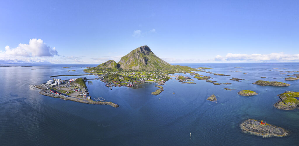
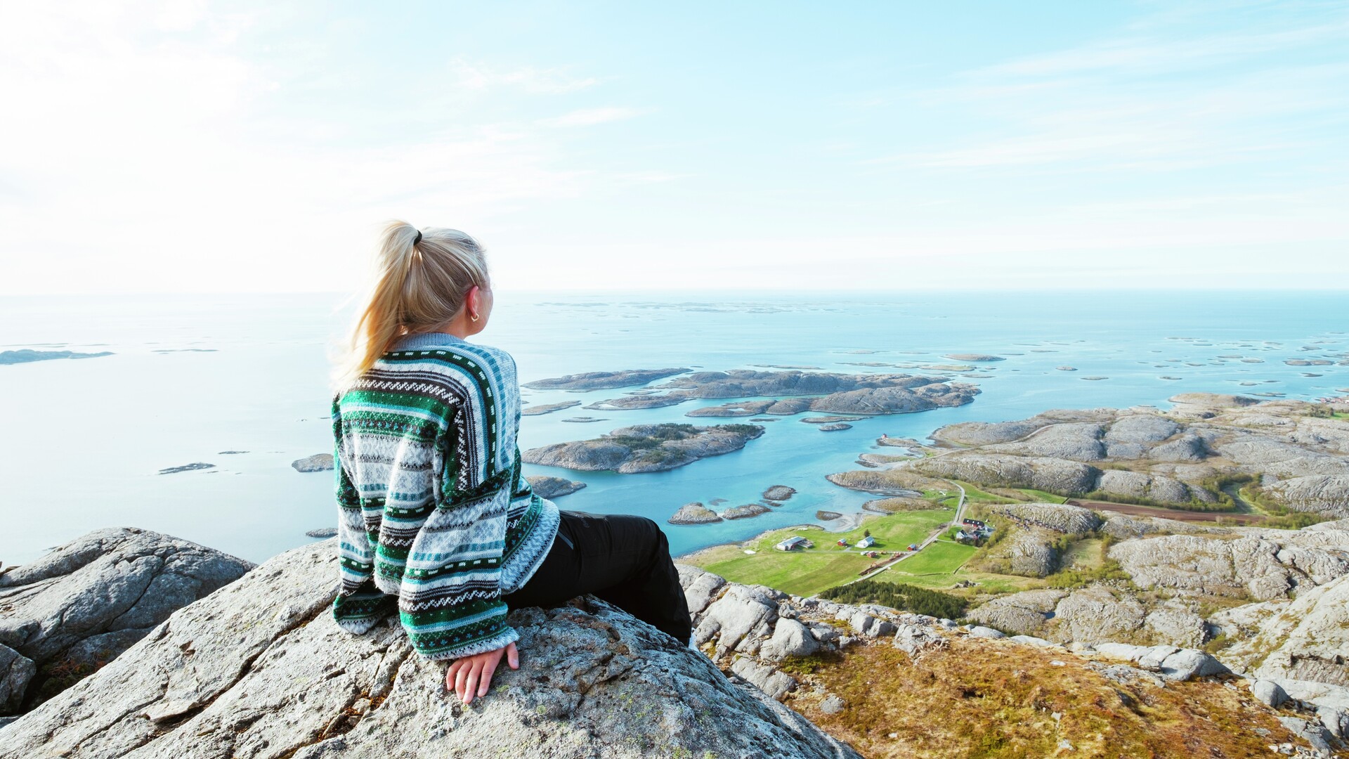
Stage 2 – Vega
 Kristoffer Møllevik / Visit Helgeland
About 54 kilometers
View the stage in Google Maps
See ferry times for the ferry from Holm to Vennesund
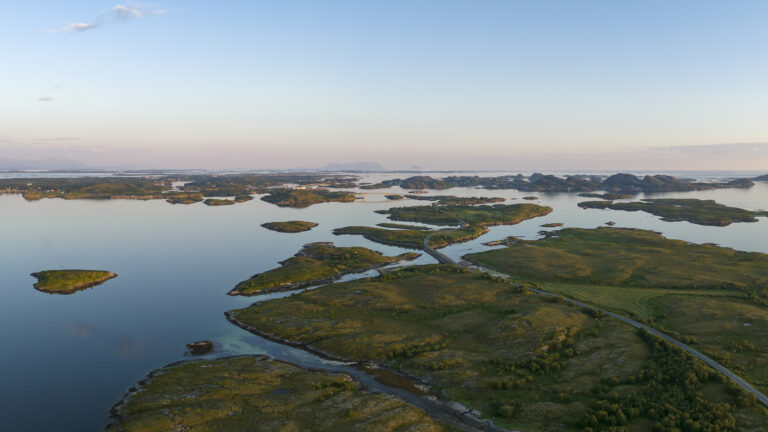
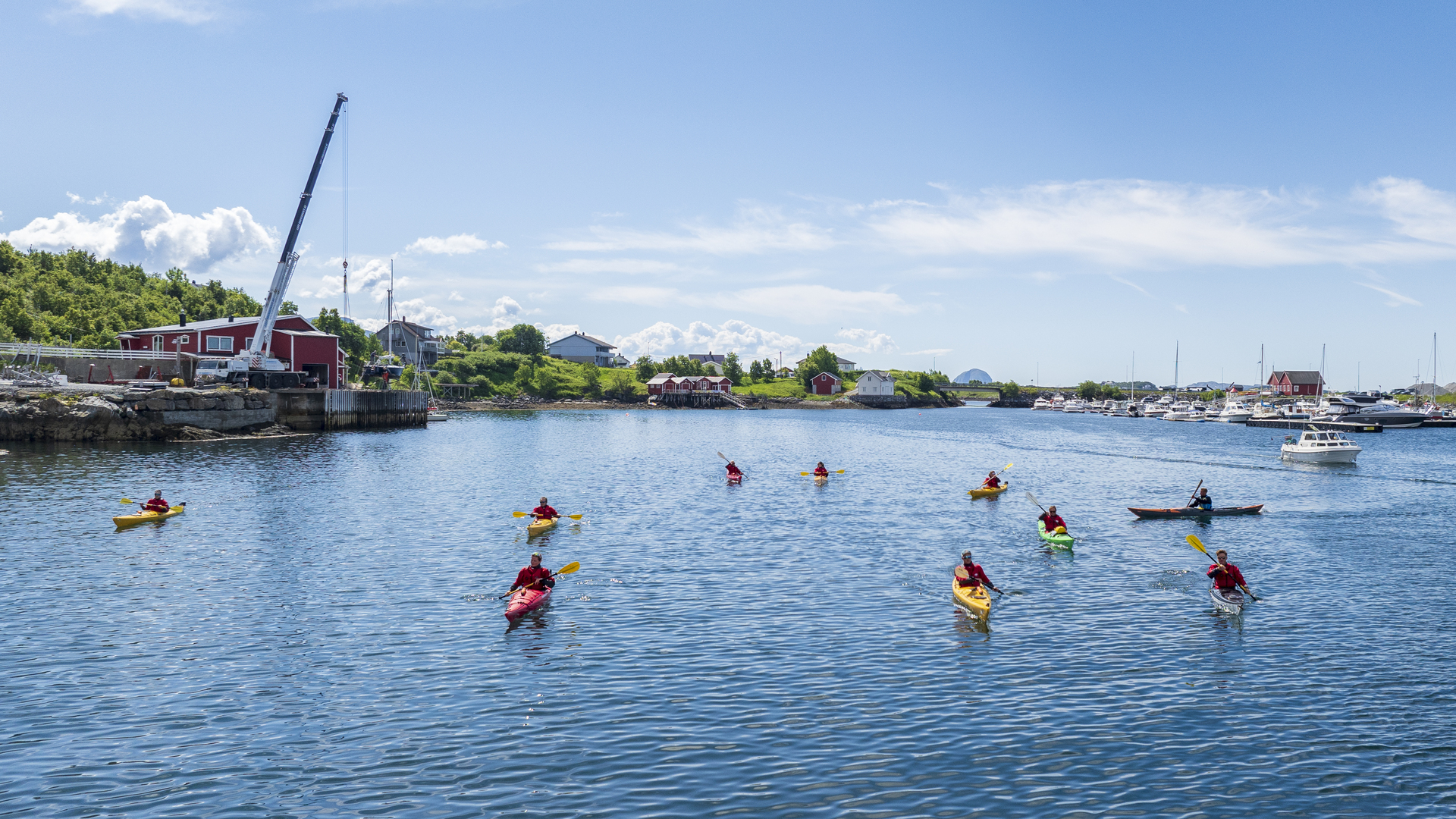
From Brønnøysund you can immediately continue northwards on the Coastal Highway, to Tjøtta and Sandnessjøen. That said, to miss out on a visit to the Vega archipelago would be almost a sin. These islanders’ unique and still-thriving culture inspired UNESCO to declare the main island Vega and the archipelago’s 6500 islands, islets and skerries as a World Heritage Site. It is one of just eight Norwegian sites honoured with a place on UNESCO’s list.
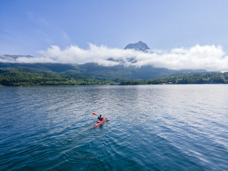
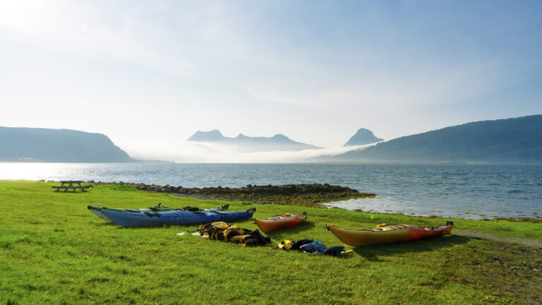
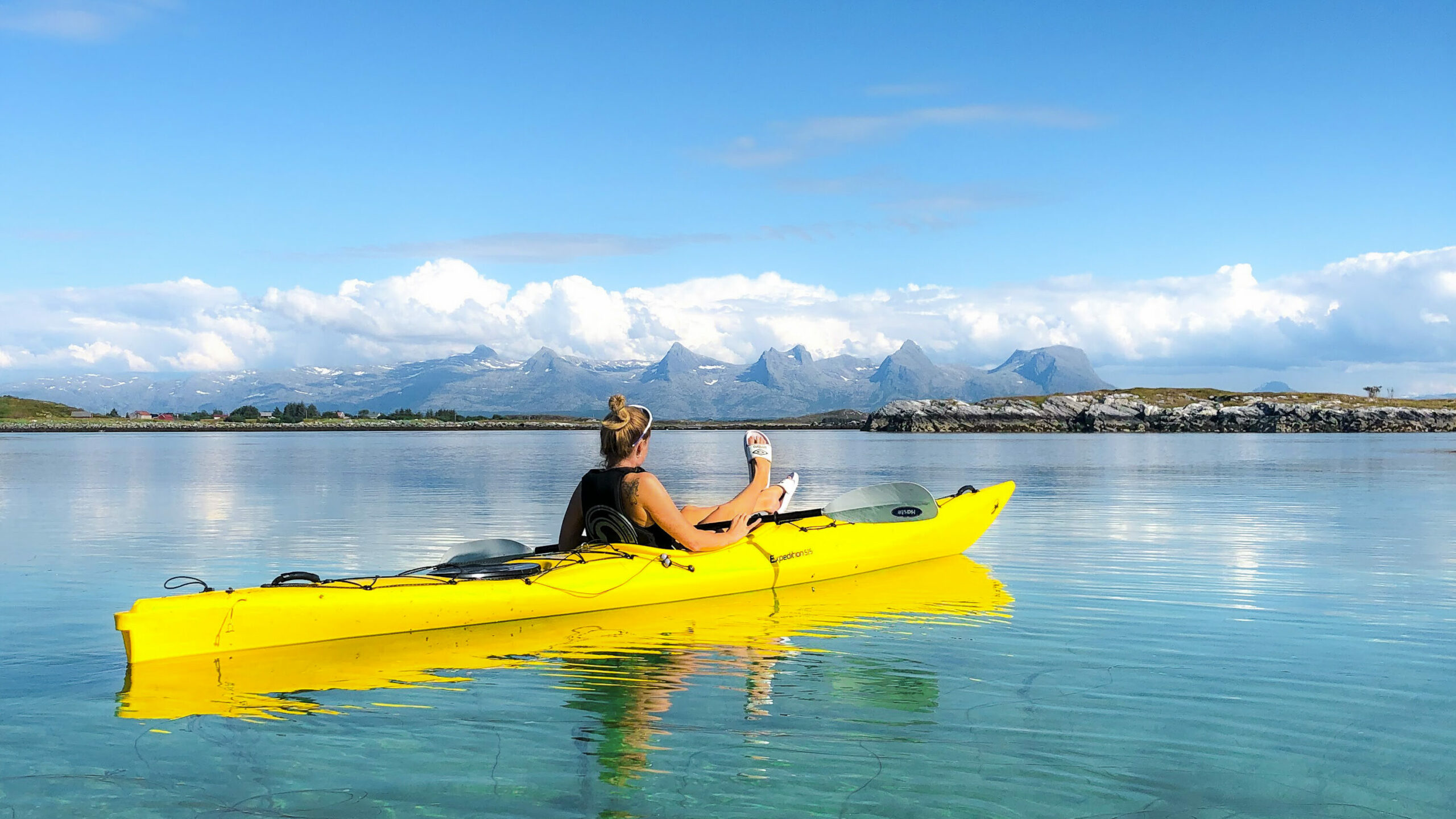
Vega, the largest island, also has high mountains, lakes that offer great fishing, and a fascinating cultural landscape. Several outlets rent out kayaks so that you can explore the sheltered and shallow waters between the nearby islets and skerries.
The Vega archipelago is teeming with life! It is one of the most important nesting areas in Europe, counting about 110 bird species during the nesting season. The most striking annual visitor is the Eider Duck. These are almost tame, having received great care by countless generations of islander bird guardians. In return, after the breeding season the bird guardians harvest the valuable down with which the eider ducks line their nest. This amazing and ancient symbiosis, which truly is unique, is the primary reason for the Vega archipelago being awarded its World Heritage status. You can learn more about the eider ducks and the islanders’ tradition as caretakers at the Vega World Heritage Centre, and by making a visit to Lånan, the largest nesting site.
When you travel to Vega, you can leave your car behind on the mainland. Most destinations on the island are only a 30- to 60-minute bike ride away. Moreover, the roads are lightly trafficked and the mostly-flat landscape is ideal to explore by bicycle. On Vega you will find beautiful sheltered coves, lush woodlands and lots of lakes. Many islets surround this main island. On its southwestern shore, the island is dominated by high mountains, which offer great summit hikes and amazing views. If you want an extra challenge, you can join a guided climb of Ravnfloget Via Ferrata, where you ascend a prepared 225-metre climbing route. It is an incredible adventure for adults as well as older children, and no prior rock-climbing experience is needed.
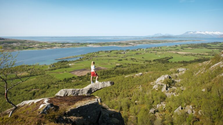
Stage 3 – From Vega or Brønnøysund to Sandnessjøen
Kristoffer Møllevik / Visit HelgelandAbout 75 kilometers
View the stage in Google Maps
See ferry times for the ferry from Igerøy (Vega) to Tjøtta
See ferry times for the ferry from Horn to Andalsvågen and from Forvik to Tjøtta
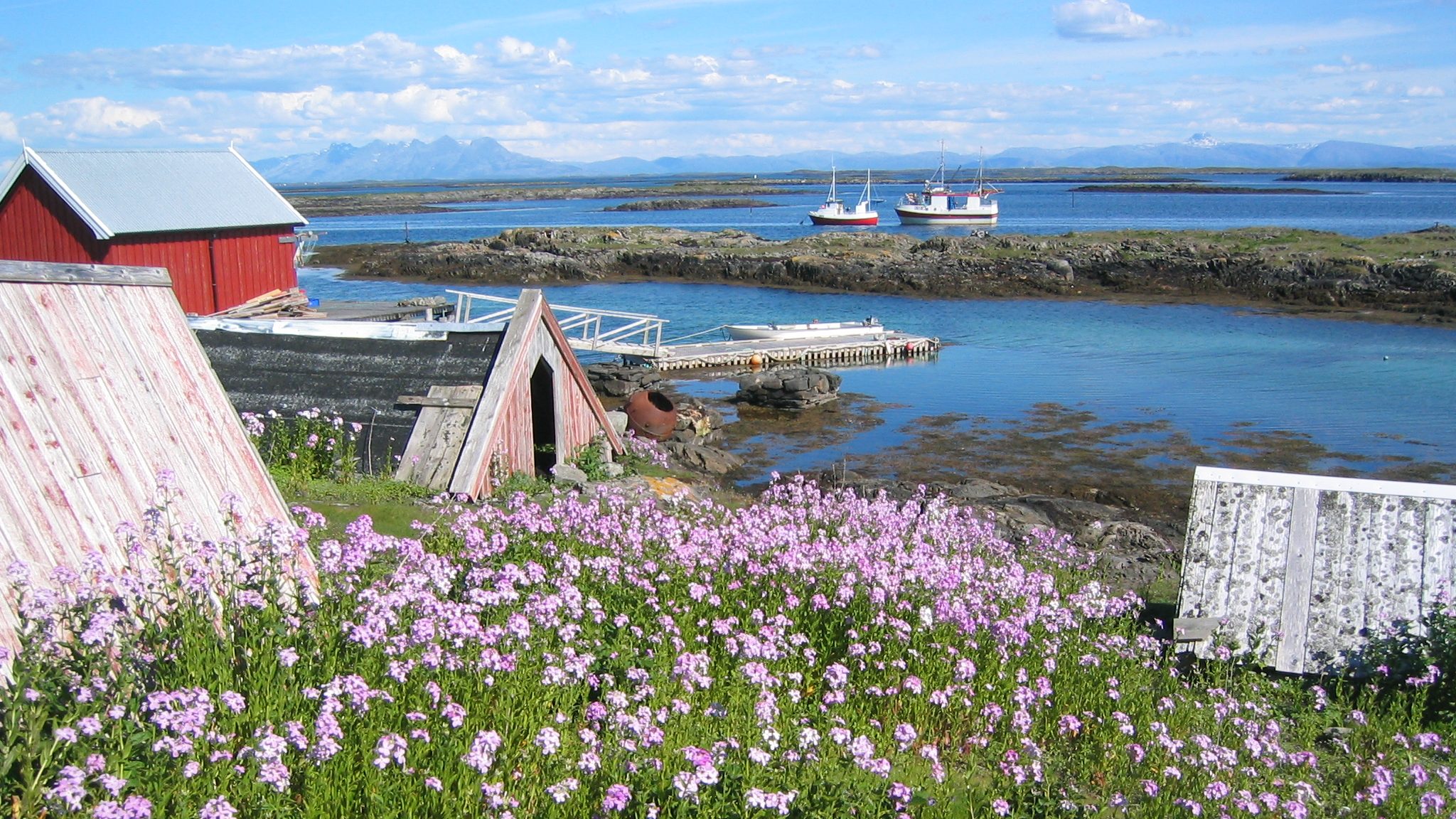
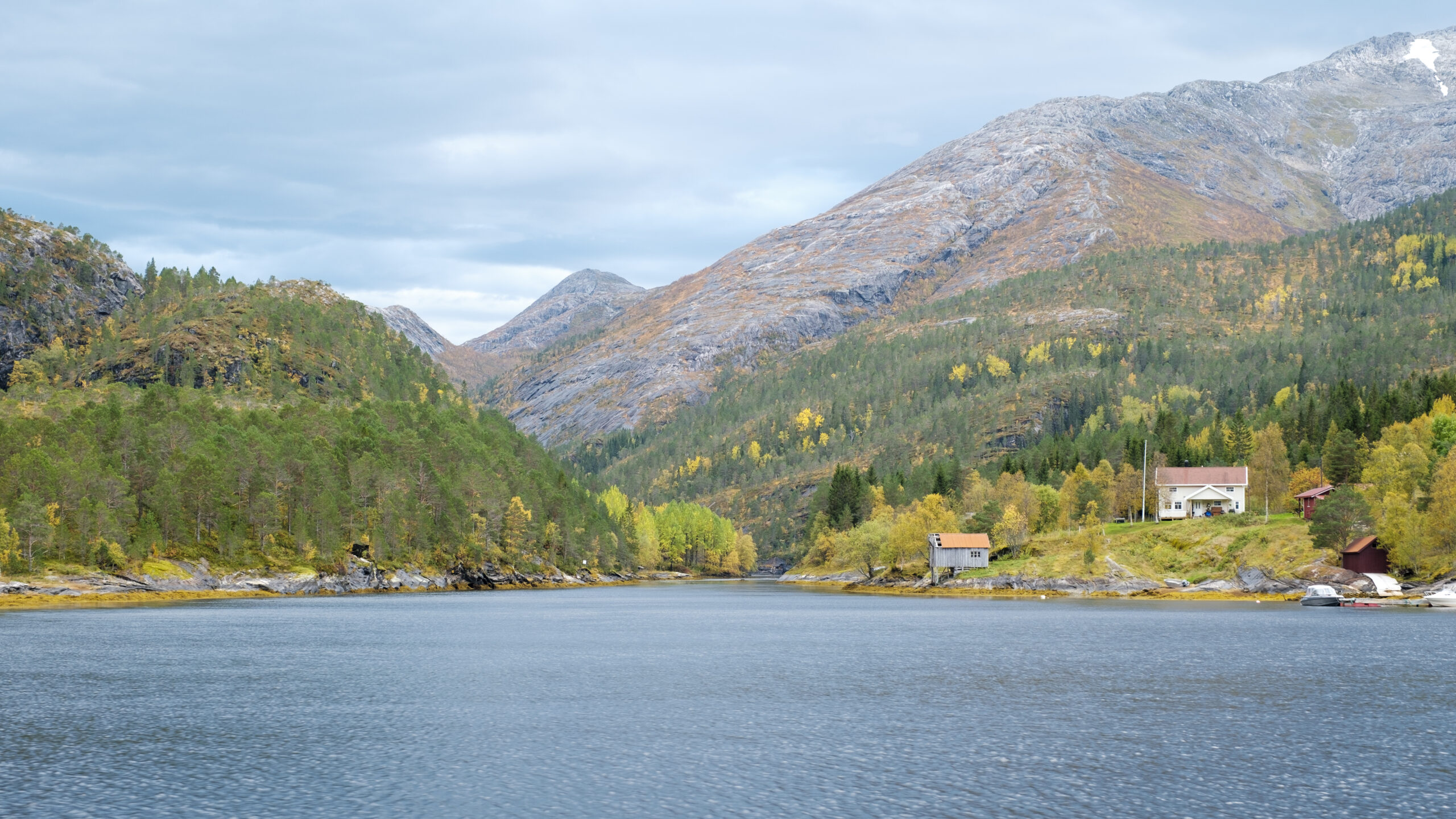
If you arrived in Vega by car, you can take a direct ferry to Tjøtta. But if you’re coming from Brønnøysund, there are two ferry crossings—first from Horn to Andalsvågen, then from Forvik to Tjøtta. Along the way, you pass through Vevelstad and the old trading post at Forvik, and it might be worth “missing” a ferry to spend a sunny day here. Visit the Vevelstad heritage museum and enjoy a few hours among the beautiful old Nordland houses and traditional boats. Or take a detour by express boat into the stunning Vistenfjord to explore the fjord and the wilderness on the edge of Lomsdal-Visten National Park.
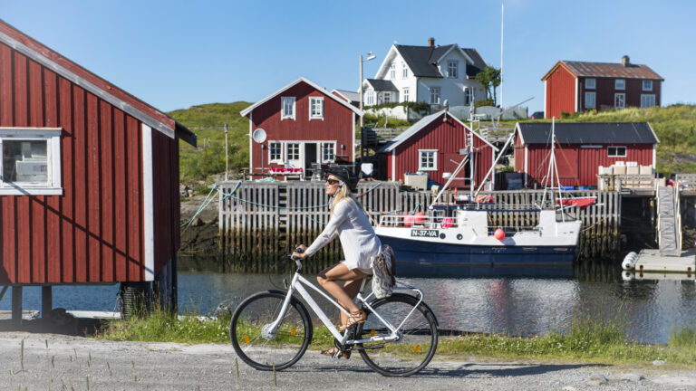
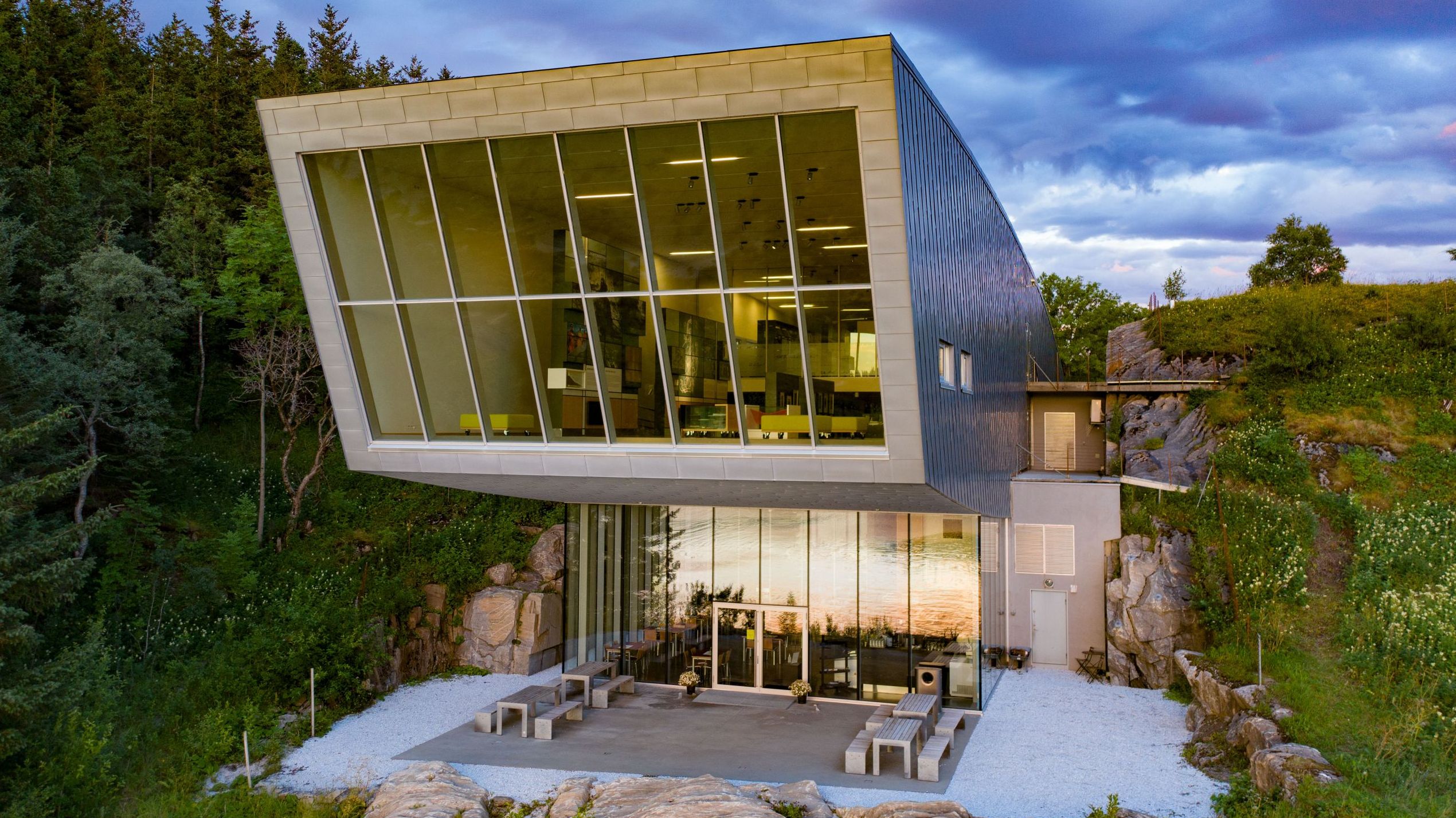
Once you reach Tjøtta, take your time heading toward Sandnessjøen. Tjøtta and Offersøya wrap around a beautiful natural sea basin that’s perfect for exploring by kayak or inflatable boat, and it’s a great spot to enjoy lunch down by the shore. You can also stop by the Petter Dass Museum, designed by Snøhetta, and the idyllic Alstahaug farmstead—have a bite at the café and just soak in the surroundings.
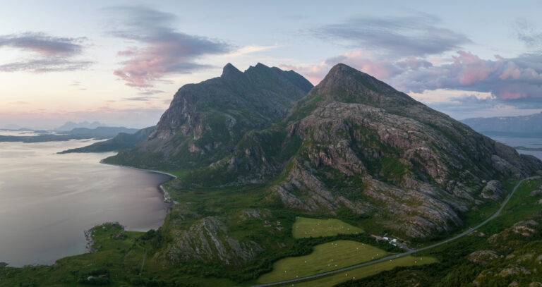
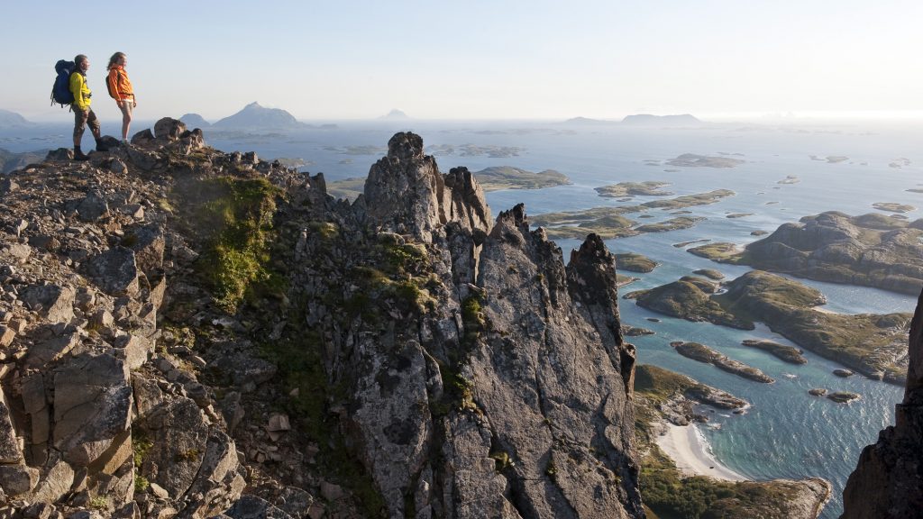
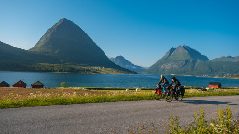
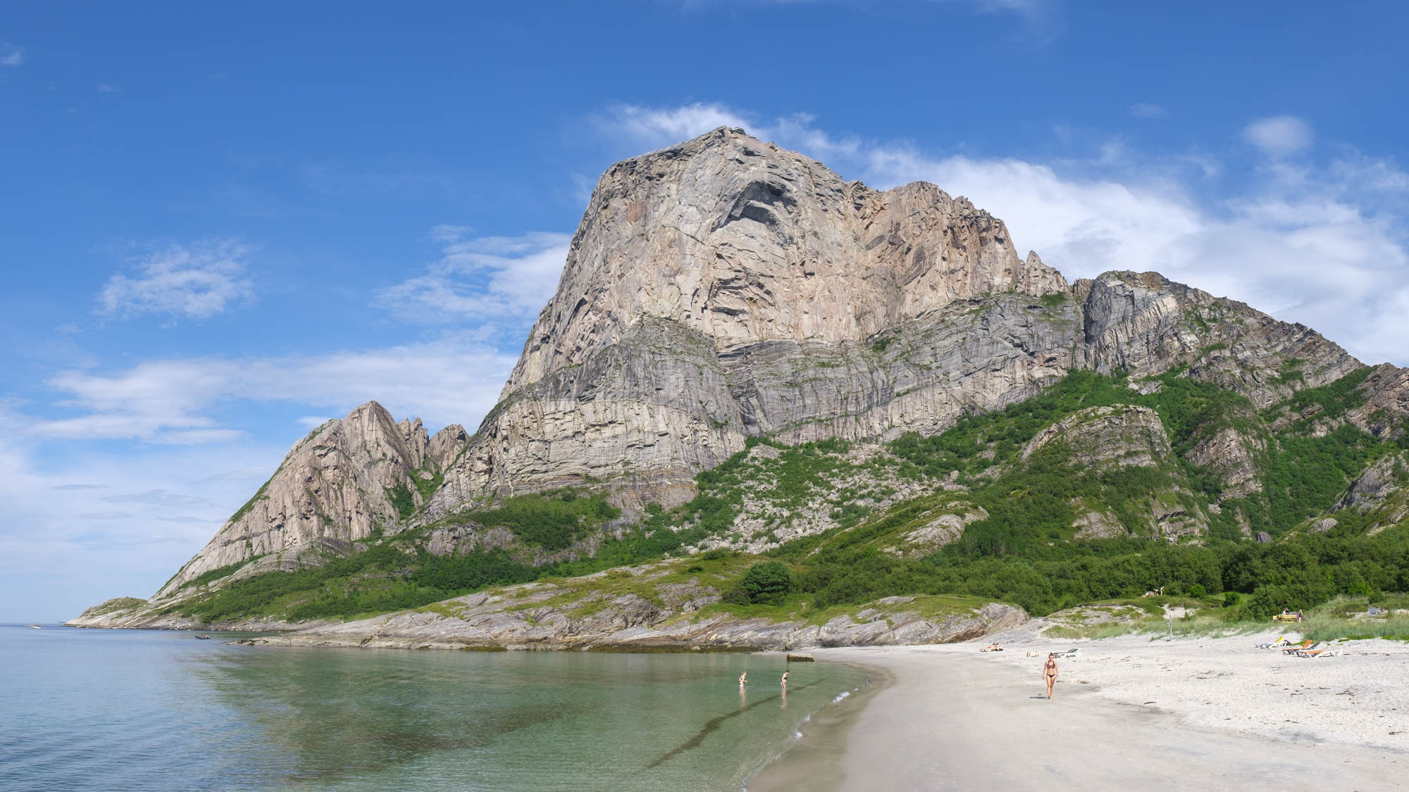
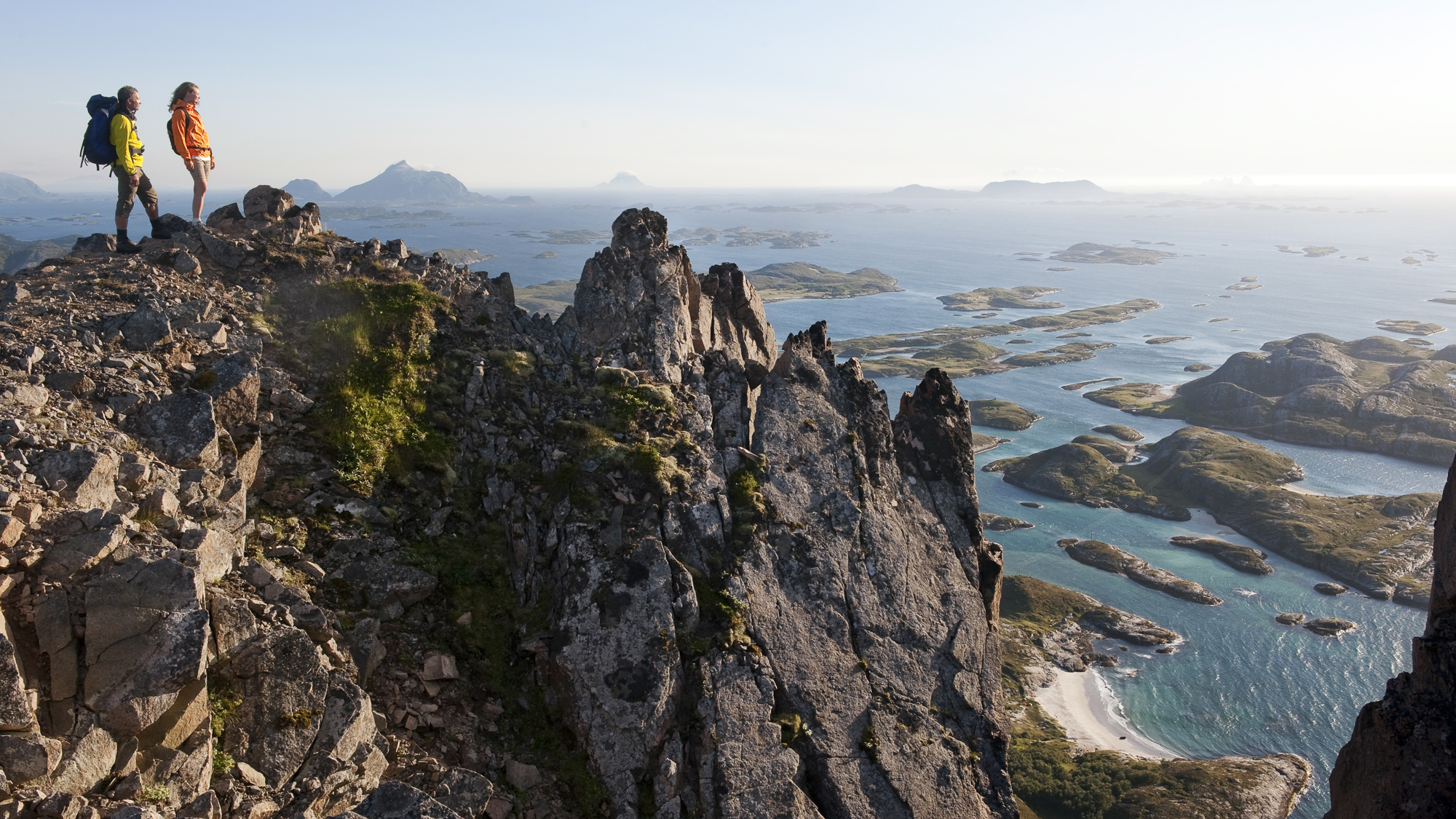
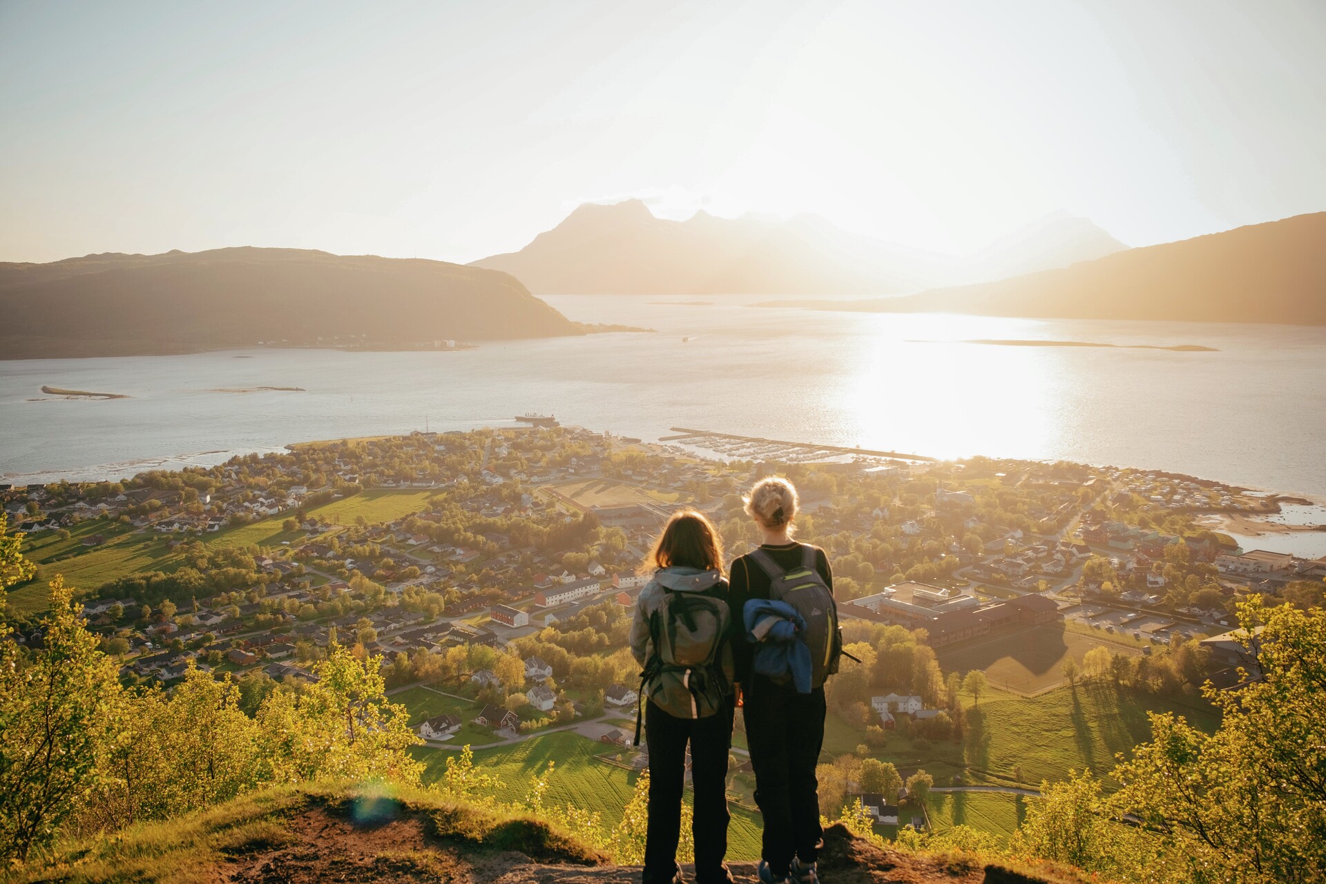
The island of Alsta and the coastal town of Sandnessjøen are great to explore by bike, and you can rent one at the local tourist office if you didn’t bring your own. A hike to one or more of the Seven Sisters peaks is highly recommended. Seeing the Helgeland coast bathed in the midnight sun from up here is an unforgettable experience! Climbing all seven peaks in one day is a serious challenge for those in top shape, but doing one or two is manageable for many.
From Sandnessjøen, it’s also worth taking a detour to Dønna and Herøy and the surrounding islands. There are plenty of charming places to eat and stay, the area is great for cycling, and the shallow skerries around Herøy are a dream for kayaking!
Stage 5 – From Sandnessjøen to Rødøya
 Terje Rakke, Nordic Life / Visit Helgeland
About 150 kilometer
View the stage in Google Maps
See ferry times for the ferry from Levang to Nesna
See ferry times for the ferry from Kilboghamn to Jektvik
The drive from Sandnessjøen to Rødøy is relatively long, but it’s easy to break up the journey with several great stops along the way.
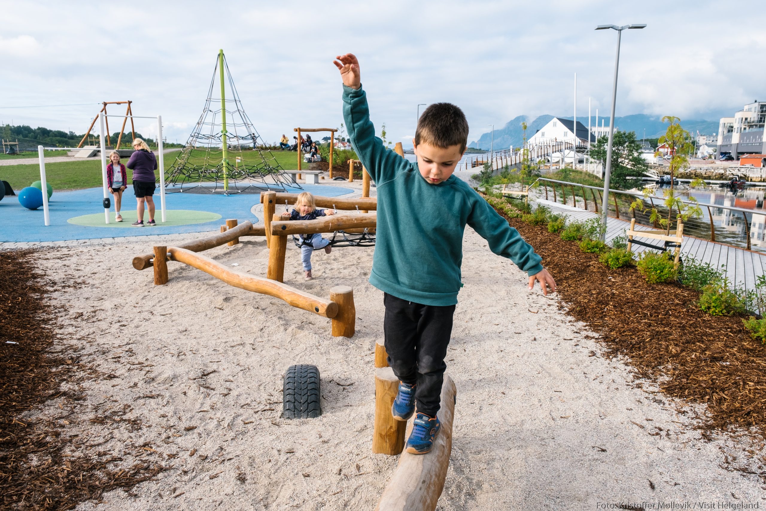
Topcamp Havblikk in Nesna is a recommended stop if you’re travelling with kids. There are good swimming spots and a playground with a large jumping pillow. For the adults, a visit to the local brewery, Raus Bryggeri, is well worth it. They offer outdoor seating, beer sales, and guided tours with tastings. If you’re planning to stay a few days in Nesna, this fjord village is a great base for day trips by express boat to the Nesna islands and other islands along the Helgeland coast.
A bit further along, you’ll come to Utskarpen, where the restaurant and food destination Til Elise Fra Marius sits beautifully in rural surroundings. This is one of Northern Norway’s top restaurants, known for its multi-course tasting menus and cosy accommodation. It’s perfect for couples or friends wanting to treat themselves to something out of the ordinary. Just remember to book your table and room well in advance.
A little further north along the Coastal Route, just before Aldersundet, you’ll find Grønsvik Coastal Fort. This well-preserved German coastal fort from World War II is now a museum. You can see several gun emplacements and explore the old bunker system, which is open to visitors. It’s a great place where grandad can enjoy the museum while the grandchildren run off some energy in the large outdoor area.
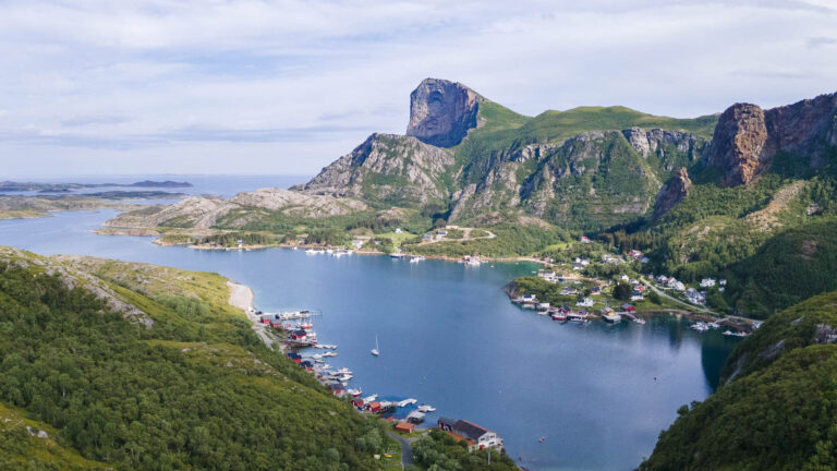
To get to Rødøya, you can take an express boat from Tonnes or a ferry from Kilboghamn via Jektvik. The roads on Rødøya are narrow and few, so it’s best to leave your car on the mainland if you can. During high season, parking on the island may be hard to find. For continuing north after Rødøya, it’s easiest if your car is already parked in Jektvik.
The island is ideal for exploring on foot—it’s just over five kilometres long and about half as wide. You can walk from beach to beach, and if you’re travelling with kids, a visit to the Fairy tale forest is a must. The bravest of the childeren can even knock on the big troll door to see if the troll is home!
If you’re not afraid of heights, a hike to Rødøyløva is a must. At 440 metres, it’s not especially high, and the trail is fairly easy, but it ends at a dramatic vertical drop at the top. Step carefully and take in the spectacular view over one of the most scenic parts of the Helgeland coast!
Stage 6 – From Rødøy to Meløy
 Meløy Adventure
About 85 kilometers
View the stage in Google Maps
See ferry times for the ferry from Ågskardet to Forøy
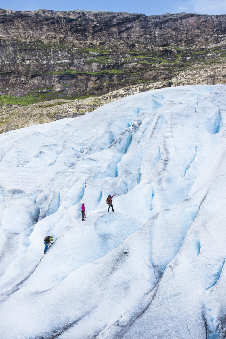
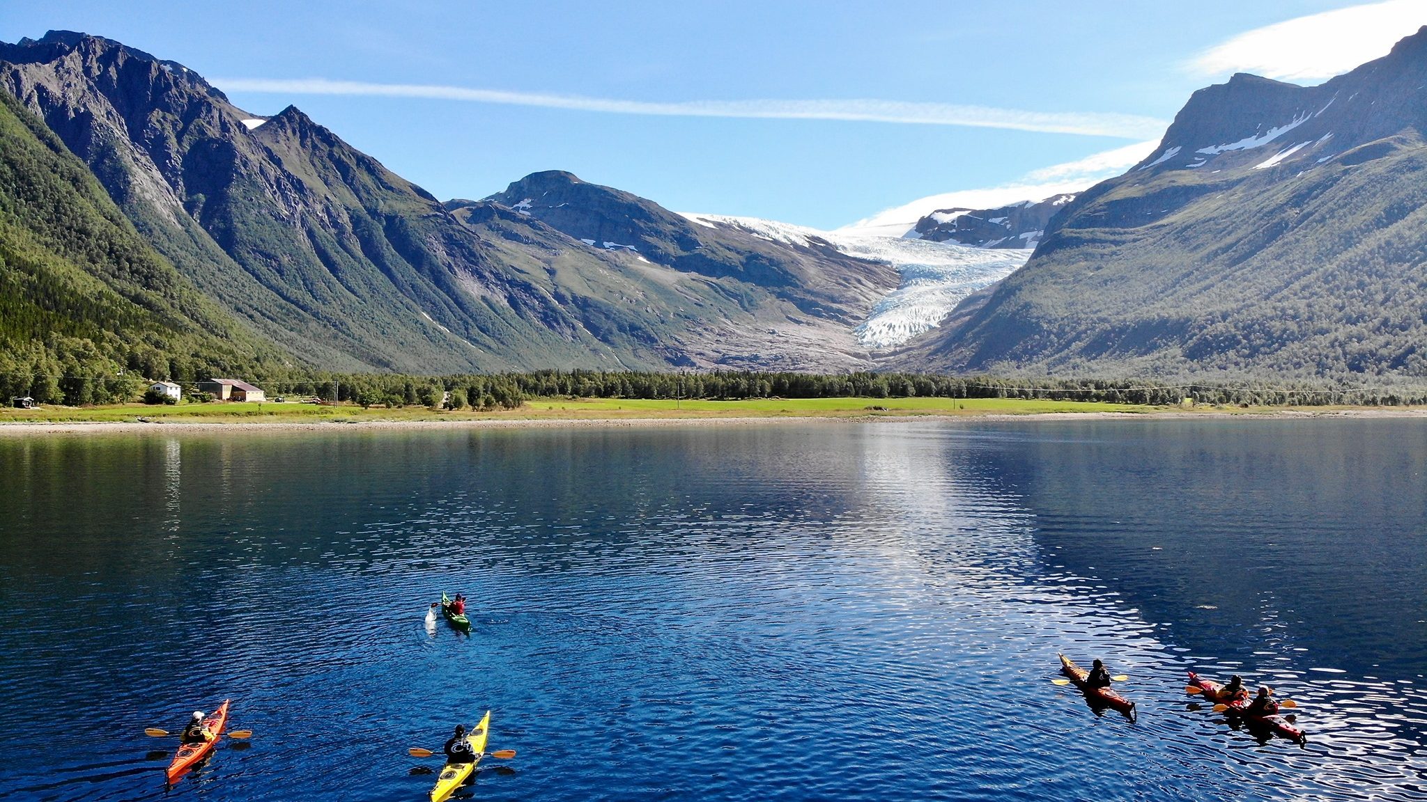
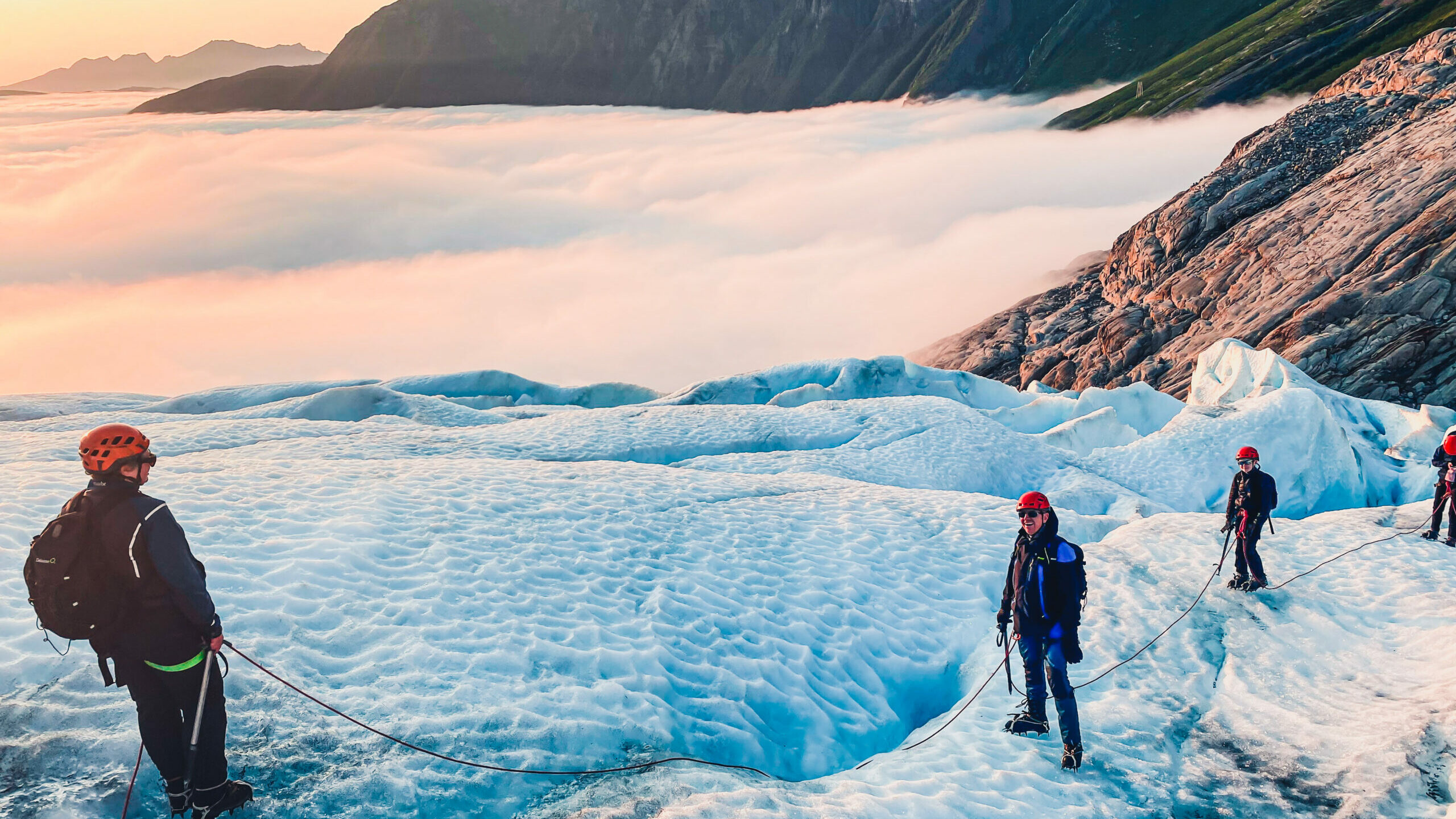
Next on your travel itinerary is the ferry from Ågskardet to Forøy. Upon arrival, head straight for the rest stop at Braset, a viewpoint that overlooks the Engabreen glacier. This glacier arm of Svartisen reaches down to the water on the other side of the fjord. To see the glacier up close, you have to take a shuttle boat across the fjord from Holandsvika, a little further into the fjord. From the quay on the other side, you have a three-kilometre walk to the glacier.
Remember to keep a safe distance from the glacier’s edge, which is unstable. Large blocks of ice often suddenly shift or break away, and if you are in the wrong place the consequences can be lethal! If you want to venture onto the glacier itself, please do so only in the company of an experienced glacier guide.
The village of Glomfjord is the perfect hub for many excellent outdoor adventures in the Meløy district. Here you can rent a kayak or mountain bike, or just put on your boots and enjoy great hiking in the beautiful mountains by the fjord.
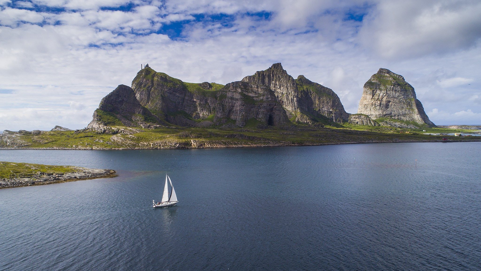
If you continue your drive further north towards Ørnes, you leave the mountains. The landscape opens up giving you a view of the coast and the islands, many of which are worth visiting. We especially recommend an excursion to Bolga or Støtt; both can be reached by boat from Ørnes

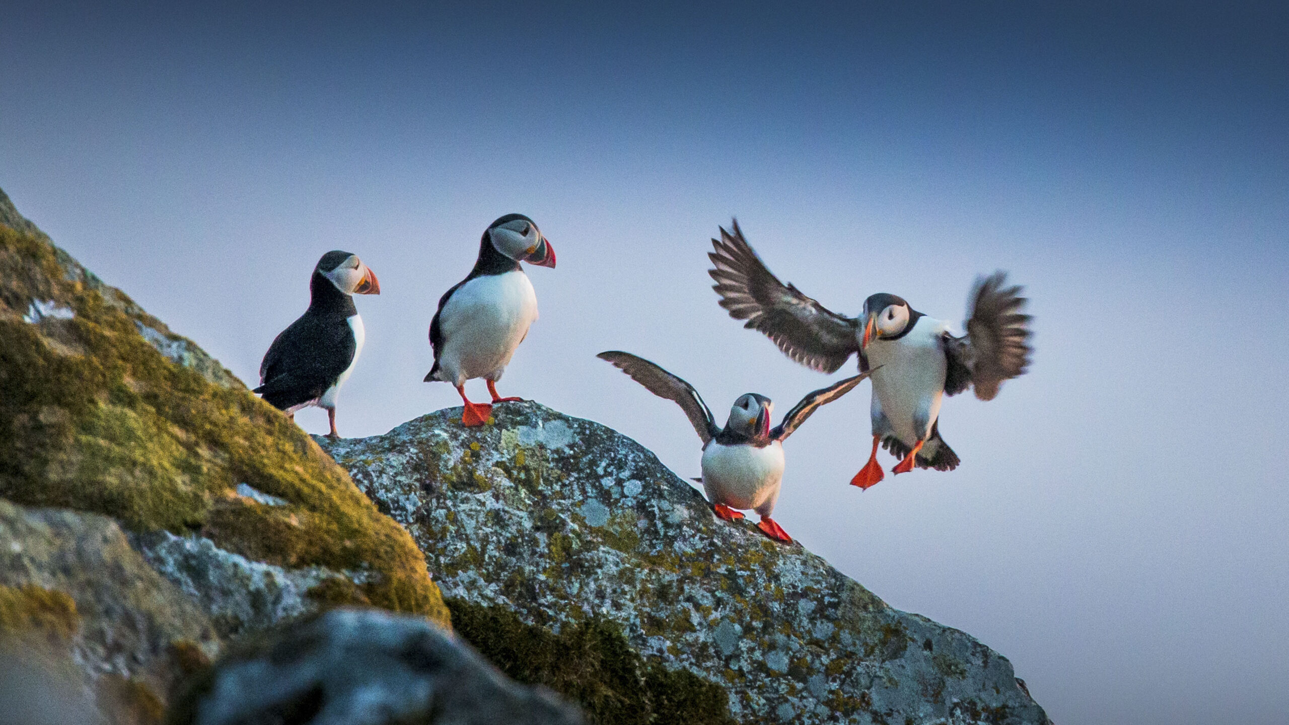
Stage 7 (bonus detours) – The islands of Lovund, Træna and Myken
 Kristoffer Møllevik / Visit Helgeland
Each of these three islands and their archipelagos are well worth exploring, and to make your Helgeland holiday complete, you really should visit at least one of them. You can take an express boat from Sandnessjøen, Nesna, Stokkvågen or Ørnes. Because these boats are infrequent, you should plan on an overnight stay. All three destinations offer a taste of the islander culture. For generations these hardy Helgelanders have faced many harsh storms, but also time and again experienced the incomparable beauty of calm seas on summer nights. Fortunately, your summer visit is likely to be far warmer and more peaceful than during the autumn or winter storms. Lovund, Træna and Myken all offer comfortable accommodation and great dining.
Lovund is the kingdom of the Puffin, that curious seabird with the colourful beak. Over a hundred thousand of them nest here during the summer months – and seeing them airborne in great numbers in the midnight sun is an unforgettable sight! Lovund is the largest bird colony on Helgeland, placing the island’s 500 human inhabitants decisively in the minority! The islanders’ offerings to you include sublime seafood, sea golfing, RIB sea-rafting safaris and day excursions to Træna. Lovund also has great hiking opportunities, and the sheltered waters around the nearby Solvær islands are a paradise for kayaking.
Træna and its archipelago, situated far from the mainland, are amongst the outermost islands in Helgeland. Perhaps surprisingly, people have lived here since the Stone Age, and the community of islanders is still thriving. Visitors will find comfortable accommodation. Those who prefer can pitch a tent and enjoy a holiday closer to nature. Træna has excellent opportunities for kayaking.
Even more isolated, and a little farther north, is the fishing community of Myken. This group of islands and islets is relatively flat and thus very exposed to whatever rough weather the Atlantic sends its way. Nonetheless, almost a dozen enthusiastic islanders choose to live here year round. Here you will also find the world’s first Arctic whiskey distillery – yet another reason to visit Myken regardless of the weather! If you are surprised, you should know that we Norsemen have always had a keen appreciation of the noble art of distilling, and those who lived far away from the reach of the sheriff, tax collector and other authorities have simply had better opportunity to perfect their craft.
Do you have questions about this voyage? Is there something you want to know more about? Please explore our website for additional information, or contact one of our Tourist Information Offices.