Børgefjell National Park / Byrkije vaarjelimmiedajve
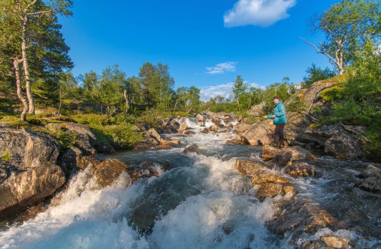
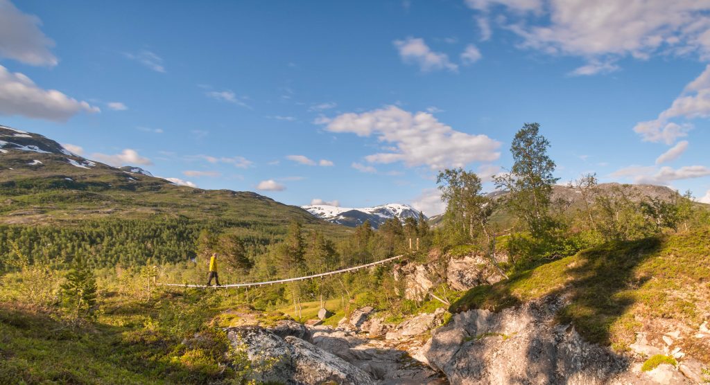
Børgefjell / Byrkjie is among our least facilitated national parks, with few or no marked trails, bridges, or DNT cabins. Here, it’s primarily about tents, maps, and compasses. And a fishing rod – don’t forget the fishing rod!
 Kristoffer Møllevik / Visit Helgeland
Wild nature and wild animals
Børgefjell is a highly undeveloped national park and is best suited for experienced hikers. Already in 1932, the Norwegian Trekking Association decided not to build cabins or create marked trails in the national park. You may find a few rental cabins, simple shelters, and huts, but for the most part, it’s tents and sleeping bags that provide shelter for hikers overnight
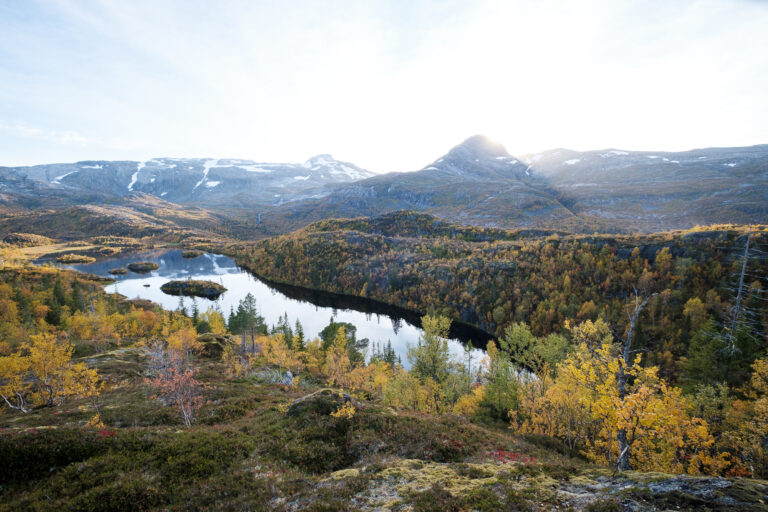
Large parts of the park are located high in the mountains, with both sharp peaks and rounder mountain areas. However, there are also several valleys with fine fishing lakes and watercourses, where hikers with fishing rods can catch their own dinner. The national park is described as a paradise for trout fishing.
The Børgefjell area is one of the few places in the country where Arctic foxes still exist, and if you are lucky, you may encounter this rare animal. In that case, enjoy the moment and proceed quietly. It is a critically endangered species that needs all the peace it can get.
 Jan Inge Larsen
Børgefjell is also an important grazing area for domesticated reindeer during spring, summer, and fall, and reindeer husbandry is the main industry in the national park. Other animals you may encounter include wolverines, lynxes, and bears, in addition to small predators like red foxes, snow voles, martens, and stoats. Moose can be found in the forested areas and mountains. Hares and squirrels are common, and beavers can be encountered in the Orvassdraget area.
The park is also rich in birdlife, especially around Tiplingan and the lower part of the Simskardelva river. Here, you may encounter rough-legged buzzards, golden eagles and other birds of prey.
- You’re free to walk or ski wherever you like, as long as you don’t disturb the wildlife. Stick to marked trails whenever possible — it helps reduce wear on the landscape.
- Cycling is not allowed in the national park, whether on a regular bike or an e-bike.
- Be aware that some areas may be closed to visitors during certain times of the year, such as parts of Børgefjell when reindeer are calving.
- You’re welcome to bring your dog, but during the leash season, it must be kept on a lead. The length and timing of this period can vary by location, so check local regulations before your trip if you’re unsure. All year round, make sure your dog doesn’t disturb wildlife like reindeer or Arctic foxes.
- You can camp almost anywhere under the right of public access. Keep at least 150 metres away from houses and cabins, and only stay in the same spot for two nights at most.
- Fires are allowed all year round — but only in places and during periods when there’s no risk of wildfire. Avoid leaving visible marks in the terrain. Use established fire pits or bring a twig stove or fire pan. Only burn fallen branches or firewood you’ve brought with you.
- You’re not allowed to cut or saw down live or dead trees. Standing dead trees, known as “gadd,” are especially important for wildlife and biodiversity, and some can be several hundred years old.
- Don’t build new cairns in the national park, and don’t tamper with the existing ones. They are important for navigation, and new cairns can harm both nature and the outdoor experience. You’ll find more information about this further down the page.
- You can hunt and fish as long as you have the correct permit and follow the applicable national and local regulations. Pay special attention to the rules on disinfecting fishing gear to prevent spreading parasites between water systems.
- Drones are not permitted in the national park. This also applies to all other motorized travel, such as e-bikes, snowmobiles, and similar vehicles.
- Take in the sounds of nature and avoid unnecessary noise. It disturbs vulnerable wildlife and can spoil the experience for other visitors. Chainsaws and motorized ice augers are not allowed in the national park.
- You need to bring the right clothing, gear, skills, and knowledge for mountain trekking. The weather can change quickly, and you can’t rely on having mobile coverage to check forecasts along the way. Conditions can shift suddenly to thick fog, strong winds, cold rain, or heavy snow. The national park is also largely undeveloped — you may come across unbridged rivers, glaciers, scree slopes, and other terrain that require the right experience to cross safely.
- Getting help can take time if something goes wrong. Plan your trip carefully, considering both weather and conditions, and the fitness and experience of everyone in your group. Follow the mountain safety rules and pack clothing and gear according to the Norwegian Trekking Association’s recommendations.
Cairns and trail markers
When hiking in the mountains and national parks of Helgeland, it’s important to remember that these areas are largely undeveloped. Often, you’ll be following simple trails, sometimes with boardwalks, and at other times the route is marked by red paint or cairns to help guide you safely through wind, rain, and fog.
If you encounter a cairn along the trail or on a mountain peak, please leave it as it is. Don’t add more stones to it, and avoid building new cairns nearby. The flora and fauna in the mountains are extremely fragile, and even small disturbances can lead to significant damage.
By practicing a leave-no-trace approach and allowing stones, plants, and animals to remain undisturbed, you help us preserve this delicate nature so that future visitors can enjoy it in its unspoiled form—just as we are fortunate to do now.
Destinations and attractions
July and August are the best months for hiking in Børgefjell. Feel free to use the official entry points to access the park, as they are marked right from the beginning. The trails may disappear eventually, and then you must navigate through nature on your own.
 Kristoffer Møllevik / Visit Helgeland
For those who only want a small taste of Børgefjell without going on a multi-day trek, the 7-kilometer Simskardrunden is recommended. On this hike, you walk on well-marked trails along the Simskardelva River and into Simskardhytta, which has an open section for day visitors. For variety, you can return on the opposite side of the river.
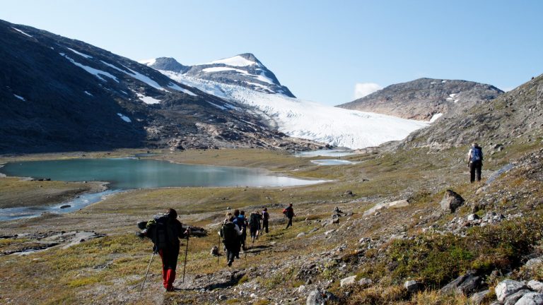
But if you are ready for a more challenging hike, you can follow Simskardet further into the park with Kvigtinden (1699 m above sea level) as your goal. This tough peak is the highest mountain in Børgefjell, but it is a demanding hike that requires good weather and careful planning.
Cabins and Mountain Farms
Due to the strict protection against technical interventions in Børgefjell, there are very few cabins here. Statskog has some open cabins, and Vefsn Hunting and Fishing Association rents out Jengelhytta in the southern part of the national park. However, almost all of them are located on the outskirts of the national park, and if you want to explore the wild areas further in, you must be prepared for a tent and sleeping bag.
Entry Points
The landscape in the national park varies from area to area, and where you start your hike can greatly influence the hiking experience you get from Børgefjell. In the west, the landscape is characterized by sharp mountains and narrow valleys, while further east, the landscape opens up more, and the mountains “round off” as you approach the border with Sweden.
Click on the links to see the entry points on Google Maps. You can read more about each of the entry points on the website for the national park.
- Tomasvatnet, at Majavatn in the southwest
- Simskardet, from Fliplingdalen in the west
- Øyum, from Susendalen in the north
- Oksvollen, from Susendalen in the north-east
Thank you for respecting the local communities, and for helping us preserve the natural beauty of Helgeland!
Please:
- Strive to leave no trace of your visit. Bring back all your rubbish, including used toilet paper, and discard it in the nearest rubbish bin.
- Plan your toilet visits and use the opportunity when you pass a toilet. In the wilderness, make sure you are not a nuisance to others.
- Respect the local wildlife. Keep a good distance from wildlife, livestock and birds. Keep your dog leashed.
- Respect private property. Keep a respectful distance from houses and cabins.
- Show good boating sense. Keep a good distance from shore and drive at a low speed, especially when you are close to anyone or anything on the water, including birds or animals. Avoid loud and disturbing engine noise. Be aware that some islands and nature reserves are important nesting sites, and that going ashore is prohibited during the nesting season.
- Follow the Norwegian Mountain Code (Fjellvettreglene). Plan your excursion according to the weather forecast, your skills and experience.
- Join a guided excursion or consider hiring an experienced guide, especially when you don’t have sufficient experience or knowledge to guarantee a safe trip.