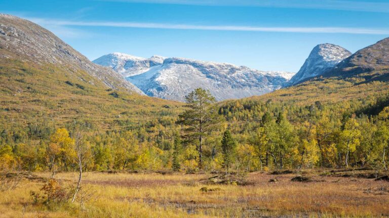
Ski touring: Kjerringtinden, 1395 m
 Kristoffer Møllevik / Visit Helgeland
Kjerringtind is a challenging peak by the large lake Røssvatnet, in the mountains of Helgeland. The trip is 4 km one way with an ascent of approx. 1000 meters of altitude, and takes approximately 3-4 hours to complete.
Description
Degree of difficulty: Demanding
Distance one way: 4 km
Ascent one way: about 1000 m.
Duration one way: 3-4 hours
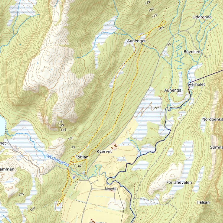
Trailhead: See the starting point with Google Maps.
 Ut.no / Kartverket
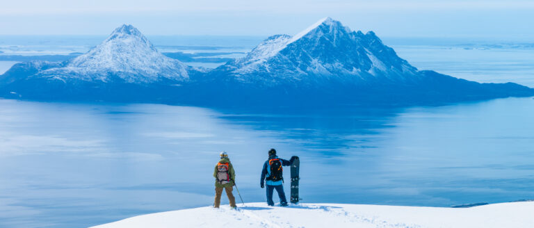
Kjerringtinden, the high mountain rising above Lake Røssvatnet, offers more than 1,000 metres of vertical ascent and excellent ski touring. This is one of the most snow-reliable areas on Helgeland, and many people come here for both their first and last ski tours of the season. The tour has virtually no approach, starting straight uphill from the parking area.
The route is relatively long, but the terrain is mostly avalanche-safe, with slopes generally under 30 degrees. It is therefore demanding mainly because of its length rather than technical difficulty. Steeper sections can be found on days with low avalanche risk, but these should be approached with care. The mountain also has very steep drop-offs on both sides, so experience in high-mountain travel is required, along with good route choices and continuous assessment of weather and snow conditions.
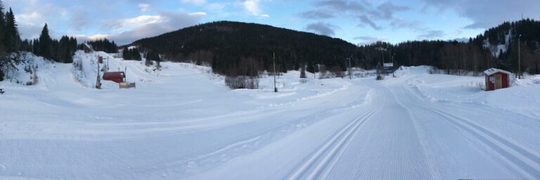
The tour usually starts from a spacious parking area just by the bridge over the Stikkelelva river. This should not be confused with the meeting points along the road, marked with blue signs and a white “M”, which are not intended for parking. Skis can be put on immediately after crossing the bridge. The first 200 vertical metres climb westward through open birch forest before reaching a small flat area above the treeline. From here, the route turns north and continues up onto the mountain itself.
The ascent then follows two clearly steeper sections before the final 200 vertical metres to the summit. In poor visibility or challenging snow conditions, it may be wise to turn around on the flatter sections around 800 and 1,100 metres above sea level. From here, you still get excellent skiing all the way back down to the road.
The descent generally follows the ascent route. Slightly steeper lines can be found by keeping more to the left (east), while gentler terrain lies further to the right (west). Keep a safe distance from the very steep sides of the mountain. In the birch forest, you can choose to follow the first stream gully down towards the road to avoid some traversing, at the cost of a short walk along the road back to the parking area.
After the tour, you can head south to the mountain village of Hattfjelldal or north to Korgen for a meal and some refreshments.
See the starting point with Google Maps
Find hiking maps on UT.no
Remember to check the weather forecast and the avalanche warning on the same day as the trip.
Plan your trip well
- Route choices should be made with safety in mind, considering the current conditions and your group’s skills.
- Always check both the weather and avalanche forecasts on the day of your trip.
- Utilize maps that detail avalanche zones and release areas, such as those available on UT.no or Fatmap.
- If the weather turns or conditions worsen unexpectedly, have an alternative hike or activity ready as plan B.
- Remember, enlisting a local professional guide will streamline this process, allowing your group to focus more on the experience and less on the logistics.
Carry the necessary gear
- Equipping yourself with appropriate clothing and gear is essential. Be prepared for weather changes and bring extra clothes in case the weather worsens or in case of injuries. In the wild terrains of Helgeland, it might take time for help to arrive, making the risk of hypothermia a real concern.
- Even if you’re not venturing into avalanche-prone terrains, carrying an avalanche transceiver, probe, and shovel is always a wise precaution.
A mountain guide enriches the ski trip
- Engaging a local, professional guide can greatly enrich your experience. Well-acquainted with the local terrains and conditions, guides expertly plan routes that cater to your group’s composition and adapt to the day’s weather and conditions. Their adept skills in assessing conditions on the go ensure you traverse safe and enjoyable paths, both ascending and descending.
- This way you have less planning and less to concider, and more time to just enjoy your journey.
Useful Links:
Important avalanche safety information for ski touring in Norway from Varsom.no
Weather Forecast on YR.no
Avalanche Warning for Southern Helgeland on Varsom.no
Avalanche Warning for Northern Helgeland (Svartisen) on Varsom.no
The «Help 113»-app from Norwegian Air Ambulance
Mountain Safety Rules on DNT.no
Packing list for skiing in the mountains from DNT.no
Thank you for respecting the local communities, and for helping us preserve the natural beauty of Helgeland!
Please:
- Strive to leave no trace of your visit. Bring back all your rubbish, including used toilet paper, and discard it in the nearest rubbish bin.
- Plan your toilet visits and use the opportunity when you pass a toilet. In the wilderness, make sure you are not a nuisance to others.
- Respect the local wildlife. Keep a good distance from wildlife, livestock and birds. Keep your dog leashed.
- Respect private property. Keep a respectful distance from houses and cabins.
- Show good boating sense. Keep a good distance from shore and drive at a low speed, especially when you are close to anyone or anything on the water, including birds or animals. Avoid loud and disturbing engine noise. Be aware that some islands and nature reserves are important nesting sites, and that going ashore is prohibited during the nesting season.
- Follow the Norwegian Mountain Code (Fjellvettreglene). Plan your excursion according to the weather forecast, your skills and experience.
- Join a guided excursion or consider hiring an experienced guide, especially when you don’t have sufficient experience or knowledge to guarantee a safe trip.