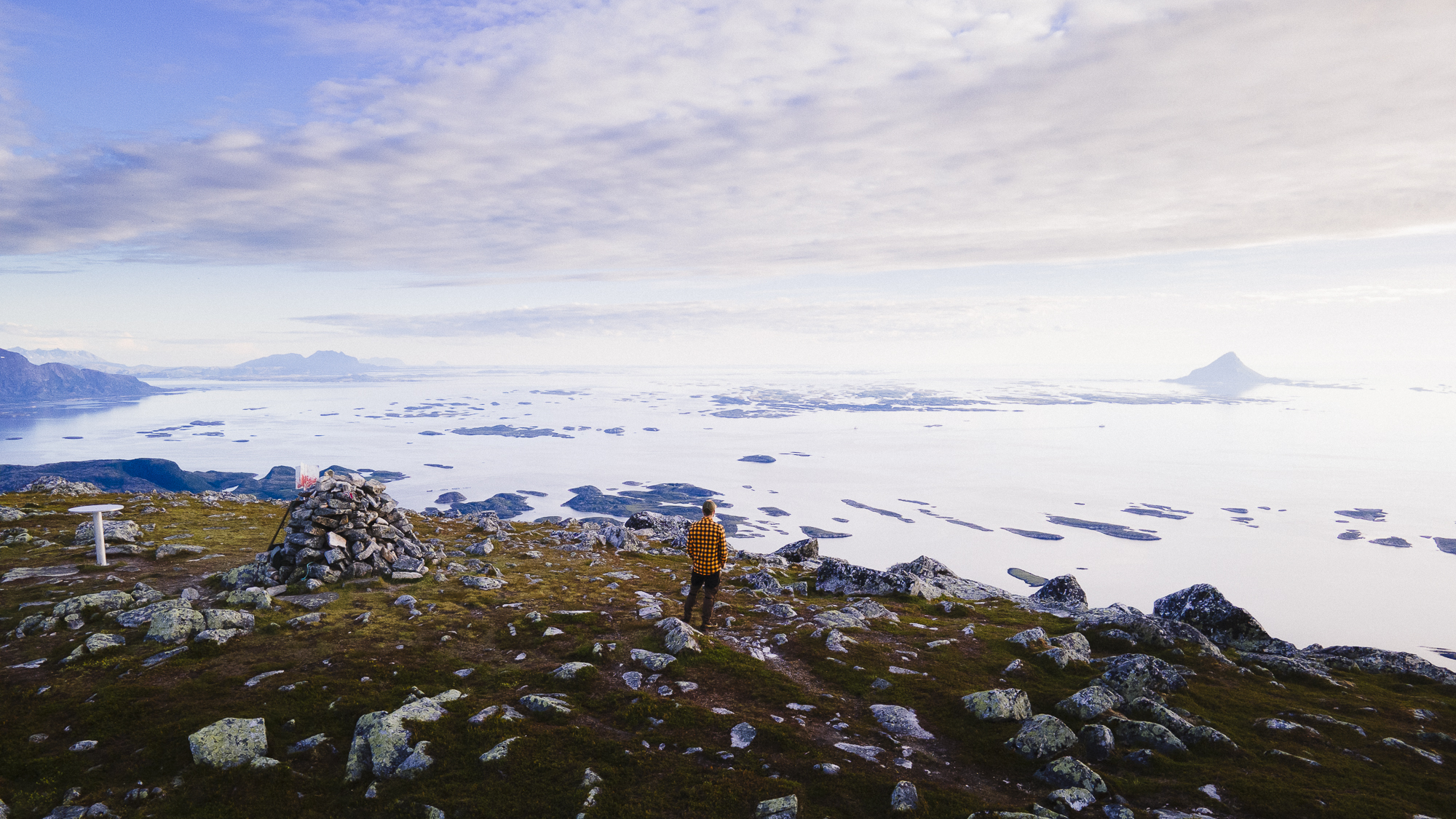
A hiking adventure: Lurøyfjellet 689 masl.
 Kristoffer Møllevik / Visit Helgeland
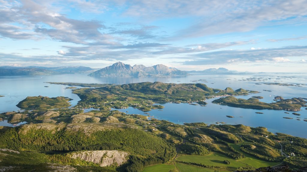
Lurøyfjellet offers one of the most beautiful scenic hikes on the Helgeland Coast, with views of nearly all the iconic fairytale mountains and the amazing islands in Lurøy.
Key info
Difficulty: Moderate. For the most part easy terrain to walk, with some demanding parts.
Distance one way: About 4,2 kilometers
Elevation gain: About 670-meter elevation
Duration one way: 1,5 to 3 hours
Season: Year-round, but depending on the snow depth in the winter. Head torch and ice grips are recommended in the winter.
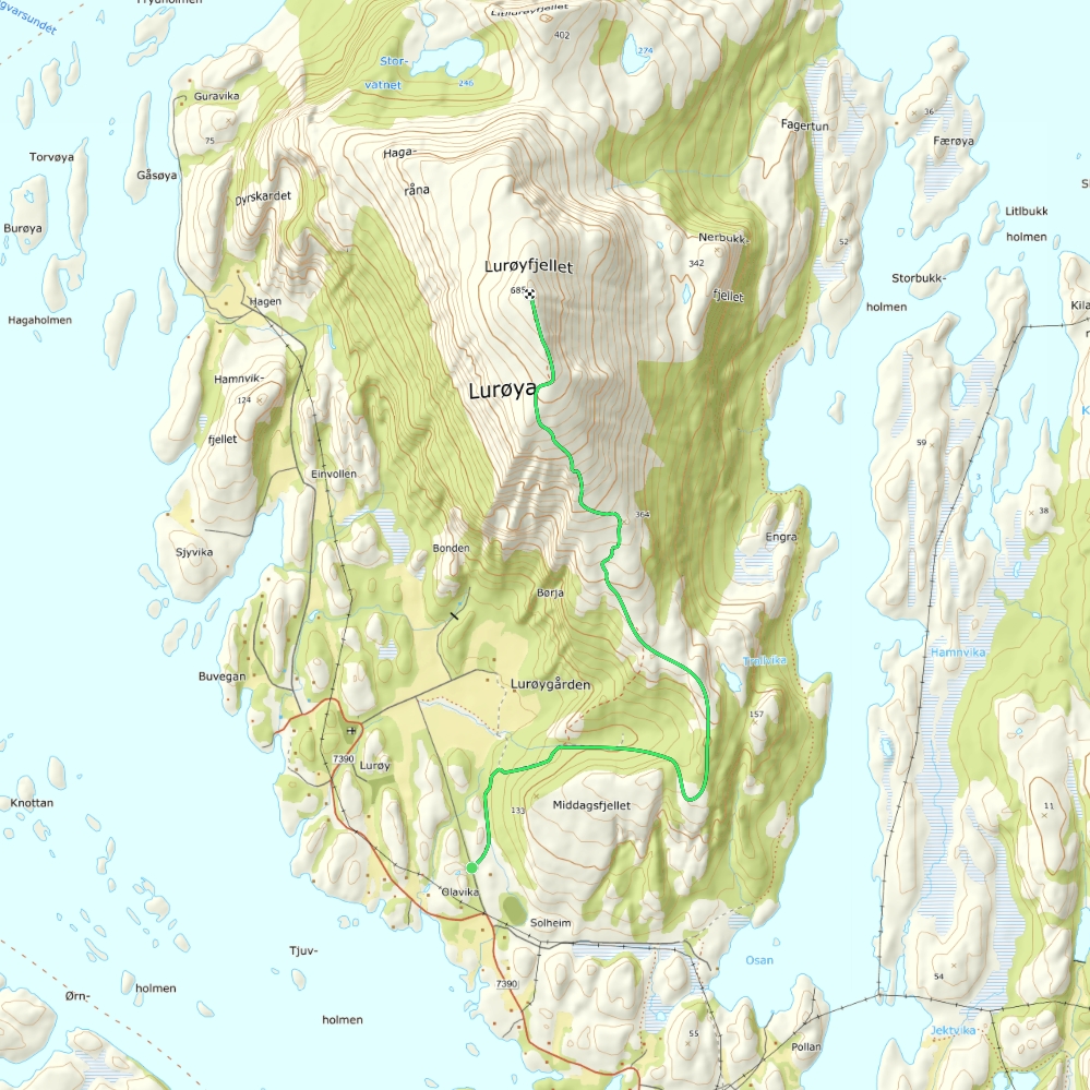
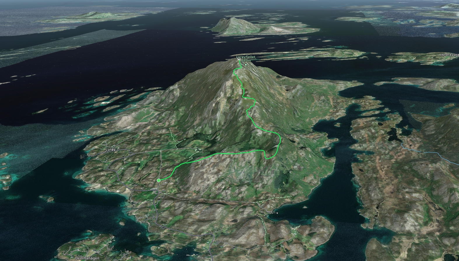
Trailhead: The trip starts by the parking lot along a gravel road, south of Lurøyfjellet, west of Middagsfjellet.
Find the trailhead on Google Maps
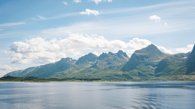
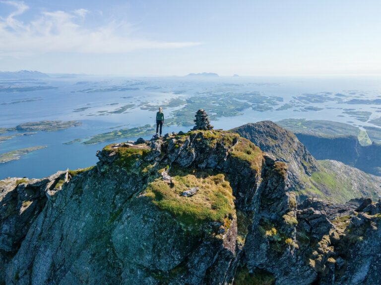
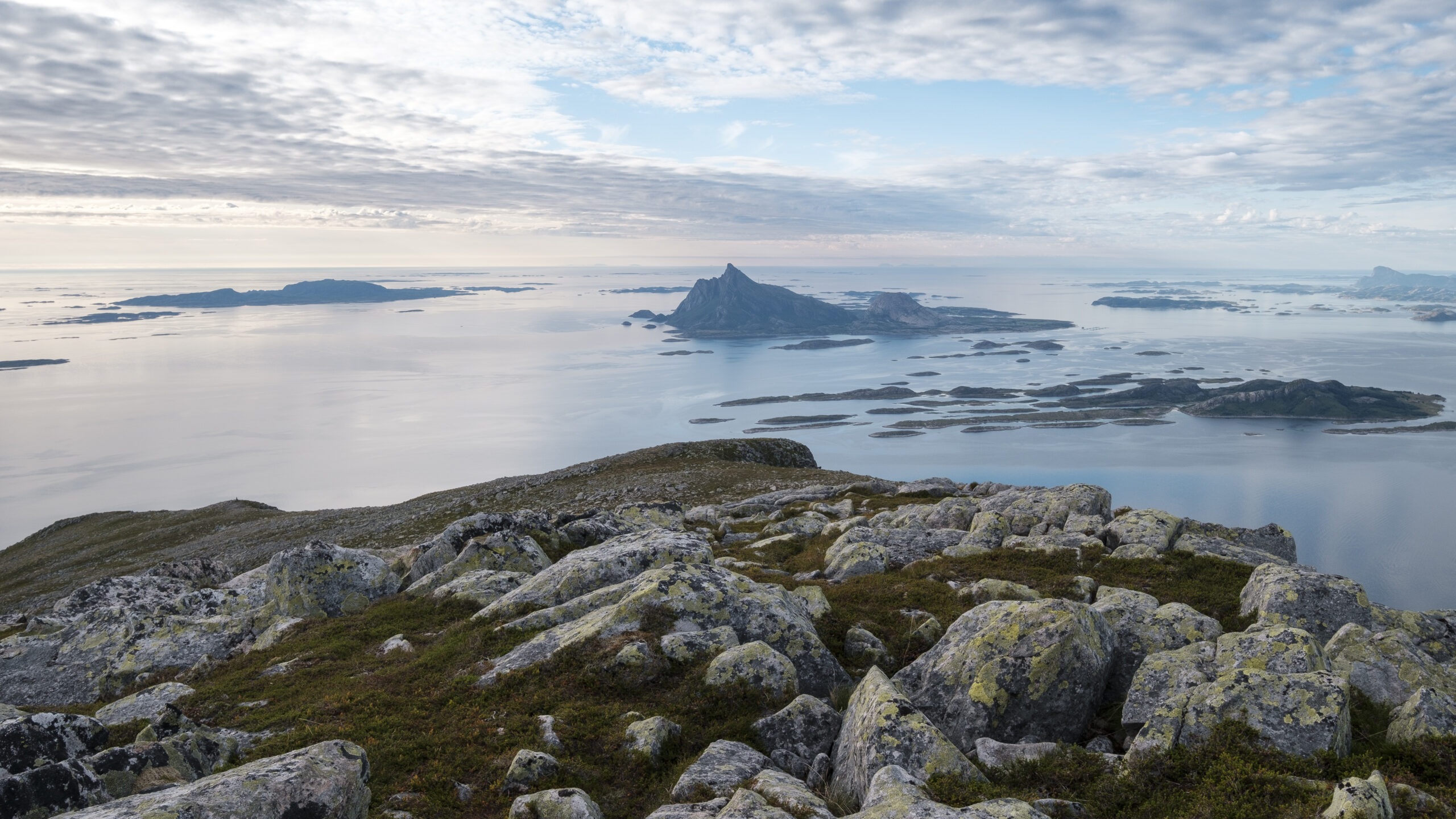
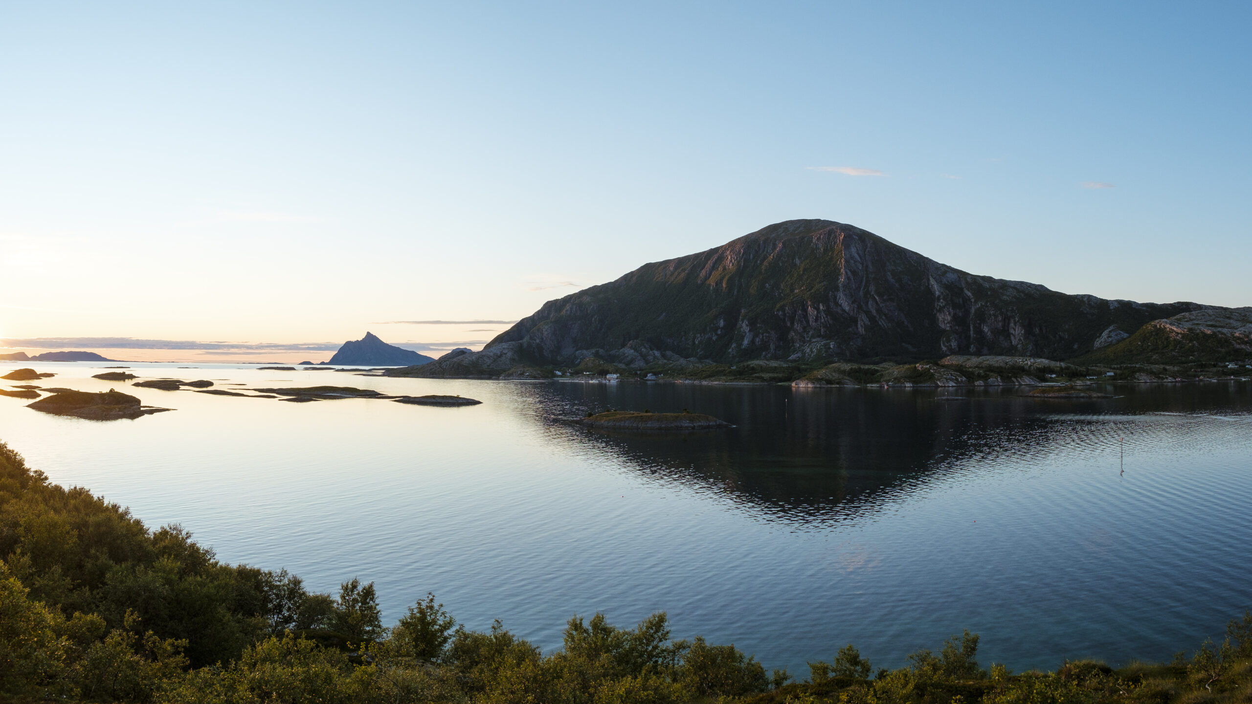
With its nearly 700-meter-high summit, makes Lurøyfjellet a tall mountain in an otherwise flat terrain, and is one of the greatest advantage points along the entire Helgeland Coast. Towards the north, you can see Hestmannen and Rødøyløva. In the west, you can see the islands of Lovund, Træna, and the beautiful Solværislands. In the south, the towering mountains of Tomskjelven, Dønnamannen, The Seven Sisters, Vega, and Søla can be seen. And in the east you can see Hjarttinden on Aldra, standing proudly in front of the other tall summits in Aldersundet. All of this and more, are things you can see from here, and still have time to get back down just in time for lunch or nightfall.
There are two alternative paths up to the summit. Both have the same starting point but the trail splits after a short walk. We recommend taking the path going right, which is a little longer but is less steep, and goes around «Lauklihumpen». The path leading left is nicknamed «The Tarzan Path», it’s shorter but quite a bit steeper.
 Kristoffer Møllevik / Visit Helgeland
 Kristoffer Møllevik / Visit Helgeland
 Kristoffer Møllevik / Visit Helgeland
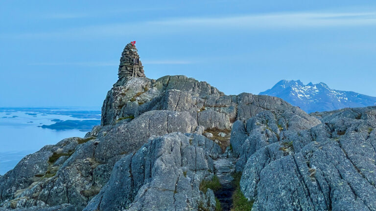
The path is well-marked the entire way up until it starts getting more flat just before the summit. Here the terrain starts to get more challenging, but you can tell there are many worn walking paths and tracks heading towards the top, so if you’re scared of heights, then it could be better to choose a path that leads away from the edge.
Find the hike description on UT.no (in Norwegian)
Find the trailhead on Google Maps
Thank you for respecting the local communities, and for helping us preserve the natural beauty of Helgeland!
Please:
- Strive to leave no trace of your visit. Bring back all your rubbish, including used toilet paper, and discard it in the nearest rubbish bin.
- Plan your toilet visits and use the opportunity when you pass a toilet. In the wilderness, make sure you are not a nuisance to others.
- Respect the local wildlife. Keep a good distance from wildlife, livestock and birds. Keep your dog leashed.
- Respect private property. Keep a respectful distance from houses and cabins.
- Show good boating sense. Keep a good distance from shore and drive at a low speed, especially when you are close to anyone or anything on the water, including birds or animals. Avoid loud and disturbing engine noise. Be aware that some islands and nature reserves are important nesting sites, and that going ashore is prohibited during the nesting season.
- Follow the Norwegian Mountain Code (Fjellvettreglene). Plan your excursion according to the weather forecast, your skills and experience.
- Join a guided excursion or consider hiring an experienced guide, especially when you don’t have sufficient experience or knowledge to guarantee a safe trip.
Find accommodations, dining options, and activities nearby.
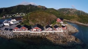
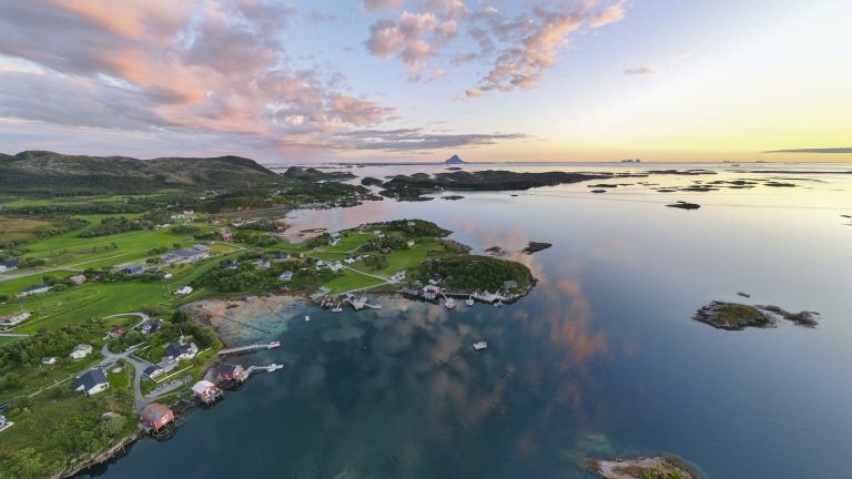
Oscarbrygga – Accommodation and dining
OscarBrygga at Tonnes offers accommodation in rorbu cabins or wharf rooms, right on the shore. From your balcony, you can enjoy the sunset or the glow of the midnight sun, to the soothing sound of the surf. Dining is offered in a refurbished old wharf building rich in ambience.